Category:Geography of Jogulamba Gadwal district
Media in category "Geography of Jogulamba Gadwal district"
The following 11 files are in this category, out of 11 total.
-
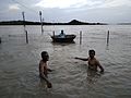 Beerolu Pushkara Ghat.jpg 4,608 × 3,456; 1.62 MB
-
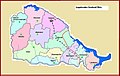
 Jogulamba District Revenue division.png 350 × 301; 60 KB
-
 Jogulamba Gadwal dist Map.jpg 789 × 498; 99 KB
-
 Jogulamba Gadwal District Map.png 680 × 512; 170 KB
-
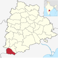 Jogulamba Gadwal in Telangana (India).svg 851 × 852; 751 KB
-
 Jogulamba Gadwal.png 1,231 × 896; 680 KB
-
 Krishna River at Gondimalla Village.jpg 1,600 × 1,200; 291 KB
-
 Krishna-river-flowing-full-near-BeechuPally.jpg 480 × 640; 81 KB
-
 Lake of Sangala Village.jpg 1,600 × 1,200; 311 KB
-
 Name Board of Karupakula Village.jpg 2,592 × 1,456; 1.35 MB
-
 Railway Bridge on Tungabhadra river near Gadwal.jpg 4,000 × 3,000; 2.51 MB


.svg)


