Category:Geography of Kamchatka Krai
Federal subjects of the Russian Federation:
Republics: Adygea · Altai · Bashkortostan · Buryatia · Chechnya · Chuvashia · (Crimea) · Dagestan · Ingushetia · Kabardino-Balkaria · Kalmykia · Karachay–Cherkessia · Karelia · Khakassia · Komi · Mari El · Mordovia · North Ossetia — Alania · Sakha (Yakutia) · Tatarstan · Tyva · UdmurtiaKrais: Altai · Kamchatka · Khabarovsk · Krasnodar · Krasnoyarsk · Perm · Primorsky · Stavropol · Zabaykalsky
Oblasts: Amur · Arkhangelsk · Astrakhan · Belgorod · Bryansk · Chelyabinsk · Irkutsk · Ivanovo · Kaliningrad · Kaluga · Kemerovo · Kirov · Kostroma · Kurgan · Kursk · Leningrad · Lipetsk · Magadan · Moscow · Murmansk · Nizhny Novgorod · Novgorod · Novosibirsk · Omsk · Orenburg · Oryol · Penza · Pskov · Rostov · Ryazan · Sakhalin · Samara · Saratov · Smolensk · Sverdlovsk · Tambov · Tomsk · Tula · Tver · Tyumen · Ulyanovsk · Vladimir · Volgograd · Vologda · Voronezh · Yaroslavl
Federal cities: Moscow · Saint Petersburg · (Sevastopol)
Autonomous oblast: Jewish
Autonomous okrugs: Chukotka · Khantia-Mansia · Nenetsia · Yamalo-Nenets
| Parent categories were assigned using the {{Category Russia}} template. In general, new categories should not be added by hand. The tree of categories is maintained automatically, any human edits may be overridden by bot. |
| Upload media | |||||
| Instance of |
| ||||
|---|---|---|---|---|---|
| |||||
Subcategories
This category has the following 17 subcategories, out of 17 total.
B
E
F
- Forests in Kamchatka Krai (1 F)
G
I
K
- Klyuchevskoy nature park (89 F)
- Kuthiny Baty (8 F)
L
M
N
- Nizjnekamtsjatsk (3 F)
P
S
Y
Media in category "Geography of Kamchatka Krai"
The following 20 files are in this category, out of 20 total.
-
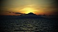 Bering Sea there somewhere - panoramio.jpg 4,000 × 2,248; 4.37 MB
-
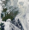
 Fires and smoke in eastern Siberia (4860627718).jpg 6,400 × 8,400; 13.65 MB
-
 Fires in Eastern Siberia (4860546639).jpg 3,887 × 4,077; 1.28 MB
-
 Kamchatka Krai, Russia, 688901 - panoramio.jpg 1,200 × 900; 274 KB
-
 Kamchatka Oleg Zaporozhets (6383855451).jpg 987 × 682; 130 KB
-
 Lopatka Cape 156.77122E 50.94908N.png 872 × 859; 1.02 MB
-
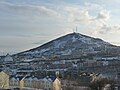 Mishennaya sopka view from Horizon.jpg 1,600 × 1,200; 896 KB
-
 Nalychevo.jpg 2,000 × 1,500; 2.83 MB
-
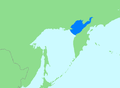 Location Shelikhov Bay.PNG 558 × 407; 10 KB
-
 Location Penzhina Bay.png 558 × 407; 10 KB
-
 Taunshits.jpg 1,024 × 680; 300 KB
-
 Unana.jpg 900 × 599; 224 KB
-
 Valaginsky mountains.jpg 900 × 598; 124 KB
-
 Warm September Sunrise (246713891).jpeg 2,048 × 1,365; 650 KB
-
 Вулкан Машковцева (Камчатка).jpg 640 × 440; 37 KB
-
 Долина Гейзеров, грязевой котёл Красный - panoramio.jpg 1,280 × 450; 194 KB
-
 Острая сопка (Камчатка).jpg 640 × 422; 91 KB
-
 Пенжинская губа, побережье.JPG 2,272 × 1,704; 760 KB
-
 Пенжинская губа.JPG 2,272 × 1,704; 800 KB
-
 Переправа - panoramio - Stranneek.jpg 3,072 × 2,304; 2.75 MB

.jpg)
.jpg)

.jpg)


.jpeg)
.jpg)
.jpg)


