Category:Geography of Khur and Biabanak County
- Counties of Isfahan Province
- Aran va Bidgol
- Ardestan
- Borkhar
- Dehaqan
- Golpayegan
- Harand
- Isfahan
- Jarqavieh
- Kashan
- Khomeyni Shahr
- Khur and Biabanak
- Kuhpayeh
- Nain
- Najafabad
- Natanz
- Shahin Shahr and Meymeh
- Shahreza
- Varzaneh
Wikimedia category | |||||
| Upload media | |||||
| Instance of | |||||
|---|---|---|---|---|---|
| Category combines topics | |||||
| Category contains | |||||
| Khur and Biabanak County | |||||
county in Isfahan Province, Iran  | |||||
| Instance of | |||||
| Location | Isfahan Province, Iran | ||||
| Capital |
| ||||
| Inception |
| ||||
| Population |
| ||||
 | |||||
Subcategories
This category has the following 2 subcategories, out of 2 total.
M
- Mesr Desert (23 F)
Media in category "Geography of Khur and Biabanak County"
The following 14 files are in this category, out of 14 total.
-
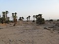 An oasis near Mehr Jan - panoramio (1).jpg 3,264 × 2,448; 3.42 MB
-
 An oasis near Mehr Jan - panoramio.jpg 3,264 × 2,448; 3.58 MB
-
 Arosan.jpg 1,777 × 1,149; 1.23 MB
-
 Arosan2.jpg 1,760 × 1,150; 1.28 MB
-
 Dadgin Iran - panoramio.jpg 1,600 × 1,200; 938 KB
-
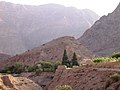
 Into the mountains near Gahmeh - panoramio.jpg 1,600 × 1,200; 977 KB
-
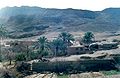
 Lonely palm trees - panoramio.jpg 3,264 × 2,448; 2.7 MB
-
 NI 40-13 Kavir-e Dar Anjir, Iran.jpg 5,000 × 3,758; 3.61 MB
-
 Oasis (56325628).jpg 2,272 × 1,704; 1.58 MB
-
 On the road from Nain to Gahmeh - panoramio.jpg 1,600 × 1,200; 1.04 MB
-
 Rahim Rajabi(bayazeh)-عبدالرحیم رجبی - روستای تاریخی و باستانی بیاضه.jpg 4,288 × 2,848; 1.5 MB
-
 Sunset between Dadgin and Gahmeh - panoramio.jpg 1,600 × 1,200; 901 KB
-
 رودخانه ته کشمون روستای تاریخی و باستانی بیاضه - BAYAZEH.jpg 4,288 × 2,848; 2.87 MB
-
 کوه جن.jpg 5,344 × 4,008; 6.18 MB
.jpg)


.jpg)

-%D8%B9%D8%A8%D8%AF%D8%A7%D9%84%D8%B1%D8%AD%DB%8C%D9%85_%D8%B1%D8%AC%D8%A8%DB%8C_-_%D8%B1%D9%88%D8%B3%D8%AA%D8%A7%DB%8C_%D8%AA%D8%A7%D8%B1%DB%8C%D8%AE%DB%8C_%D9%88_%D8%A8%D8%A7%D8%B3%D8%AA%D8%A7%D9%86%DB%8C_%D8%A8%DB%8C%D8%A7%D8%B6%D9%87.jpg)


