Category:Geography of San Luis Province
- Provinces of Argentina
 Buenos Aires
 Catamarca
 Chaco
Chaco Chubut
 Córdoba
 Corrientes
 Entre Ríos
 Formosa
 Jujuy
Jujuy La Pampa
 La Rioja
 Mendoza
 Misiones
 Neuquén
 Río Negro
 Salta
Salta San Juan
 San Luis
 Santa Cruz
 Santa Fe
 Santiago del Estero
 Tierra del Fuego
 Tucumán
- Autonomous city
 Buenos Aires
Wikimedia category | |||||
| Upload media | |||||
| Instance of | |||||
|---|---|---|---|---|---|
| Category combines topics | |||||
| geography | |||||
science that studies the terrestrial surface, the societies that inhabit it and the territories, landscapes, places or regions that form it when interacting with each other     | |||||
| Pronunciation audio | |||||
| Instance of |
| ||||
| Different from | |||||
| Partially coincident with | |||||
| San Luis Province | |||||
province of Argentina  Catedral de San Luis   -2.svg)  | |||||
| Instance of | |||||
| Location | Argentina | ||||
| Capital | |||||
| Legislative body |
| ||||
| Head of government |
| ||||
| Inception |
| ||||
| Highest point |
| ||||
| Population |
| ||||
| Area |
| ||||
| Elevation above sea level |
| ||||
| official website | |||||
 | |||||
English: This category is for multimedia files related to the Geography of San Luis Province in  Argentina.
Español: Esta categoría es para contenido multimedia relacionado con la geografía de la provincia de San Luis, Argentina.
Subcategories
This category has the following 7 subcategories, out of 7 total.
Media in category "Geography of San Luis Province"
The following 25 files are in this category, out of 25 total.
-
 Arboles y nube.JPG 640 × 480; 167 KB
-
 Arco de entrada union san luis.jpg 720 × 540; 102 KB
-
 Argentina - Río Desaguadero.JPG 4,320 × 3,240; 8.6 MB
-
 Atardecer con el Cerro Negro.JPG 640 × 480; 164 KB
-
 Cerro camino palmeras.JPG 640 × 480; 162 KB
-
 Cerro Negro con visitante.JPG 640 × 480; 165 KB
-
 Cerro Negro destacado.JPG 640 × 480; 170 KB
-
 Cerro Negro2.JPG 640 × 480; 165 KB
-
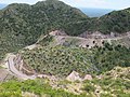
 Circuito Serrano San Luis 01.jpg 2,848 × 2,134; 1.23 MB
-
 Circuito Serrano San Luis 02.jpg 2,848 × 2,134; 1.4 MB
-
 Circuito Serrano San Luis 03.jpg 2,848 × 2,134; 1.31 MB
-
 Ciudad de La Punta.jpg 2,848 × 2,134; 1.38 MB
-
 Rio conlara.jpg 2,592 × 1,944; 1.66 MB
-
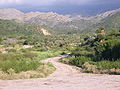
 Entrada a Papagayos.jpg 640 × 480; 162 KB
-
 Guanacache-Desaguadero-Bebedero.jpg 512 × 602; 84 KB
-
 Hacia el río.JPG 640 × 480; 149 KB
-
 Los Riscos.jpg 1,303 × 1,035; 540 KB
-
 LR Defender Made in Brazil.jpg 800 × 600; 414 KB
-
 Monte W Balde.jpg 1,550 × 900; 195 KB
-
 Morteros comenchingones.JPG 2,048 × 1,536; 1.55 MB
-
 Palmeras Caranday.JPG 640 × 480; 133 KB
-
 Pueblo Papagayos.JPG 640 × 480; 154 KB
-
 Rio San Francisco San Luis Argentina.JPG 3,264 × 2,448; 1.47 MB
-
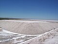 Salinas del Bebedero.jpg 2,848 × 2,134; 1.4 MB
-
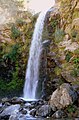 Salto del Tabaquillo.jpg 1,536 × 2,327; 746 KB


