Category:Geography of Timóteo
Subcategories
This category has the following 9 subcategories, out of 9 total.
C
- Cachoeira do Vale (7 F)
M
- Maps in Timóteo (2 F)
N
P
- Pico do Ana Moura (8 F)
S
- Streams in Timóteo (5 F)
Media in category "Geography of Timóteo"
The following 11 files are in this category, out of 11 total.
-
 Earth and Sky.JPG 4,320 × 2,432; 2.8 MB
-
 Elevatória de esgoto bruto em Timóteo MG.JPG 3,165 × 2,110; 5.37 MB
-
 Foz do Rio Piracicaba no Rio Doce vista do mirante da Estação Pedra Mole, Ipatinga MG.JPG 4,300 × 2,867; 5.27 MB
-
 Landsat Coronel Fabriciano and Timóteo MG.jpg 4,288 × 2,848; 1.11 MB
-
 Landsat Coronel Fabriciano, Ipatinga and Timóteo MG.jpg 4,288 × 2,848; 4.62 MB
-
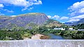 Rio Piracicaba e Pedra da Baratinha ao fundo, Timoteo.jpg 4,032 × 2,268; 2.01 MB
-
 Rio Piracicaba entre Timóteo e Ipatinga MG.JPG 3,180 × 2,120; 1.85 MB
-
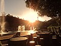 Sunset in Timóteo MG.JPG 4,000 × 3,000; 4.88 MB
-
 Vista a montante da foz do Rio Piracicaba no Rio Doce entre Ipatinga e Timóteo MG.JPG 3,900 × 2,600; 3.39 MB
-
 Vista da subestação de energia de Timóteo MG.jpg 4,606 × 3,070; 7.6 MB
-
 Vista do Cemitério Jardim da Saudade, Timóteo MG.JPG 2,460 × 1,845; 1.54 MB


