Category:Geography of Uganda
Uganda Geography  | |||||
| Upload media | |||||
| Instance of |
| ||||
|---|---|---|---|---|---|
| Subclass of | |||||
| Facet of | |||||
| Location |
| ||||
 | |||||
Subcategories
This category has the following 17 subcategories, out of 17 total.
Media in category "Geography of Uganda"
The following 11 files are in this category, out of 11 total.
-
 Great rift valley.jpg 2,816 × 2,112; 1.44 MB
-
 Otuboi-Bata-road.jpg 2,048 × 1,536; 357 KB
-
 Rechts het begin van het Bwindi Nationaal Park (6734866791).jpg 1,280 × 960; 155 KB
-
 Rwenjori.jpg 3,000 × 4,000; 2.78 MB
-
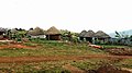 Sina village.jpg 960 × 540; 89 KB
-
 Sukulu1.jpg 2,222 × 1,418; 444 KB
-
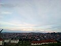 The Kisasi Hill View overlooking Kampala Northern Bypass.jpg 2,560 × 1,920; 1.05 MB
-
 Uganda (30773343263).jpg 3,717 × 1,884; 6.72 MB
-
 Uganda (30774245943).jpg 3,244 × 2,157; 7.43 MB
-
 Uganda (31209910720).jpg 3,515 × 1,991; 5.58 MB
-
 Uganda6.jpg 640 × 404; 29 KB


.jpg)


.jpg)
.jpg)
.jpg)
