Category:Geography of Zuheros
Municipalities of the province of Córdoba: Adamuz · Aguilar de la Frontera · Almedinilla · Almodóvar del Río · Baena · Belmez · Benamejí · Carcabuey · Cardeña · La Carlota · El Carpio · Córdoba · Espiel · Fuente Obejuna · Fuente Palmera · Hornachuelos · Iznájar · Lucena · Luque · Montalbán de Córdoba · Montoro · Obejo · Palma del Río · Peñarroya-Pueblonuevo · Priego de Córdoba · Puente Genil · Rute · Villa del Río · Zuheros ·
Subcategories
This category has the following 2 subcategories, out of 2 total.
C
- Cueva de los Murciélagos (8 F)
M
- Maps of Zuheros (4 F)
Media in category "Geography of Zuheros"
The following 10 files are in this category, out of 10 total.
-
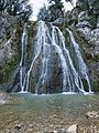 Cascada de las Chorreras.jpg 768 × 1,024; 311 KB
-
 Landschaft in andalusien08.jpg 4,000 × 3,000; 7.64 MB
-
 Llegando a Zuheros (7176633577).jpg 3,264 × 2,448; 3.55 MB
-
 Mayo 2018 104.jpg 2,448 × 3,264; 3.71 MB
-
 Mayo 2018 106.jpg 2,448 × 3,264; 2.97 MB
-
 Mayo 2018 109.jpg 3,264 × 2,448; 3.22 MB
-
 Río Bailón, Zuheros. Parque Natural de la Subbética Cordobesa.jpg 1,200 × 1,600; 432 KB
-
 Vía Verde de la Subbética-Zuheros.jpg 4,592 × 3,056; 3.39 MB
-
 Zuheros - 009 (30621766401).jpg 3,072 × 2,304; 2.63 MB
-
 Zuheros - paisajes.jpg 4,592 × 3,056; 4.03 MB


.jpg)


.jpg)
