Category:Georgia State Route 89
 | number: | (eighty-nine) |
|---|---|---|
| State highways in Georgia (U.S. state): | 70 · 72 · 73 · 74 · 75 · 76 · 77 · 79 · 81 · 82 · 83 · 85 · 87 · 89 · 90 · 91 · 92 · 93 · 94 · 96 · 97 · 99 · 100 · 101 · 102 · 103 · 104 · 105 · 107 · 108 · 109 |
English: State Route 89 is a state highway in Georgia. The route is concurrent with U.S. Route 441 for its whole length.
Media in category "Georgia State Route 89"
The following 18 files are in this category, out of 18 total.
-
 Building on stilts next to Suwannee River, Fargo.JPG 4,320 × 3,240; 4.54 MB
-
 Cassia Lodge, Homerville Masonic Building.JPG 4,320 × 3,240; 4.46 MB
-
 ClinchCoRecDept.jpg 3,072 × 2,304; 1.11 MB
-
 Fargo limit, US441 SB.JPG 4,320 × 3,240; 4.5 MB
-
 Fargo water tower, US441.JPG 4,320 × 3,240; 4.46 MB
-
 Fargo welcome, US441 NB.JPG 4,320 × 3,240; 4.6 MB
-
 FargoCharterSchool.jpg 3,072 × 2,304; 2.03 MB
-
 FargoCityHall.jpg 3,072 × 2,304; 1.47 MB
-
 GA122 US441 intersection, Clinch County.jpg 5,184 × 3,456; 5.57 MB
-
 GA177 end, Clinch County.JPG 4,320 × 3,240; 4.49 MB
-
 Georgia 89.svg 600 × 600; 6 KB
-
 Georgia Forestry Commission Tower, Homerville.JPG 4,320 × 3,240; 4.42 MB
-
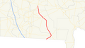 Georgia state route 89 map.png 759 × 429; 69 KB
-
 Homerville Congregational Methodist Church.JPG 4,320 × 3,240; 4.55 MB
-
 Okefenokee Swamp historical marker, Fargo.JPG 4,320 × 3,240; 4.54 MB
-
 Rite Aid, Homerville.JPG 4,320 × 3,240; 4.46 MB
-
 SuwaneeRiverVisitorsCenter.jpg 3,072 × 2,304; 1.19 MB
-
 Suwannee River boat ramp, Fargo.JPG 4,320 × 3,240; 4.51 MB


