Category:Geothermal energy maps of Germany
Media in category "Geothermal energy maps of Germany"
The following 75 files are in this category, out of 75 total.
-
 Altenbeken geothermische Karte.png 800 × 837; 55 KB
-
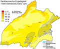
 Augustdorf geothermische Karte.png 800 × 700; 46 KB
-
 Bad Driburg geothermische Karte.png 600 × 700; 62 KB
-
 Bad Lippspringe geothermische Karte.png 940 × 680; 315 KB
-
 Bad Oeynhausen geothermische Karte.png 800 × 900; 67 KB
-
 Bad Salzuflen geothermische Karte.png 1,000 × 900; 110 KB
-
 Bad Wünnenberg geothermische Karte.png 779 × 615; 138 KB
-
 Barntrup geothermische Karte.png 800 × 700; 58 KB
-
 Beverungen geothermische Karte.png 900 × 930; 77 KB
-
 Blomberg geothermische Karte.png 1,150 × 815; 78 KB
-
 Borchen geothermische Karte.png 1,081 × 853; 51 KB
-
 Borgentreich geothermische Karte.png 650 × 630; 45 KB
-
 Borgholzhausen - Geothermal Yield.svg 495 × 331; 187 KB
-
 Borgholzhausen geothermische Karte.png 815 × 650; 51 KB
-
 Brakel geothermische Karte.png 700 × 700; 56 KB
-
 Bünde geothermische Karte.png 750 × 800; 53 KB
-
 Büren geothermische Karte.png 865 × 683; 114 KB
-
 Delbrück geothermische Karte.png 975 × 802; 58 KB
-
 Detmold geothermische Karte.png 700 × 600; 60 KB
-
 Dörentrup geothermische Karte.png 820 × 600; 45 KB
-
 Enger geothermische Karte.png 800 × 600; 41 KB
-
 Espelkamp geothermische Karte.png 950 × 700; 50 KB
-
 Extertal geothermische Karte.png 1,000 × 820; 66 KB
-
 Geothermie peckeloh.png 1,000 × 670; 75 KB
-
 Geothermische Standorte.gif 1,000 × 665; 124 KB
-
 Gütersloh geothermische Karte.png 1,081 × 906; 62 KB
-
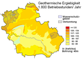
 Halle - Geothermal Yield.svg 470 × 362; 376 KB
-
 Halle geothermische Karte.png 820 × 800; 61 KB
-
 Harsewinkel geothermische Karte.png 657 × 414; 43 KB
-
 Herford geothermische Karte.png 900 × 880; 70 KB
-
 Herford mapa geotèrmica.PNG 900 × 880; 68 KB
-
 Herzebrock-Clarholz geothermische Karte.png 570 × 480; 37 KB
-
 Hiddenhausen geothermische Karte.png 680 × 530; 36 KB
-
 Hille geothermische Karte.png 600 × 620; 41 KB
-
 Horn-Bad Meinberg geothermische Karte.png 700 × 600; 51 KB
-
 Hövelhof geothermische Karte.png 872 × 614; 43 KB
-
 Höxter geothermische Karte.png 600 × 760; 53 KB
-
 Hüllhorst geothermische Karte.png 900 × 600; 39 KB
-
 Kalletal geothermische Karte.png 630 × 600; 59 KB
-
 Kirchlengern geothermische Karte.png 750 × 700; 41 KB
-
 Lage (Lippe) geothermische Karte.png 810 × 880; 80 KB
-
 Langenberg geothermische Karte.png 650 × 597; 21 KB
-
 Lemgo geothermische Karte.png 600 × 650; 49 KB
-
 Leopoldshöhe geothermische Karte.png 700 × 680; 44 KB
-
 Lichtenau geothermische Karte.png 800 × 611; 176 KB
-
 Löhne geothermische Karte.png 700 × 800; 50 KB
-
 Lübbecke geothermische Karte.png 900 × 650; 49 KB
-
 Lügde geothermische Karte.png 500 × 730; 48 KB
-
 Marienmünster geothermische Karte.png 800 × 780; 60 KB
-
 Minden geothermische Karte.png 1,000 × 900; 80 KB
-
 Nieheim geothermische Karte.png 884 × 771; 83 KB
-
 Oerlinghausen geothermische Karte.png 800 × 600; 47 KB
-
 Paderborn geothermische Karte.png 880 × 678; 276 KB
-
 Petershagen geothermische Karte.png 836 × 695; 56 KB
-
 Porta Westfalica geothermische Karte.png 1,100 × 750; 73 KB
-
 Preußisch Oldendorf geothermische Karte.png 800 × 800; 55 KB
-
 Rahden geothermische Karte.png 700 × 650; 42 KB
-
 Rheda-Wiedenbrück geothermische Karte.png 600 × 580; 32 KB
-
 Rietberg geothermische Karte.png 577 × 596; 42 KB
-
 Rödinghausen geothermische Karte.png 700 × 650; 35 KB
-
 Salzkotten geothermische Karte.png 904 × 633; 144 KB
-
 Schieder-Schwalenberg geothermische Karte.png 700 × 580; 49 KB
-
 Schlangen geothermische Karte.png 850 × 700; 69 KB
-
 Schloss Holte-Stukenbrock geothermische Karte.png 580 × 450; 40 KB
-
 Spenge geothermische Karte.png 740 × 670; 40 KB
-
 Spenge geothermische Karte.svg 837 × 714; 197 KB
-
 Steinhagen geothermische Karte.png 770 × 630; 48 KB
-
 Steinheim geothermische Karte.png 650 × 580; 47 KB
-
 Stemwede geothermische Karte.png 700 × 700; 40 KB
-
 Verl geothermische Karte.png 745 × 610; 146 KB
-
 Versmold geothermische Karte.png 1,000 × 670; 49 KB
-
 Vlotho geothermische Karte.png 1,050 × 704; 100 KB
-
 Warburg geothermische Karte.png 872 × 600; 63 KB
-
 Werther geothermische Karte.png 760 × 597; 49 KB
-
 Willebadessen geothermische Karte.png 740 × 550; 53 KB


_geothermische_Karte.png)


