Category:Gerretjeshoeve
| Object location | | View all coordinates using: OpenStreetMap |
|---|
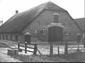
farmhouse in Utrechtse Heuvelrug, Netherlands  | |||||
| Upload media | |||||
| Instance of | |||||
|---|---|---|---|---|---|
| Location | Leersum, Utrecht, Netherlands | ||||
| Street address |
| ||||
| Located on street |
| ||||
| Heritage designation |
| ||||
 | |||||
Nederlands: Boerderij Boerendans, Gerretjes Hoeve, Gerretjeshoeve
|
This is a category about rijksmonument number 24066
|
| Address |
|
Media in category "Gerretjeshoeve"
The following 23 files are in this category, out of 23 total.
-
 Achtergevel - Leersum - 20451615 - RCE.jpg 1,200 × 900; 182 KB
-
 Achtergevel boerderij - Leersum - 20370505 - RCE.jpg 1,200 × 807; 188 KB
-
 Achtergevel boerderij - Leersum - 20370506 - RCE.jpg 1,200 × 806; 199 KB
-
 Deur naar de geut - Leersum - 20451614 - RCE.jpg 592 × 888; 84 KB
-
 Exterieur OVERZICHT SCHUREN - Leersum - 20263351 - RCE.jpg 1,200 × 772; 188 KB
-
 Exterieur OVERZICHT SCHUREN - Leersum - 20263352 - RCE.jpg 1,200 × 780; 185 KB
-
 Exterieur OVERZICHT VOORGEVEL, LINKER ZIJGEVEL - Leersum - 20263350 - RCE.jpg 1,200 × 764; 178 KB
-
 Kaaskelder - Leersum - 20451616 - RCE.jpg 1,200 × 900; 91 KB
-
 Leersum - Gerretjeshoeve, Boerenbuurt 32 RM24066.JPG 4,530 × 3,348; 3.05 MB
-
 Overzicht "Gerretjes-hoeve" - Leersum - 20130433 - RCE.jpg 1,200 × 794; 226 KB
-
 Schuur - Leersum - 20130434 - RCE.jpg 1,200 × 798; 170 KB
-
 Sleutelstuk in de woonkamer - Leersum - 20451625 - RCE.jpg 1,200 × 900; 117 KB
-
 Voor- en zijgevel - Leersum - 20451612 - RCE.jpg 1,200 × 900; 181 KB
-
 Voor- en zijgevel - Leersum - 20451620 - RCE.jpg 1,200 × 900; 139 KB
-
 Voor- en zijgevel - Leersum - 20451627 - RCE.jpg 1,200 × 900; 143 KB
-
 Voor- en zijgevel nr. Leersum 5 - Leersum - 20451621 - RCE.jpg 1,200 × 900; 149 KB
-
 Voor- en zijgevel nr. NI 1 ; RdMZ, Zeist - Leersum - 20451617 - RCE.jpg 1,200 × 900; 136 KB
-
 Voor- en zijgevel nr. NV 8 ; RdMZ, Zeist - Leersum - 20451619 - RCE.jpg 1,200 × 900; 132 KB
-
 Voorgevel - Leersum - 20451613 - RCE.jpg 1,200 × 900; 210 KB
-
 Voorgevel boerderij - Leersum - 20370503 - RCE.jpg 1,200 × 799; 190 KB
-
 Voorgevel boerderij - Leersum - 20370504 - RCE.jpg 1,200 × 801; 202 KB
-
 Zij- en achtergevel hooiberg - Leersum - 20451622 - RCE.jpg 1,200 × 900; 146 KB
-
 Zij- en achtergevel nr. NI 2 ; RdMZ, Zeist - Leersum - 20451618 - RCE.jpg 1,200 × 900; 136 KB


