Category:Gill (ravine)
A gill is a term used in Northern England for a river-cut ravine. The word appears in settlement names, river names, ravine names and area names. It may possibly derive from the Norse gjelle.
Subcategories
This category has the following 10 subcategories, out of 10 total.
A
- Arn Gill (8 F)
B
C
- Coppy Gill (10 F)
E
- East Gill Force (20 F)
M
- Mirk Fell Gill (1 F)
N
- North Gill Beck (4 F)
P
- Posforth Gill (2 F)
S
- Swinner Gill (48 F)
T
- Trollers Gill (36 F)
Media in category "Gill (ravine)"
The following 32 files are in this category, out of 32 total.
-
 Back Gill. - geograph.org.uk - 292935.jpg 640 × 480; 215 KB
-
 Beldin Gill on Steel House Moor - geograph.org.uk - 344537.jpg 640 × 480; 144 KB
-
 Birks Gill - geograph.org.uk - 1752853.jpg 2,592 × 1,944; 1.08 MB
-
 Blayshaw Gill. - geograph.org.uk - 303836.jpg 640 × 480; 101 KB
-
 Brow Gill Beck at God's Bridge - geograph.org.uk - 846423.jpg 429 × 640; 94 KB
-
 Brow Gill Beck joining Cam Beck - geograph.org.uk - 398348.jpg 640 × 359; 91 KB
-
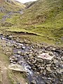
 Burn Gill passing under the Nidd Aqueduct - geograph.org.uk - 583389.jpg 640 × 480; 138 KB
-
 Byerbeck Gill looking upstream - geograph.org.uk - 634331.jpg 640 × 480; 142 KB
-
 Cawder Gill - geograph.org.uk - 308119.jpg 640 × 480; 111 KB
-
 Cogden Gill Above Grinton.jpg 2,400 × 1,600; 2.82 MB
-
 Colt House Gill - geograph.org.uk - 583403.jpg 640 × 480; 123 KB
-
 Dauber Gill - geograph.org.uk - 1505872.jpg 640 × 480; 143 KB
-
 East Gill Dyke - geograph.org.uk - 650757.jpg 640 × 480; 114 KB
-
 Entrance to Gaping Gill - geograph.org.uk - 935575.jpg 640 × 480; 112 KB
-
 Five Gills on Harter Fell geograph-2393774-by-Ian-Taylor.jpg 640 × 425; 306 KB
-

-
 Gill Beck - geograph.org.uk - 1562320.jpg 480 × 640; 171 KB
-
 Hag Dike Gill and Providence pot. - geograph.org.uk - 144928.jpg 480 × 640; 146 KB
-
 New Hill Gill Brotton - geograph.org.uk - 1714809.jpg 2,048 × 1,365; 561 KB
-
 North Gill Beck - geograph.org.uk - 112531.jpg 640 × 480; 121 KB
-
 North Gill Beck - geograph.org.uk - 266159.jpg 640 × 480; 112 KB
-
 North Gill Beck - geograph.org.uk - 473216.jpg 480 × 640; 206 KB
-
 Orms Gill - geograph.org.uk - 373453.jpg 640 × 480; 121 KB
-
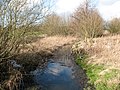 Ouse Gill Beck - geograph.org.uk - 360099.jpg 640 × 480; 146 KB
-
 Posforth Gill beck - geograph.org.uk - 517322.jpg 640 × 480; 180 KB
-
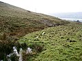
 Sheepfold next to Strans Gill. - geograph.org.uk - 264962.jpg 640 × 480; 111 KB
-
 Skell Gill - geograph.org.uk - 116717.jpg 427 × 640; 136 KB
-
 Slee House Gill - geograph.org.uk - 279182.jpg 640 × 480; 117 KB
-
 Sleets Gill Beck - geograph.org.uk - 1776839.jpg 480 × 640; 112 KB
-
 Sleets Gill Wood. - geograph.org.uk - 98539.jpg 640 × 480; 101 KB
-
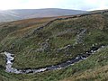
 South Gill Beck - geograph.org.uk - 287702.jpg 640 × 480; 94 KB
-
 Steel House Gill - geograph.org.uk - 489113.jpg 640 × 427; 104 KB


