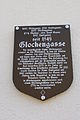
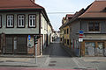
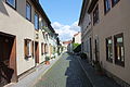
Category:Glockengasse (Erfurt)
| Object location | | View all coordinates using: OpenStreetMap |
|---|
street in Erfurt, Germany  | |||||
| Upload media | |||||
| Instance of | |||||
|---|---|---|---|---|---|
| Location | Erfurt, Thuringia, Germany | ||||
 | |||||
Subcategories
This category has the following 48 subcategories, out of 48 total.
- Glockengasse 1 (Erfurt) (3 F)
- Glockengasse 2 (Erfurt) (5 F)
- Glockengasse 3 (Erfurt) (3 F)
- Glockengasse 4 (Erfurt) (2 F)
- Glockengasse 5 (Erfurt) (2 F)
- Glockengasse 6 (Erfurt) (3 F)
- Glockengasse 7 (Erfurt) (2 F)
- Glockengasse 8 (Erfurt) (2 F)
- Glockengasse 9 (Erfurt) (3 F)
- Glockengasse 10 (Erfurt) (2 F)
- Glockengasse 11 (Erfurt) (2 F)
- Glockengasse 12 (Erfurt) (4 F)
- Glockengasse 13 (Erfurt) (3 F)
- Glockengasse 14 (Erfurt) (5 F)
- Glockengasse 15 (Erfurt) (2 F)
- Glockengasse 19 (Erfurt) (1 F)
- Glockengasse 20 (Erfurt) (1 F)
- Glockengasse 21 (Erfurt) (1 F)
- Glockengasse 22 (Erfurt) (2 F)
- Glockengasse 23 (Erfurt) (3 F)
- Glockengasse 24 (Erfurt) (3 F)
- Glockengasse 26 (Erfurt) (1 F)
- Glockengasse 27 (Erfurt) (3 F)
- Glockengasse 28 (Erfurt) (1 F)
- Glockengasse 30 (Erfurt) (1 F)
- Glockengasse 31 (Erfurt) (1 F)
- Glockengasse 32 (Erfurt) (1 F)
- Glockengasse 33 (Erfurt) (6 F)
- Glockengasse 34 (Erfurt) (5 F)
- Glockengasse 35 (Erfurt) (7 F)
- Glockengasse 36 (Erfurt) (5 F)
- Glockengasse 37 (Erfurt) (5 F)
- Glockengasse 38 (Erfurt) (3 F)
- Glockengasse 39 (Erfurt) (6 F)
- Glockengasse 40 (Erfurt) (1 F)
- Glockengasse 41 (Erfurt) (5 F)
- Glockengasse 42 (Erfurt) (4 F)
- Glockengasse 43 (Erfurt) (3 F)
- Glockengasse 44 (Erfurt) (4 F)
- Glockengasse 45 (Erfurt) (4 F)
- Glockengasse 46 (Erfurt) (3 F)
- Glockengasse 47 (Erfurt) (4 F)
- Glockengasse 48 (Erfurt) (2 F)
- Glockengasse 49 (Erfurt) (3 F)
- Glockengasse 50 (Erfurt) (3 F)
- Glockengasse 53 (Erfurt) (2 F)
- Glockengasse 54 (Erfurt) (2 F)
- Glockengasse 55 (Erfurt) (2 F)
Media in category "Glockengasse (Erfurt)"
The following 12 files are in this category, out of 12 total.
-
 Glockengasse 43 Erfurt 2014 Tafel.jpg 2,848 × 4,272; 3.93 MB
-
 Glockengasse Erfurt.JPG 1,600 × 1,200; 407 KB
-
 Erfurt Glockengasse 762.jpg 4,896 × 3,264; 10.95 MB
-
 Andreasstrasse Erfurt 3.jpg 5,327 × 3,551; 3.8 MB
-
 Erfurt Glockeng 2.jpg 2,736 × 3,648; 2.94 MB
-
 Erfurt Glockeng 3.jpg 3,648 × 2,736; 2.13 MB
-
 Erfurt Glockeng.jpg 3,456 × 5,184; 6.66 MB
-
 Erfurt Glockengasse 763.jpg 3,264 × 4,896; 10.09 MB
-
 Glockengasse Erfurt 2014.jpg 4,272 × 2,848; 4.02 MB
-
 Glockengasse 10 Erfurt 2014.jpg 2,848 × 4,272; 4.94 MB
-
 J24 047 Glockengasse.jpg 5,601 × 3,734; 4.48 MB
-
 Straßenansicht Erfurt Glockengasse.jpg 3,264 × 2,448; 2.63 MB


