Category:Goadby
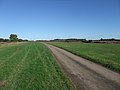
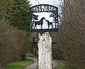
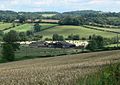
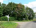
English: Goadby is a village and civil parish in the Harborough district of Leicestershire, England, about 8 miles north of Market Harborough. According to the 2001 census it had a population of 43.
village and civil parish in Leicestershire, United Kingdom  | |||||
| Upload media | |||||
| Instance of | |||||
|---|---|---|---|---|---|
| Location | Harborough, Leicestershire, East Midlands, England | ||||
 | |||||
Subcategories
This category has only the following subcategory.
Media in category "Goadby"
The following 91 files are in this category, out of 91 total.
-
 Approaching Goadby - geograph.org.uk - 147922.jpg 640 × 480; 121 KB
-
 Bridleway along Palmers Lane - geograph.org.uk - 3343816.jpg 3,349 × 2,630; 2.73 MB
-
 Cattle grid along the lane to Goadby - geograph.org.uk - 3341679.jpg 2,133 × 1,673; 1.24 MB
-
 Church of St John the Baptist, Goadby - geograph.org.uk - 6378305.jpg 3,776 × 2,520; 3.26 MB
-
 Cycle Route 64 (from left) joins Cycle Route 63 - geograph.org.uk - 6305984.jpg 3,776 × 2,520; 3.27 MB
-
 Cycle Route 64 towards Goadby - geograph.org.uk - 2122817.jpg 4,000 × 3,000; 2.94 MB
-
 Ewes and lambs near Rolleston - geograph.org.uk - 753571.jpg 640 × 404; 63 KB
-
 Farmland north of Goadby - geograph.org.uk - 3343640.jpg 3,743 × 2,615; 3.1 MB
-
 Field and hedge north of Palmers Lane - geograph.org.uk - 3343788.jpg 2,949 × 2,687; 2.34 MB
-
 Flooded cattle grid along the lane to Goadby - geograph.org.uk - 3341692.jpg 2,520 × 1,792; 1.33 MB
-
 Gates and farmland at Goadby Home Farm - geograph.org.uk - 3343626.jpg 3,400 × 2,399; 2.52 MB
-
 Goadby Church - geograph.org.uk - 4314299.jpg 640 × 480; 48 KB
-
 Goadby Hill junction - geograph.org.uk - 5278934.jpg 480 × 640; 45 KB
-
 Goadby Home Farm - geograph.org.uk - 3341755.jpg 3,392 × 2,579; 2.84 MB
-
 Goadby Home Farm - geograph.org.uk - 3343686.jpg 2,427 × 1,744; 1.27 MB
-
 Goadby Road, Leicestershire - geograph.org.uk - 537553.jpg 640 × 423; 112 KB
-
 Half hidden trig point - geograph.org.uk - 540283.jpg 510 × 640; 134 KB
-
 Hill to Goadby - geograph.org.uk - 5278933.jpg 480 × 640; 48 KB
-
 Horse Hill south of Goadby - geograph.org.uk - 3341772.jpg 4,000 × 3,000; 3.76 MB
-
 Horse Hill towards Goadby - geograph.org.uk - 3341764.jpg 3,869 × 2,831; 3.65 MB
-
 Lake House Farm - geograph.org.uk - 3343668.jpg 2,706 × 1,777; 1.51 MB
-
 Midshires Way, Leicestershire - geograph.org.uk - 537540.jpg 640 × 480; 133 KB
-
 Palmer's Lane junction - geograph.org.uk - 5300534.jpg 640 × 480; 52 KB
-
 Palmers Lane heading east - geograph.org.uk - 3343679.jpg 4,000 × 3,000; 3.22 MB
-
 Palmers Lane heading towards Noseley - geograph.org.uk - 3343703.jpg 3,454 × 2,830; 2.06 MB
-
 Palmers Lane near Goadby - geograph.org.uk - 3343698.jpg 3,141 × 2,299; 2.4 MB
-
 Palmers Lane near Goadby - geograph.org.uk - 3343778.jpg 2,284 × 1,894; 1.33 MB
-
 Pine House, Goadby (geograph 7009424).jpg 1,024 × 768; 177 KB
-
 Ploughed field - geograph.org.uk - 537548.jpg 640 × 457; 149 KB
-
 Public bridleway to Rolleston - geograph.org.uk - 3343699.jpg 3,419 × 2,538; 2.85 MB
-
 Public bridleway to Tugby - geograph.org.uk - 3343646.jpg 3,457 × 2,611; 2.69 MB
-
 Public footpath along Horse Hill - geograph.org.uk - 3341767.jpg 4,000 × 3,000; 3.49 MB
-
 Road junction and grass triangle - geograph.org.uk - 5458212.jpg 4,032 × 2,268; 3.31 MB
-
 Sheep and pasture along Palmers Lane - geograph.org.uk - 3343782.jpg 2,530 × 2,075; 1.73 MB
-
 Sign for Pine Tree Stud - geograph.org.uk - 3341699.jpg 3,161 × 2,561; 2 MB
-
 Small wooded hill north of Goadby - geograph.org.uk - 3344683.jpg 3,908 × 2,720; 3.46 MB
-
 The Street in Goadby, Leicestershire - geograph.org.uk - 505509.jpg 640 × 448; 112 KB
-
 Towards Noseley along Palmers Lane - geograph.org.uk - 3343689.jpg 3,050 × 2,419; 2.23 MB
-
 Tugby Road in Goadby - geograph.org.uk - 3341773.jpg 1,937 × 1,561; 788 KB
-
 Tugby Road north of Goadby village - geograph.org.uk - 3343634.jpg 3,741 × 2,995; 3.54 MB
-
 Tugby Road, near Goadby in Leicestershire - geograph.org.uk - 505505.jpg 640 × 521; 121 KB
-
 View towards Home Plantation - geograph.org.uk - 3341704.jpg 2,730 × 2,187; 1.78 MB
-
 View towards Keythorpe Wood - geograph.org.uk - 3355514.jpg 2,199 × 1,398; 1,019 KB
-
 West towards Keythorpe Wood - geograph.org.uk - 6074696.jpg 640 × 486; 98 KB
-
 Woodland along Palmers Lane - geograph.org.uk - 3343695.jpg 4,000 × 3,000; 3.61 MB
-
 A view towards Crackbottle Lodge - geograph.org.uk - 540274.jpg 640 × 418; 83 KB
-
 Busy Intersection - geograph.org.uk - 504666.jpg 640 × 485; 102 KB
-
 Cattle near Goadby - geograph.org.uk - 505514.jpg 610 × 640; 124 KB
-

-
 Dangerous Animals - geograph.org.uk - 147924.jpg 640 × 481; 113 KB
-
 Electricity Pylons - geograph.org.uk - 504639.jpg 545 × 640; 143 KB
-
 Farm buildings - geograph.org.uk - 147923.jpg 640 × 442; 80 KB
-
 Farm Buildings - geograph.org.uk - 147927.jpg 640 × 480; 69 KB
-
 Farmland near the Rolleston Gated Road - geograph.org.uk - 504556.jpg 640 × 575; 128 KB
-
 Farmland north of Noseley - geograph.org.uk - 504613.jpg 640 × 453; 118 KB
-
 Farmland south of Goadby - geograph.org.uk - 505535.jpg 556 × 640; 135 KB
-
 Farmland south of Goadby, Leicestershire - geograph.org.uk - 505522.jpg 640 × 435; 105 KB
-
 Fields - geograph.org.uk - 205539.jpg 640 × 480; 114 KB
-
 Footpath and pylon - geograph.org.uk - 505550.jpg 487 × 640; 102 KB
-
 Gates and fields - geograph.org.uk - 405145.jpg 640 × 480; 58 KB
-
 Goadby Hill - geograph.org.uk - 238818.jpg 640 × 480; 105 KB
-
 Goadby Road - geograph.org.uk - 537503.jpg 480 × 640; 134 KB
-
 Goadby Road, Leicestershire - geograph.org.uk - 537507.jpg 640 × 480; 115 KB
-

-
 Goadby Road, view W toward Goadby - geograph.org.uk - 223460.jpg 640 × 480; 75 KB
-
 Goadby village centre - geograph.org.uk - 147919.jpg 495 × 640; 83 KB
-
 Horse Hill south of Goadby - geograph.org.uk - 505531.jpg 640 × 495; 105 KB
-
 Horse Hill, Goadby - geograph.org.uk - 505517.jpg 640 × 480; 111 KB
-
 Isset's Lodge - geograph.org.uk - 223479.jpg 640 × 480; 86 KB
-
 Late afternoon view - geograph.org.uk - 540291.jpg 640 × 418; 63 KB
-
 Leicestershire countryside - geograph.org.uk - 505557.jpg 480 × 640; 150 KB
-
 Midway between Goadby and Glooston - geograph.org.uk - 505539.jpg 640 × 461; 95 KB
-
 Millfield Clump, Leicestershire - geograph.org.uk - 504561.jpg 640 × 494; 178 KB
-
 New houses in Goadby - geograph.org.uk - 147920.jpg 640 × 377; 68 KB
-
 Noseley Farmland, Leicestershire - geograph.org.uk - 504623.jpg 640 × 509; 121 KB
-
 Noseley Home Farm, Leicestershire - geograph.org.uk - 504626.jpg 640 × 467; 117 KB
-
 Palmers Lane - geograph.org.uk - 205541.jpg 640 × 480; 72 KB
-

-

-
 Plaque on Triangulation Pillar - geograph.org.uk - 147926.jpg 480 × 640; 124 KB
-
 Riders on Horse Hill - geograph.org.uk - 505512.jpg 640 × 577; 153 KB
-
 Road Junction at Top Lodge - geograph.org.uk - 504550.jpg 640 × 502; 145 KB
-
 Rolleston Wood - geograph.org.uk - 147929.jpg 640 × 480; 97 KB
-
 Small Brook - geograph.org.uk - 504646.jpg 480 × 640; 145 KB
-
 Steep bend - geograph.org.uk - 405141.jpg 640 × 480; 63 KB
-
 The Midshires Way, Leicestershire - geograph.org.uk - 540289.jpg 640 × 480; 141 KB
-
 The Midshires Way, Leicestershire - geograph.org.uk - 540290.jpg 640 × 494; 155 KB
-
 The missing triangulation pillar - geograph.org.uk - 147925.jpg 640 × 480; 106 KB
-
 Track towards Lake House Farm - geograph.org.uk - 238803.jpg 640 × 480; 68 KB
-
 View towards Noseley Wood - geograph.org.uk - 417202.jpg 640 × 480; 96 KB
-
 Walking towards Glooston - geograph.org.uk - 405139.jpg 640 × 480; 62 KB


_joins_Cycle_Route_63_-_geograph.org.uk_-_6305984.jpg)


.jpg)


