Category:Gonalston
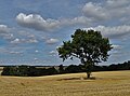
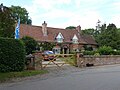
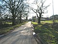
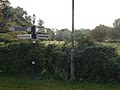
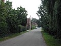
English: Gonalston is a small village in Nottinghamshire lying
village in Nottinghamshire, UK | |||||
| Upload media | |||||
| Instance of | |||||
|---|---|---|---|---|---|
| Location | Newark and Sherwood, Nottinghamshire, East Midlands, England | ||||
| Population |
| ||||
 | |||||
Subcategories
This category has only the following subcategory.
L
Media in category "Gonalston"
The following 163 files are in this category, out of 163 total.
-
 A spike of rosebay - geograph.org.uk - 6525798.jpg 960 × 1,280; 493 KB
-
 A612 Southwell Road at Gonalston - geograph.org.uk - 4879732.jpg 800 × 522; 162 KB
-
 Allington, Gonalston - geograph.org.uk - 6508479.jpg 1,280 × 960; 411 KB
-
 Apparently unnamed road, Gonalston - geograph.org.uk - 4224638.jpg 1,024 × 768; 260 KB
-
 Approaching Thistly Coppice - geograph.org.uk - 5609399.jpg 1,024 × 768; 281 KB
-
 Autumn red - geograph.org.uk - 1536337.jpg 462 × 640; 168 KB
-
 Bench mark, bridge over the Dover Beck, Gonalston - geograph.org.uk - 6508444.jpg 1,280 × 1,280; 616 KB
-
 Bend in the bridleway by Thistly Coppice - geograph.org.uk - 5611427.jpg 1,024 × 768; 275 KB
-
 Bentley Wood - geograph.org.uk - 5611664.jpg 1,024 × 768; 279 KB
-
 Bridge over Dover Beck - geograph.org.uk - 1098245.jpg 640 × 480; 99 KB
-
 Bridge over the Dover Beck - geograph.org.uk - 1536327.jpg 640 × 479; 152 KB
-
 Bridge over the Dover Beck - geograph.org.uk - 1536338.jpg 640 × 479; 157 KB
-
 Bridge over the Dover Beck, Gonalston - geograph.org.uk - 6508448.jpg 1,280 × 1,280; 696 KB
-
 Bridleway above Car Holt Farm - geograph.org.uk - 5609414.jpg 1,024 × 768; 293 KB
-
 Bridleway alongside Thistly Coppice - geograph.org.uk - 5611636.jpg 1,024 × 768; 316 KB
-
 Bridleway at Thistly Coppice - geograph.org.uk - 4237415.jpg 1,024 × 768; 134 KB
-
 Bridleway near Hagg Cottage - geograph.org.uk - 1758821.jpg 640 × 480; 102 KB
-
 Bridleway near Hagg Cottage - geograph.org.uk - 5611644.jpg 1,024 × 768; 246 KB
-
 Bridleway near Hagg Farm - geograph.org.uk - 6525771.jpg 1,280 × 960; 465 KB
-
 Bridleway north of Hagg Farm - geograph.org.uk - 4060968.jpg 1,024 × 768; 198 KB
-
 Bridleway to Epperstone east of Eastwood Farm - geograph.org.uk - 4237404.jpg 1,024 × 768; 148 KB
-
 Bridleway to Hagg Farm - geograph.org.uk - 1758832.jpg 640 × 480; 130 KB
-
 Bridleway to Lowdham - geograph.org.uk - 1758499.jpg 640 × 480; 148 KB
-
 Bridleway to Souther Wood - geograph.org.uk - 5864653.jpg 5,184 × 3,888; 6.11 MB
-
 Bridleway towards Thistly Coppice - geograph.org.uk - 4237409.jpg 1,024 × 768; 134 KB
-
 Bridleway west of Thurgarton (1) - geograph.org.uk - 4239468.jpg 1,024 × 768; 152 KB
-
 Bridleway west of Thurgarton (2) - geograph.org.uk - 4239469.jpg 1,024 × 768; 139 KB
-
 Car Holt Farm, Gonalston - geograph.org.uk - 6526231.jpg 1,280 × 872; 478 KB
-
 Cast iron railings on small road bridge - geograph.org.uk - 2647340.jpg 3,648 × 2,736; 6.2 MB
-
 Change in direction - geograph.org.uk - 5611429.jpg 1,024 × 768; 469 KB
-
 Church of St Laurence, Gonalston - geograph.org.uk - 6508464.jpg 1,280 × 928; 355 KB
-
 Cliff Mill - geograph.org.uk - 1508222.jpg 640 × 479; 120 KB
-
 Concrete debris near Lowdham - geograph.org.uk - 6508432.jpg 1,280 × 960; 528 KB
-
 Contented cattle - geograph.org.uk - 6508436.jpg 1,280 × 760; 552 KB
-
 Cottages on Gonalston Lane, Gonalston - geograph.org.uk - 4224618.jpg 1,024 × 768; 221 KB
-
 Dead trees - geograph.org.uk - 1508022.jpg 640 × 479; 98 KB
-
 Distant at caution - geograph.org.uk - 1508202.jpg 640 × 479; 83 KB
-
 Enclosed footpath towards Car Holt Farm - geograph.org.uk - 4931062.jpg 640 × 477; 124 KB
-
 Enclosed footpath towards Hagg Farm - geograph.org.uk - 4931060.jpg 640 × 634; 171 KB
-
 Farm and footpath gates of differing styles - geograph.org.uk - 6508431.jpg 1,280 × 973; 508 KB
-
 Farm track and Thistly Coppice - geograph.org.uk - 6525764.jpg 1,280 × 874; 314 KB
-
 Farm track near Hagg Cottage - geograph.org.uk - 5611650.jpg 1,024 × 768; 262 KB
-
 Farm track near Hagg Farm - geograph.org.uk - 1758815.jpg 640 × 480; 97 KB
-
 Farm track near Hagg Farm - geograph.org.uk - 5611639.jpg 1,024 × 768; 247 KB
-
 Farm track to Thistly Coppice - geograph.org.uk - 5611640.jpg 1,024 × 768; 155 KB
-
 Farmland near Hagg Cottage - geograph.org.uk - 1758825.jpg 640 × 480; 89 KB
-
 Field boundary and bridleway - geograph.org.uk - 6526208.jpg 1,280 × 960; 448 KB
-
 Field of flax near Eastwood Farm - geograph.org.uk - 6525761.jpg 1,280 × 960; 400 KB
-
 Field of rape - geograph.org.uk - 6525777.jpg 1,280 × 960; 366 KB
-
 Field on the edge of Gonalston - geograph.org.uk - 2647353.jpg 3,648 × 2,736; 6.24 MB
-
 Fieldside track - geograph.org.uk - 4931072.jpg 640 × 480; 97 KB
-
 Fingers in the sky - geograph.org.uk - 1508027.jpg 640 × 640; 91 KB
-
 Flooded Farmland, Gonalston - geograph.org.uk - 1758496.jpg 640 × 480; 107 KB
-
 Footbridge near Gonalston - geograph.org.uk - 1508215.jpg 479 × 640; 146 KB
-
 Footpath and fields - geograph.org.uk - 4931061.jpg 640 × 442; 119 KB
-
 Footpath to Gonalston - geograph.org.uk - 4931073.jpg 640 × 466; 88 KB
-
 Footpath towards Car Holt Farm - geograph.org.uk - 4931063.jpg 640 × 488; 153 KB
-
 Former Blacksmith's shop on Main Street, Gonalston - geograph.org.uk - 6606347.jpg 1,064 × 1,600; 853 KB
-
 Gate at the end of the bridleway - geograph.org.uk - 5611755.jpg 1,024 × 768; 213 KB
-
 Glebe Farm, Gonalston - geograph.org.uk - 1105255.jpg 640 × 427; 110 KB
-
 Gonalston Crossing - geograph.org.uk - 1508207.jpg 640 × 479; 84 KB
-
 Gonalston Crossing - geograph.org.uk - 4224605.jpg 1,024 × 768; 221 KB
-
 Gonalston Farm bus stop - geograph.org.uk - 1508226.jpg 640 × 479; 92 KB
-
 Gonalston Farm Shop - geograph.org.uk - 1508224.jpg 640 × 460; 63 KB
-
 Gonalston Farm Shop - geograph.org.uk - 1536345.jpg 640 × 479; 102 KB
-
 Gonalston Lane - geograph.org.uk - 1508159.jpg 640 × 479; 140 KB
-
 Gonalston Lane - geograph.org.uk - 1508199.jpg 640 × 479; 105 KB
-
 Gonalston Lane - geograph.org.uk - 1758502.jpg 640 × 480; 102 KB
-
 Gonalston Lane - geograph.org.uk - 5609416.jpg 1,024 × 768; 344 KB
-
 Gonalston Lane crosses Southwell Road - geograph.org.uk - 4931076.jpg 640 × 482; 107 KB
-
 Gonalston Lane towards Epperstone - geograph.org.uk - 4931074.jpg 640 × 507; 103 KB
-
 Gonalston Lane towards Gonalston - geograph.org.uk - 4931067.jpg 640 × 427; 98 KB
-
 Gonalston Lane towards Gonalston - geograph.org.uk - 4931075.jpg 640 × 490; 132 KB
-
 Gonalston Lane, Gonalston - geograph.org.uk - 4224648.jpg 1,024 × 768; 296 KB
-
 Gonalston Road, Gonalston - geograph.org.uk - 6606137.jpg 1,600 × 1,131; 1.04 MB
-
 Gonalston smithy - geograph.org.uk - 1508183.jpg 640 × 479; 84 KB
-
 Gonalston smithy - geograph.org.uk - 1508188.jpg 640 × 479; 116 KB
-
 Gonalston smithy - geograph.org.uk - 1508191.jpg 640 × 479; 119 KB
-
 Grass field and Souther Wood - geograph.org.uk - 5611635.jpg 1,024 × 768; 198 KB
-
 Grass field at Gonalston - geograph.org.uk - 5611853.jpg 1,024 × 768; 218 KB
-
 Grazing cattle, Gonalston - geograph.org.uk - 6253880.jpg 1,024 × 768; 168 KB
-
 Grooves in the soil - geograph.org.uk - 1508168.jpg 640 × 464; 107 KB
-
 Hagg Cottage - geograph.org.uk - 4060918.jpg 1,024 × 768; 190 KB
-
 Hagg Cottage, Gonalston - geograph.org.uk - 6525802.jpg 1,280 × 960; 519 KB
-
 Hagg Farm - geograph.org.uk - 1508110.jpg 640 × 479; 64 KB
-
 Hagg Farm - geograph.org.uk - 1508127.jpg 640 × 479; 81 KB
-
 Hagg Farm - geograph.org.uk - 1758816.jpg 640 × 480; 39 KB
-
 Hagg Farm - geograph.org.uk - 5611430.jpg 1,024 × 768; 205 KB
-
 Hagg Farm - geograph.org.uk - 5611641.jpg 1,024 × 768; 197 KB
-
 Hagg Farm, Gonalston - geograph.org.uk - 6525768.jpg 1,280 × 842; 301 KB
-
 Hagg Farm, Gonalston - geograph.org.uk - 6525800.jpg 1,280 × 892; 369 KB
-
 Harvest time at Hagg Farm - geograph.org.uk - 5864665.jpg 4,749 × 3,887; 4.02 MB
-
 Hermitage, Gonalston - geograph.org.uk - 6508438.jpg 1,280 × 960; 542 KB
-
 Holme Farm, Gonalston - geograph.org.uk - 1508193.jpg 640 × 479; 86 KB
-
 Holme Farm, Gonalston - geograph.org.uk - 1508194.jpg 640 × 479; 80 KB
-
 Horse riders by Souther Wood - geograph.org.uk - 5864658.jpg 4,805 × 3,501; 3.92 MB
-
 House at Gonalston - geograph.org.uk - 1508185.jpg 640 × 479; 101 KB
-
 Isolated tree near Eastwood Farm - geograph.org.uk - 5611425.jpg 1,024 × 768; 186 KB
-
 Kite deterrent - geograph.org.uk - 6508483.jpg 1,280 × 960; 288 KB
-
 Leland's Dumble - geograph.org.uk - 1508169.jpg 640 × 479; 127 KB
-
 Lone tree between Hagg Farm and Eastwood Farm - geograph.org.uk - 5864671.jpg 5,043 × 3,728; 3.81 MB
-
 Looking towards Thistly Coppice - geograph.org.uk - 1508109.jpg 640 × 479; 109 KB
-
 Manor Cottages, Gonalston.jpg 1,280 × 960; 390 KB
-
 Manor Farmhouse, Gonalston - geograph.org.uk - 1508176.jpg 640 × 479; 118 KB
-
 Manor Farmhouse, Gonalston.jpg 1,280 × 931; 411 KB
-
 Minor Road, Gonalston - geograph.org.uk - 1758489.jpg 640 × 480; 111 KB
-
 Minor Road, Gonalston - geograph.org.uk - 1758492.jpg 640 × 480; 123 KB
-
 Misleading signpost (1) - geograph.org.uk - 1508179.jpg 640 × 479; 90 KB
-
 Misleading signpost (2) - geograph.org.uk - 1508180.jpg 640 × 479; 156 KB
-
 Mistletoe and snowdrops - geograph.org.uk - 1749716.jpg 640 × 480; 111 KB
-
 Moat adjacent to Gonalston Church - geograph.org.uk - 6508461.jpg 1,280 × 870; 473 KB
-
 Narrow bridleway - geograph.org.uk - 5611680.jpg 1,024 × 768; 206 KB
-
 Near The Old Kennels, Gonalston. - geograph.org.uk - 1508171.jpg 640 × 479; 92 KB
-
 Old Blacksmiths Forge, Gonalston - geograph.org.uk - 449191.jpg 640 × 480; 150 KB
-
 Old Rectory, Gonalston.jpg 1,280 × 960; 491 KB
-
 Orchard near Hagg Farm - geograph.org.uk - 5611642.jpg 1,024 × 768; 181 KB
-
 Path near Epperstone - geograph.org.uk - 1098340.jpg 640 × 480; 123 KB
-
 Ploughed field and Souther Wood - geograph.org.uk - 5609403.jpg 1,024 × 768; 253 KB
-
 Postbox on Gonalston Lane Gonalston - geograph.org.uk - 6606366.jpg 1,600 × 1,120; 1,020 KB
-
 Rape field and Souther Wood - geograph.org.uk - 6525774.jpg 1,280 × 960; 393 KB
-
 Ride through Thistle Coppice - geograph.org.uk - 1508120.jpg 640 × 479; 151 KB
-
 Riding field near Lowdham - geograph.org.uk - 1098259.jpg 640 × 480; 99 KB
-
 Road junction, Gonalston (1) - geograph.org.uk - 4224634.jpg 1,024 × 768; 164 KB
-
 Road junction, Gonalston (2) - geograph.org.uk - 4224646.jpg 1,024 × 768; 283 KB
-
 Road through Gonalston Village - geograph.org.uk - 38971.jpg 640 × 480; 120 KB
-
 Roadway to Gonalston Lane - geograph.org.uk - 5611643.jpg 1,024 × 768; 271 KB
-
 Small field next to Hagg Cottage - geograph.org.uk - 4060905.jpg 1,024 × 768; 212 KB
-
 Spital Wood - geograph.org.uk - 1506946.jpg 640 × 479; 93 KB
-
 Spurge (Euphorbia) - geograph.org.uk - 6508488.jpg 1,280 × 960; 457 KB
-
 Spurge (Euphorbia) - geograph.org.uk - 6508491.jpg 1,280 × 1,280; 400 KB
-
 St Laurence's Church, Gonalston - geograph.org.uk - 4879671.jpg 800 × 532; 113 KB
-
 St Laurence's Church, Gonalston - geograph.org.uk - 5864700.jpg 3,649 × 4,878; 3.61 MB
-
 Stop me and buy one - geograph.org.uk - 2647357.jpg 2,430 × 1,824; 1.05 MB
-
 Stream at Lowdham Mill - geograph.org.uk - 1098234.jpg 640 × 480; 123 KB
-
 Summer Saturday walkers - geograph.org.uk - 6508485.jpg 1,280 × 883; 457 KB
-
 Swing in the churchyard - geograph.org.uk - 6508466.jpg 1,280 × 960; 568 KB
-
 Telephone Kiosk, Gonalston.jpg 916 × 1,024; 366 KB
-
 The Almshouses, Gonalston - geograph.org.uk - 6508459.jpg 1,280 × 960; 458 KB
-
 The Dover Beck valley - geograph.org.uk - 1508165.jpg 640 × 479; 98 KB
-
 The edge of Thistly Coppice - geograph.org.uk - 1508123.jpg 640 × 479; 83 KB
-
 The Forge, Gonalston - geograph.org.uk - 6508473.jpg 1,280 × 960; 520 KB
-
 The Forge, Gonalston.jpg 1,024 × 768; 218 KB
-
 The Hermitage, Gonalston - geograph.org.uk - 1536342.jpg 640 × 479; 105 KB
-
 The Hut - geograph.org.uk - 1011907.jpg 614 × 446; 116 KB
-
 The Manor, Gonalston - geograph.org.uk - 6508476.jpg 960 × 1,280; 436 KB
-
 The old road to Southwell - geograph.org.uk - 6508440.jpg 1,280 × 960; 651 KB
-
 The south western approach to Gonalston - geograph.org.uk - 4224651.jpg 1,024 × 768; 300 KB
-
 Thistly Coppice - geograph.org.uk - 1758810.jpg 640 × 480; 142 KB
-
 Three-way split at Hagg Farm - geograph.org.uk - 6525801.jpg 1,280 × 890; 377 KB
-
 Towards Netherfield Farm - geograph.org.uk - 4931068.jpg 640 × 445; 104 KB
-
 Track and woods near Epperstone - geograph.org.uk - 1098301.jpg 640 × 480; 103 KB
-
 Track through Thistly Coppice - geograph.org.uk - 5611637.jpg 1,024 × 768; 360 KB
-
 Track to Hagg Farm - geograph.org.uk - 4060929.jpg 1,024 × 768; 234 KB
-
 Trees behind Lowdam Mill - geograph.org.uk - 1098222.jpg 640 × 480; 115 KB
-
 Valley of the Dover Beck - geograph.org.uk - 6508486.jpg 1,280 × 960; 573 KB
-
 Very basic foot crossing south of Gonalston - geograph.org.uk - 4224614.jpg 1,024 × 768; 413 KB
-
 View towards Brockwood Farm - geograph.org.uk - 5611426.jpg 1,024 × 768; 186 KB
-

-
 Where is the bridleway^ - geograph.org.uk - 6525780.jpg 1,280 × 960; 424 KB
-
 Willows along the Dover Beck - geograph.org.uk - 1536333.jpg 640 × 479; 80 KB
-
 A612 at Gonalston - geograph.org.uk - 1508197.jpg 640 × 475; 100 KB
-
 Carr Beck - geograph.org.uk - 1508210.jpg 479 × 640; 128 KB
-
 Lowdham Traffic Island - geograph.org.uk - 35714.jpg 640 × 480; 80 KB


_-_geograph.org.uk_-_4239468.jpg)
_-_geograph.org.uk_-_4239469.jpg)


_-_geograph.org.uk_-_1508179.jpg)
_-_geograph.org.uk_-_1508180.jpg)


_-_geograph.org.uk_-_4224634.jpg)
_-_geograph.org.uk_-_4224646.jpg)


_-_geograph.org.uk_-_6508488.jpg)
_-_geograph.org.uk_-_6508491.jpg)


