Category:Goole
English: Goole is a town, civil parish and port located approximately 45 miles (72 km) inland on the confluence of the rivers Don and Ouse in the East Riding of Yorkshire, England.
town, civil parish and inland port in the East Riding of Yorkshire, England  | |||||
| Upload media | |||||
| Instance of | |||||
|---|---|---|---|---|---|
| Location | East Riding of Yorkshire, Yorkshire and the Humber, England | ||||
| Population |
| ||||
| Different from | |||||
| official website | |||||
 | |||||
Subcategories
This category has the following 19 subcategories, out of 19 total.
B
C
- Cemeteries in Goole (2 F)
G
H
I
M
O
- Old Goole (8 F)
P
- Plaques in Goole (1 F)
R
S
- Ships scrapped in Goole (empty)
T
W
- Woods of Goole (bus company) (3 F)
Y
Media in category "Goole"
The following 200 files are in this category, out of 398 total.
(previous page) (next page)-
 "Dog Crap Alley" - geograph.org.uk - 2930452.jpg 1,024 × 768; 197 KB
-
 "Fast Julia" manoeuvres into Goole Docks - geograph.org.uk - 5767389.jpg 1,024 × 768; 151 KB
-
 "Salt and pepper" - Goole - geograph.org.uk - 6299117.jpg 640 × 480; 71 KB
-
 "The Gate" community theatre, Goole - geograph.org.uk - 2249597.jpg 2,608 × 1,952; 1.11 MB
-
 "The Port in Green Fields" - geograph.org.uk - 878238.jpg 640 × 433; 59 KB
-
 A W Nielsen Road, M62 Trading Estate, Goole - geograph.org.uk - 6344311.jpg 4,000 × 3,000; 3.97 MB
-
 A walk from Goole ^1 - geograph.org.uk - 1991655.jpg 800 × 600; 286 KB
-
 A walk from Goole ^2 - geograph.org.uk - 1991661.jpg 800 × 600; 316 KB
-
 A walk from Goole ^4 - geograph.org.uk - 1991665.jpg 800 × 600; 210 KB
-
 A walk from Goole ^54 - geograph.org.uk - 1992027.jpg 800 × 600; 300 KB
-
 A walk from Goole ^55 - geograph.org.uk - 1992040.jpg 800 × 600; 247 KB
-
 A walk from Goole ^56 - geograph.org.uk - 1992042.jpg 800 × 600; 259 KB
-
 A walk from Goole ^57 - geograph.org.uk - 1992046.jpg 800 × 600; 166 KB
-
 A walk from Goole ^58 - geograph.org.uk - 1992051.jpg 800 × 600; 196 KB
-
 A walk from Goole ^59 - geograph.org.uk - 1992057.jpg 800 × 600; 238 KB
-
 A walk from Goole ^61 - geograph.org.uk - 1992074.jpg 800 × 600; 212 KB
-
 A walk from Goole ^62 - geograph.org.uk - 1992080.jpg 800 × 600; 294 KB
-
 A walk from Goole ^7 - geograph.org.uk - 1991683.jpg 800 × 600; 183 KB
-
 A161 towards Crowle - geograph.org.uk - 2549796.jpg 1,600 × 1,200; 450 KB
-
 A161 towards Old Goole - geograph.org.uk - 2276079.jpg 1,600 × 1,200; 357 KB
-
 A614 Airmyn Road - geograph.org.uk - 5922682.jpg 1,024 × 710; 88 KB
-
 A614 Rawcliffe Road - geograph.org.uk - 5922677.jpg 1,024 × 769; 121 KB
-
 Abandoned crane - geograph.org.uk - 2533162.jpg 768 × 1,024; 102 KB
-

-
 Aire ^ Calder Navigation with railway bridges - geograph.org.uk - 2741663.jpg 1,500 × 843; 1.11 MB
-
 Airmyn Road (A614) towards Goole - geograph.org.uk - 2024134.jpg 640 × 480; 64 KB
-
 Airmyn Road, Goole - geograph.org.uk - 5147180.jpg 1,600 × 1,200; 587 KB
-
 Aldham Dock and St. John's Church - geograph.org.uk - 2478062.jpg 1,024 × 768; 137 KB
-
 Aldham Dock, Goole (2) - geograph.org.uk - 2478049.jpg 1,024 × 768; 116 KB
-
 Aldham Dock, Goole (3) - geograph.org.uk - 2478056.jpg 1,024 × 768; 124 KB
-
 Aldham Dock, Goole - geograph.org.uk - 2478038.jpg 1,024 × 768; 133 KB
-
 Allotment shed by the track to Stanewell Farm - geograph.org.uk - 6085522.jpg 3,755 × 4,962; 5.14 MB
-
 Allotments off Moorland Road - geograph.org.uk - 5918608.jpg 1,600 × 1,064; 917 KB
-
 Allotments south of Old Goole - geograph.org.uk - 5918590.jpg 1,600 × 1,064; 696 KB
-

-
 Andrew Percy MP constituency office - geograph.org.uk - 5920625.jpg 1,600 × 1,064; 568 KB
-
 Approaching Goole (South Dock) Bridge - geograph.org.uk - 5459583.jpg 640 × 480; 367 KB
-
 At the entrance to Ouse Dock from Ship Dock, Goole - geograph.org.uk - 4788399.jpg 5,184 × 3,888; 5.77 MB
-
 Bandstand, riverside gardens - geograph.org.uk - 5278462.jpg 1,024 × 768; 124 KB
-
 Barge Dock in Goole - geograph.org.uk - 4904190.jpg 4,608 × 3,456; 3.47 MB
-
 Barge Dock, Goole - geograph.org.uk - 5263621.jpg 1,024 × 768; 90 KB
-
 Barge on the Aire and Calder Navigation - geograph.org.uk - 5459586.jpg 640 × 481; 464 KB
-
 Beneath Goole Bridge - geograph.org.uk - 2930349.jpg 1,024 × 768; 160 KB
-
 Big empty ship, Aldam Dock - geograph.org.uk - 2586496.jpg 1,024 × 768; 102 KB
-
 Boat Hoist Detail, Goole South Dock - geograph.org.uk - 5459059.jpg 640 × 481; 307 KB
-

-
 Boats on the Aire and Calder - geograph.org.uk - 1983405.jpg 768 × 1,024; 454 KB
-
 Boothferry Road goes over the M62 - geograph.org.uk - 2112438.jpg 800 × 600; 173 KB
-
 Bric-a-Brac shop, Marshfield Avenue, Goole - geograph.org.uk - 6082548.jpg 1,024 × 768; 169 KB
-
 Bridge over Earnshaw's Warping Drain - geograph.org.uk - 3803241.jpg 640 × 427; 49 KB
-
 Bridge Street at Albert Road - geograph.org.uk - 5463123.jpg 1,024 × 576; 114 KB
-
 Bridged access to West Dock, Goole - geograph.org.uk - 4695295.jpg 1,024 × 768; 123 KB
-
 Building site, Captains Close, Goole - geograph.org.uk - 2204970.jpg 640 × 480; 71 KB
-
 Bungalows on Clifton Gardens - geograph.org.uk - 2224276.jpg 1,024 × 768; 130 KB
-

-
 Business premises, Aldam Dock, Goole - geograph.org.uk - 4695320.jpg 1,024 × 768; 110 KB
-

-
 Canal craft berthed at Yorkshire Waterways Museum - geograph.org.uk - 3136790.jpg 4,000 × 3,000; 2.28 MB
-
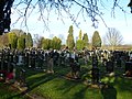
 Cemetery, Goole - geograph.org.uk - 2023572.jpg 640 × 480; 121 KB
-
 Centenary Road, Goole - geograph.org.uk - 2110880.jpg 800 × 600; 227 KB
-
 Centenary Road, Goole - geograph.org.uk - 5920450.jpg 1,600 × 1,064; 751 KB
-
 Centenary Road, Goole - geograph.org.uk - 5920454.jpg 1,600 × 1,064; 443 KB
-
 Centenary Road, Goole - geograph.org.uk - 5920458.jpg 1,600 × 1,064; 531 KB
-
 Centenary Road, Goole - geograph.org.uk - 5920483.jpg 1,600 × 1,064; 690 KB
-
 Centenary Road, Goole - geograph.org.uk - 5920486.jpg 1,600 × 1,064; 509 KB
-
 Centenary Road, Goole - geograph.org.uk - 5920489.jpg 1,600 × 1,064; 601 KB
-
 Church Close, Old Goole - geograph.org.uk - 2018187.jpg 1,024 × 768; 98 KB
-
 Coal Wagon Hoist, Railway Dock - geograph.org.uk - 5459463.jpg 640 × 480; 352 KB
-

-
 Container crane, Ship Dock, Goole - geograph.org.uk - 4695289.jpg 1,024 × 768; 126 KB
-
 Container stack behind St. John's church - geograph.org.uk - 1965176.jpg 768 × 1,024; 136 KB
-
 Containers on the dockside - geograph.org.uk - 2483589.jpg 1,024 × 768; 128 KB
-
 Control room, Ocean Lock, Goole - geograph.org.uk - 3570782.jpg 1,024 × 768; 105 KB
-
 Corner of Grange Road and Dunhill Road, Goole - geograph.org.uk - 2249604.jpg 2,446 × 1,828; 968 KB
-
 Cross Street West, Goole - geograph.org.uk - 2249608.jpg 2,608 × 1,952; 1.2 MB
-
 Cycleway and footpath, M62 trading estate - geograph.org.uk - 2171814.jpg 1,024 × 768; 126 KB
-
 Dereliction in South Street - geograph.org.uk - 2477978.jpg 1,024 × 768; 144 KB
-
 Dock gates, Goole - geograph.org.uk - 2478046.jpg 1,024 × 768; 160 KB
-
 Doorway, St. John's Street, Goole - geograph.org.uk - 1965179.jpg 2,448 × 3,264; 3.32 MB
-

-
 Dry Dock, Goole - geograph.org.uk - 5147161.jpg 1,600 × 1,200; 480 KB
-
 Dutch River Bridge - geograph.org.uk - 5538782.jpg 1,499 × 931; 1.4 MB
-
 Dutch River Bridge - geograph.org.uk - 6342258.jpg 2,000 × 1,091; 1.8 MB
-

-
 Dutch River Mouth, Goole, at high tide - geograph.org.uk - 5513781.jpg 1,024 × 768; 114 KB
-
 Dutch River, Goole - geograph.org.uk - 2549743.jpg 1,600 × 1,200; 312 KB
-
 Dutch River, Goole - geograph.org.uk - 5920812.jpg 1,600 × 1,064; 707 KB
-
 Edible oil tanks at Goole Docks - geograph.org.uk - 5864174.jpg 1,499 × 1,006; 1.35 MB
-
 Entrance to Goole Joint Cadet Centre - geograph.org.uk - 4063316.jpg 1,024 × 768; 161 KB
-
 Entrance to Humber Street workshops - geograph.org.uk - 2018184.jpg 1,024 × 768; 133 KB
-
 Ex Pilot Cutter T. W. Prickett - geograph.org.uk - 4997784.jpg 2,289 × 3,067; 2.12 MB
-

-
 Farmland north of Rawcliffe Road - geograph.org.uk - 6082504.jpg 1,024 × 768; 127 KB
-
 Field with emerging crop - geograph.org.uk - 3824006.jpg 1,500 × 926; 1.16 MB
-
 Fields north of the A614 on the edge of Goole - geograph.org.uk - 5263164.jpg 1,024 × 768; 122 KB
-
 Flood bank along the Ouse - geograph.org.uk - 2018196.jpg 1,024 × 768; 149 KB
-
 Flood defences, River Ouse - geograph.org.uk - 2023569.jpg 640 × 480; 98 KB
-
 Flooded Drydock Goole Docks - geograph.org.uk - 3136765.jpg 4,000 × 3,000; 2.49 MB
-
 Footpath and Flood bank by the River Ouse - geograph.org.uk - 4903973.jpg 4,552 × 3,390; 3.8 MB
-
 Former Lancashire ^ Yorkshire Railway Building - geograph.org.uk - 5920723.jpg 1,064 × 1,600; 660 KB
-
 Former School - geograph.org.uk - 2308204.jpg 1,024 × 768; 120 KB
-
 Former School on Moorland Road, Old Goole - geograph.org.uk - 5920854.jpg 1,600 × 1,064; 641 KB
-
 Former Yorkshire Electric Power Company - geograph.org.uk - 5920729.jpg 1,600 × 1,064; 527 KB
-
 Former Yorkshire Electric Power Company - geograph.org.uk - 5920756.jpg 1,600 × 1,064; 483 KB
-
 Gates to nowhere - geograph.org.uk - 2930455.jpg 1,024 × 768; 204 KB
-
 George VI postbox on Centenary Road, Goole - geograph.org.uk - 5920462.jpg 1,064 × 1,600; 818 KB
-
 Gibraltar Court Flats, North Street, Goole - geograph.org.uk - 4158438.jpg 1,600 × 1,071; 593 KB
-
 Goole - adult education buildings - geograph.org.uk - 3267852.jpg 1,184 × 1,600; 451 KB
-
 Goole - Arden House - geograph.org.uk - 3210228.jpg 1,600 × 1,312; 612 KB
-
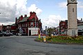
 Goole - Clock Tower and Bank Chambers - geograph.org.uk - 3268187.jpg 1,600 × 1,176; 556 KB
-
 Goole - Conservative Club - geograph.org.uk - 3268179.jpg 1,600 × 1,224; 486 KB
-
 Goole - former goods offices - geograph.org.uk - 3267849.jpg 1,600 × 1,239; 525 KB
-

-
 Goole - Haig Memorial Hall - geograph.org.uk - 3210237.jpg 640 × 267; 52 KB
-
 Goole - houses on Clifton Gardens - geograph.org.uk - 3210376.jpg 1,222 × 1,600; 547 KB
-
 Goole - Ocean Lock - geograph.org.uk - 1824449.jpg 1,600 × 1,192; 524 KB
-
 Goole - Parish Church spire - geograph.org.uk - 3268166.jpg 1,171 × 1,600; 497 KB
-
 Goole - shops on Boothferry Road - geograph.org.uk - 3210211.jpg 1,600 × 1,199; 566 KB
-
 Goole - shops on Pasture Road - geograph.org.uk - 3211574.jpg 1,600 × 877; 385 KB
-
 Goole - St Johns Street - geograph.org.uk - 3268160.jpg 468 × 640; 107 KB
-
 Goole - terrace on Hook Road - geograph.org.uk - 1824427.jpg 1,200 × 1,600; 449 KB
-
 Goole - The City ^ County and Art Deco building - geograph.org.uk - 3268173.jpg 1,600 × 1,181; 543 KB
-
 Goole - The Courtyard - geograph.org.uk - 3211581.jpg 1,600 × 1,233; 568 KB
-
 Goole Boathouse - geograph.org.uk - 5458949.jpg 640 × 480; 423 KB
-
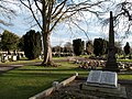
 Goole Cemetery - geograph.org.uk - 6225144.jpg 1,600 × 1,065; 874 KB
-
 Goole Cemetery - geograph.org.uk - 6225147.jpg 1,600 × 1,065; 638 KB
-
 Goole Cemetery - geograph.org.uk - 6225149.jpg 1,600 × 1,065; 720 KB
-
 Goole Cemetery - geograph.org.uk - 6225151.jpg 1,600 × 1,065; 715 KB
-
 Goole Clock Tower, Goole - geograph.org.uk - 5920653.jpg 1,600 × 1,064; 459 KB
-
 Goole Docks - entrance lock - geograph.org.uk - 6299468.jpg 640 × 480; 33 KB
-
 Goole Docks - entrance lock - geograph.org.uk - 6299473.jpg 640 × 480; 73 KB
-
 Goole Docks - geograph.org.uk - 1881666.jpg 3,456 × 2,304; 4.92 MB
-
 Goole Docks - geograph.org.uk - 2549736.jpg 640 × 480; 54 KB
-
 Goole Docks - geograph.org.uk - 3737543.jpg 640 × 480; 69 KB
-
 Goole Docks - geograph.org.uk - 3737575.jpg 640 × 480; 58 KB
-
 Goole Docks - geograph.org.uk - 3737824.jpg 640 × 480; 61 KB
-
 Goole Docks - geograph.org.uk - 3737844.jpg 640 × 480; 55 KB
-
 Goole Docks - geograph.org.uk - 3742549.jpg 640 × 480; 38 KB
-
 Goole Docks - geograph.org.uk - 3742558.jpg 640 × 480; 59 KB
-
 Goole Docks - geograph.org.uk - 3758492.jpg 640 × 473; 60 KB
-

-
 Goole Docks - railway waggon lift. - geograph.org.uk - 3742531.jpg 480 × 640; 65 KB
-

-
 Goole Docks, Aldam Dock - geograph.org.uk - 1881660.jpg 3,456 × 2,304; 4.55 MB
-
 Goole Docks, Looking west - geograph.org.uk - 1881681.jpg 3,456 × 2,304; 4.71 MB
-
 Goole Docks, Lowther Bridge - geograph.org.uk - 5459425.jpg 640 × 481; 346 KB
-
 Goole Docks, Ocean Lock - geograph.org.uk - 1881665.jpg 3,456 × 2,304; 4.51 MB
-
 Goole Docks, Ocean Lock - geograph.org.uk - 1881668.jpg 3,456 × 2,304; 4.05 MB
-
 Goole Docks, Ocean Lock - geograph.org.uk - 5459548.jpg 640 × 427; 250 KB
-
 Goole Docks, The Iron Bridge - geograph.org.uk - 1881662.jpg 3,456 × 2,304; 4.37 MB
-
 Goole Harbour, South Dock - geograph.org.uk - 5459055.jpg 640 × 481; 366 KB
-
 Goole High School Academy playing fields - geograph.org.uk - 4280384.jpg 800 × 600; 197 KB
-
 Goole in distance - panoramio.jpg 3,264 × 2,448; 3.54 MB
-
 Goole Joint Cadet Centre, from the east - geograph.org.uk - 4063335.jpg 1,024 × 768; 141 KB
-
 Goole Joint Cadet Centre, from the rear (west) - geograph.org.uk - 4063321.jpg 1,024 × 768; 138 KB
-
 Goole Mariners' Club - geograph.org.uk - 6299127.jpg 640 × 480; 59 KB
-

-
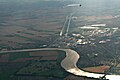
 Goole Reach (2) - geograph.org.uk - 2309236.jpg 1,024 × 768; 131 KB
-
 Goole Reach - geograph.org.uk - 2304058.jpg 1,024 × 768; 162 KB
-

-

-
 Goole shipyard offices - geograph.org.uk - 2098309.jpg 2,000 × 1,096; 1.65 MB
-
 Goole signal box - geograph.org.uk - 1881292.jpg 3,456 × 2,304; 4.51 MB
-
 Goole Signal Box - geograph.org.uk - 4052877.jpg 640 × 480; 69 KB
-
 Goole Town Cricket Club - geograph.org.uk - 4745861.jpg 1,024 × 682; 175 KB
-
 Goole Town Guide Headquarters - geograph.org.uk - 2224271.jpg 1,024 × 768; 159 KB
-
 Goole Town Guide HQ down Clifton Gardens - geograph.org.uk - 2110887.jpg 800 × 600; 186 KB
-
 Goole West Dock - geograph.org.uk - 2550764.jpg 1,600 × 1,200; 258 KB
-
 Goole, 'The Venue' - geograph.org.uk - 1881438.jpg 3,400 × 2,248; 4.91 MB
-
 Goole, Former public house - geograph.org.uk - 1881674.jpg 3,344 × 2,228; 4.08 MB
-
 Goole, Lancashire and Yorkshire Railway Goods Office - geograph.org.uk - 1881677.jpg 3,456 × 2,304; 4.48 MB
-
 Goole, Level crossing - geograph.org.uk - 1881203.jpg 3,456 × 2,304; 5.42 MB
-
 Goole, Pasture Road - geograph.org.uk - 1881308.jpg 3,456 × 2,304; 5.23 MB
-
-
 Goole, Roundabout - geograph.org.uk - 1881372.jpg 3,456 × 2,304; 5.34 MB
-
 Goole, The Dutch River - geograph.org.uk - 1881698.jpg 3,456 × 2,304; 4.62 MB
-
 Goole, The Dutch River - geograph.org.uk - 1881704.jpg 3,456 × 2,304; 4.76 MB
-
 Goole, Western Road - geograph.org.uk - 5459589.jpg 640 × 427; 303 KB
-
 Goole, Yorkshire Electric Power Company offices - geograph.org.uk - 1881267.jpg 3,456 × 2,304; 4.75 MB
-
 Gravel on the Aire ^ Calder (2) - geograph.org.uk - 2586465.jpg 1,024 × 768; 117 KB
-
 Gravel on the Aire ^ Calder (3) - geograph.org.uk - 2586509.jpg 1,024 × 768; 106 KB
-
 Gravel on the Aire ^ Calder - geograph.org.uk - 2586460.jpg 1,024 × 768; 114 KB
-
 Haig Memorial Hall, Goole - geograph.org.uk - 6205904.jpg 1,600 × 1,200; 385 KB
-
 Haig Memorial Hall, Pasture Road, Goole - geograph.org.uk - 5920508.jpg 1,600 × 1,064; 587 KB
-

-
 Hook - River Ouse boundary post - geograph.org.uk - 1824413.jpg 1,200 × 1,600; 758 KB
-
 Hook Road Cemetery - geograph.org.uk - 4280440.jpg 800 × 600; 158 KB
-
 Hook Road Cemetery and Chapel - geograph.org.uk - 4280436.jpg 800 × 600; 117 KB
-
 Hook Road Cemetery Chapel with graves - geograph.org.uk - 2741671.jpg 1,125 × 1,500; 1.47 MB
-
 Hook Road Cemetery, Goole - geograph.org.uk - 2741479.jpg 1,500 × 1,125; 1.89 MB
-
 Hook Road, Goole - geograph.org.uk - 2392793.jpg 800 × 600; 335 KB
-
 House at Goole Reach - geograph.org.uk - 6085528.jpg 4,954 × 3,618; 4.12 MB
-
 House next to The Park, by the A161 - geograph.org.uk - 3803226.jpg 640 × 427; 37 KB
-
 House on the corner of Moorland Road - geograph.org.uk - 3803237.jpg 640 × 427; 50 KB
-
 House on the south bank of the Dutch River - geograph.org.uk - 1983401.jpg 1,024 × 768; 165 KB
-
 Houses on Hook Road, Goole - geograph.org.uk - 5112913.jpg 1,024 × 768; 158 KB
-
 Houses on Princess Street, Goole - geograph.org.uk - 4695285.jpg 1,024 × 768; 132 KB
-

-
 Housing along Hook Road - geograph.org.uk - 5278460.jpg 1,024 × 768; 191 KB
-
 Hudson Ward silo, Barge Dock, Goole - geograph.org.uk - 5263618.jpg 1,024 × 768; 95 KB


_towards_Goole_-_geograph.org.uk_-_2024134.jpg)


_-_geograph.org.uk_-_2478049.jpg)
_-_geograph.org.uk_-_2478056.jpg)


_Bridge_-_geograph.org.uk_-_5459583.jpg)


_(26481289082).jpg)


_(28537127233).jpg)


_-_geograph.org.uk_-_4063321.jpg)


_-_geograph.org.uk_-_2309236.jpg)

_(26481288932).jpg)
_(26507570401).jpg)


_-_geograph.org.uk_-_2586465.jpg)
_-_geograph.org.uk_-_2586509.jpg)


