Category:Goosehill Camp
This is a category about listed building number 1008375. |
| Object location | | View all coordinates using: OpenStreetMap |
|---|
hillfort in West Sussex  | |||||
| Upload media | |||||
| Instance of |
| ||||
|---|---|---|---|---|---|
| Location | West Dean, Chichester, West Sussex, South East England, England | ||||
| Heritage designation | |||||
| Significant event |
| ||||
 | |||||
Media in category "Goosehill Camp"
The following 5 files are in this category, out of 5 total.
-
 Archaeological stratigraphy at Goosehill Camp.jpg 1,552 × 2,592; 1.19 MB
-
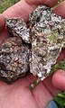 Burnt Flint from Goosehill Camp.jpg 1,552 × 2,592; 1.27 MB
-
 Goose Hill camp - geograph.org.uk - 9286.jpg 640 × 426; 93 KB
-
 Goosehill Camp worked flint.jpg 1,552 × 2,592; 975 KB
-
 Goosehill Camp, Bow Hill.jpg 2,592 × 1,552; 1.52 MB


