Category:Gowthorpe, East Riding of Yorkshire
English: Gowthorpe is a hamlet in the East Riding of Yorkshire, England. It is situated approximately 4 miles (6.4 km) north west of Pocklington town centre and 3 miles (4.8 km) east of the village of Stamford Bridge.
village in United Kingdom  | |||||
| Upload media | |||||
| Instance of | |||||
|---|---|---|---|---|---|
| Location | Bishop Wilton, East Riding of Yorkshire, Yorkshire and the Humber, England | ||||
 | |||||
Media in category "Gowthorpe, East Riding of Yorkshire"
The following 15 files are in this category, out of 15 total.
-
 Barley near Gowthorpe - geograph.org.uk - 211284.jpg 640 × 479; 47 KB
-
 Beck Field - geograph.org.uk - 399684.jpg 640 × 478; 164 KB
-
 Bridleway to Youlthorpe - geograph.org.uk - 399709.jpg 640 × 478; 121 KB
-
 Derelict farm buildings - geograph.org.uk - 308993.jpg 640 × 360; 69 KB
-
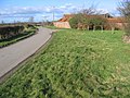
 Entering Gowthorpe.jpg 640 × 360; 64 KB
-
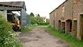 Farm Buildings Gowthorpe.jpg 640 × 360; 84 KB
-
 Gowthorpe Beck - geograph.org.uk - 399675.jpg 478 × 640; 177 KB
-
 Gowthorpe Fields - geograph.org.uk - 125999.jpg 640 × 480; 125 KB
-
 Gowthorpe.jpg 640 × 480; 137 KB
-
 Haystack - Gowthorpe - geograph.org.uk - 211286.jpg 640 × 479; 49 KB
-
 Helicopter Above Full Sutton Airfield - geograph.org.uk - 921406.jpg 640 × 480; 48 KB
-
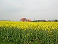
 Rape - geograph.org.uk - 399468.jpg 640 × 478; 206 KB
-
 Towards Grange Farm - geograph.org.uk - 399470.jpg 640 × 478; 112 KB
-
 Towards White Hill Farm - geograph.org.uk - 399689.jpg 640 × 478; 123 KB
-
 White Hill - geograph.org.uk - 399703.jpg 640 × 478; 149 KB


