Category:Grade II listed bridges in Rutland
Ceremonial counties of England: Bedfordshire · Berkshire · Buckinghamshire · Cambridgeshire · Cheshire · Cornwall · Cumbria · Derbyshire · Devon · Dorset · Durham · East Riding of Yorkshire · Essex · Gloucestershire · Greater London · Greater Manchester · Hampshire · Herefordshire · Hertfordshire · Kent · Lancashire · Leicestershire · Lincolnshire · Merseyside · Norfolk · North Yorkshire · Northamptonshire · Northumberland · Nottinghamshire · Oxfordshire · Rutland · Shropshire · Somerset · South Yorkshire · Staffordshire · Suffolk · Surrey · Tyne and Wear · Warwickshire · West Midlands · West Sussex · West Yorkshire · Wiltshire · Worcestershire
City-counties: Bristol ·
Former historic counties:
Other former counties:
City-counties: Bristol ·
Former historic counties:
Other former counties:
Subcategories
This category has the following 4 subcategories, out of 4 total.
C
- Collyweston Bridge (6 F)
D
- Duddington Bridge (13 F)
K
- Ketton Bridge (2 F)
O
- Oakham level crossing footbridge (11 F)
Media in category "Grade II listed bridges in Rutland"
The following 22 files are in this category, out of 22 total.
-
 Boundary arch, Wakerley Bridge (1) - geograph.org.uk - 4899690.jpg 1,280 × 1,055; 425 KB
-
 Boundary arch, Wakerley Bridge (2) - geograph.org.uk - 4899692.jpg 960 × 1,280; 470 KB
-
 Bridge at Ryhall - geograph.org.uk - 4544442.jpg 4,000 × 3,000; 4.02 MB
-
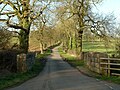
 Bridge on the road to Lyndon - geograph.org.uk - 4840692.jpg 1,280 × 960; 550 KB
-
 Bridge over River Welland (geograph 2061190).jpg 1,880 × 1,304; 636 KB
-
 Bridge over the Gwash, Bridge Street, Ryhall - geograph.org.uk - 5667728.jpg 3,776 × 2,520; 3.54 MB
-
 Bridge over the River Chater - geograph.org.uk - 4842170.jpg 1,280 × 960; 584 KB
-
 Bridge Street - geograph.org.uk - 903026.jpg 640 × 427; 89 KB
-
 Bridge Street, Ryhall - geograph.org.uk - 3089822.jpg 800 × 600; 346 KB
-
 Bridge Street, Ryhall - geograph.org.uk - 4544453.jpg 4,000 × 3,000; 4.36 MB
-
 Church Bridge, Empingham - geograph.org.uk - 4827814.jpg 960 × 1,280; 475 KB
-
 Church Bridge, Empingham - geograph.org.uk - 4827818.jpg 1,280 × 960; 501 KB
-
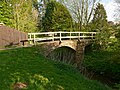 Footbridge over the River Gwash - geograph.org.uk - 4953492.jpg 1,280 × 960; 646 KB
-
 Horn Mill bridge - geograph.org.uk - 4818253.jpg 1,280 × 960; 477 KB
-
 Horn Mill bridge - geograph.org.uk - 4818260.jpg 1,280 × 960; 475 KB
-

-
 Moor Lane bridge, South Luffenham - geograph.org.uk - 4911332.jpg 1,280 × 935; 637 KB
-
 Ryhall Bridge - geograph.org.uk - 903021.jpg 640 × 427; 100 KB
-
 Turtle Bridge crossing the River Welland (geograph 6471144).jpg 3,547 × 2,400; 2.65 MB
-

-
 Wakerley Road bridge over the River Welland (geograph 2448282).jpg 4,000 × 3,000; 4.4 MB
-
 West parapet of Swooning Bridge, Uppingham Road - geograph.org.uk - 4909278.jpg 1,024 × 683; 195 KB
_-_geograph.org.uk_-_4899690.jpg)
_-_geograph.org.uk_-_4899692.jpg)


.jpg)


.jpg)

.jpg)
