Category:Grade II listed buildings in Cheshire
Ceremonial counties of England: Bedfordshire · Berkshire · Buckinghamshire · Cambridgeshire · Cheshire · Cornwall · Cumbria · Derbyshire · Devon · Dorset · Durham · East Riding of Yorkshire · East Sussex · Essex · Gloucestershire · Greater London · Greater Manchester · Hampshire · Herefordshire · Hertfordshire · Kent · Lancashire · Leicestershire · Lincolnshire · Merseyside · Norfolk · North Yorkshire · Northamptonshire · Northumberland · Nottinghamshire · Oxfordshire · Rutland · Shropshire · Somerset · South Yorkshire · Staffordshire · Suffolk · Surrey · Tyne and Wear · Warwickshire · West Midlands · West Sussex · West Yorkshire · Wiltshire · Worcestershire
City-counties: Bristol · City of London
Former historic counties: Westmorland ·
Other former counties:
City-counties: Bristol · City of London
Former historic counties: Westmorland ·
Other former counties:
Wikimedia category | |||||
| Upload media | |||||
| Instance of | |||||
|---|---|---|---|---|---|
| |||||
Subcategories
This category has the following 102 subcategories, out of 102 total.
*
1
4
- 41, Chestergate (1 F)
A
- Adelphi Mill, Bollington (17 F)
- Albion Mill (3 F)
- Aldford Stocks (7 F)
- Alma Mill (5 F)
- Arley Tudor barn (8 F)
- Armoury Towers, Macclesfield (38 F)
- Market House, Audlem (6 F)
B
- Bate Mill (8 F)
- Beeston Castle Lodge (18 F)
- Beeston Stone Lock (6 F)
- Brunner Library, Northwich (8 F)
- Bunbury Mill (18 F)
- Byrons Mill (5 F)
C
- Combermere Monument (4 F)
- Crewe Market Hall (6 F)
- Crompton Road Mill (3 F)
D
- Dutch Tea House, Eaton Hall (2 F)
- Dutton Locks (44 F)
- Dutton Stop Lock (12 F)
F
- Frodsham war memorial (7 F)
H
- Hale Head Light (29 F)
- Hale ice house (3 F)
K
- Knutsford Town Hall (6 F)
L
- Lower Paradise Mill (1 F)
- Lyceum Theatre, Crewe (5 F)
M
- Macclesfield Cemetery Lodge (1 F)
- Malpas Cross (5 F)
- The Meat Safe, Lyme Park (3 F)
N
- Norton Water Tower (7 F)
P
- Pulford Village Hall (4 F)
- Plaza, Northwich (6 F)
- Preston Brook Tunnel (17 F)
R
- Regency Mill (3 F)
- Regent Foundry (4 F)
- Runcorn Library (3 F)
- Runcorn signal box (9 F)
S
- Saltersford Locks (14 F)
- Saltersford Tunnel (26 F)
- Sandbach Literary Institute (4 F)
- Sandbach Town Hall (12 F)
- Styal Cross (6 F)
T
- The Timberyard, Lyme Park (8 F)
- Trafford Mill (4 F)
U
- Union Mill (7 F)
- Upper Washford Mill (11 F)
V
- Vale Royal Locks (30 F)
- Victoria Mills (7 F)
W
- Wardle Pinfold (3 F)
- Warrington Academy (3 F)
- Warrington Police Station (6 F)
- Weaver Hall Museum and Workhouse (16 F)
- Widnes Corporation Bus Depot (3 F)
- Widnes Town Hall (4 F)
Media in category "Grade II listed buildings in Cheshire"
The following 200 files are in this category, out of 844 total.
(previous page) (next page)-
 1 and 3, Wallworths Bank, Congleton 01.jpg 4,000 × 3,000; 818 KB
-
 1 and 3, Wallworths Bank, Congleton 02.jpg 4,000 × 3,000; 4.75 MB
-
 1 and 3, Wallworths Bank, Congleton 03.jpg 4,000 × 3,000; 4.41 MB
-
 10A, Princess Street, Knutsford.jpg 3,000 × 4,000; 4.72 MB
-
 11, Bridge Street, Congleton.jpg 4,000 × 3,000; 1.03 MB
-
 1159891 Gates to Sandbach Church.jpg 1,800 × 1,350; 717 KB
-
 12 and 14 Swan Bank, Congleton.jpg 4,000 × 3,000; 4.88 MB
-
 12, Princess Street, Knutsford.jpg 3,000 × 4,000; 1.66 MB
-
 13, Bridge Street, Congleton.jpg 3,000 × 4,000; 1,011 KB
-
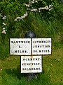
 1330048 Canal Milestone, Trent and Mersey Canal.jpg 1,350 × 1,800; 619 KB
-
 1330395 Trustee Savings Bank, Sandbach.jpg 1,800 × 1,350; 525 KB
-
 15, King Street, Knutsford.jpg 3,106 × 4,079; 1.38 MB
-
 16–20 High Street, Congleton.jpg 4,000 × 3,000; 740 KB
-
 17 and 19, King Street, Knutsford.jpg 4,000 × 3,000; 1.31 MB
-
 1898 Milestone - geograph.org.uk - 5602311.jpg 865 × 2,091; 1.12 MB
-
 19, King Edward Street, Macclesfield.jpg 2,560 × 1,920; 3.46 MB
-
 1–5, Bridge Street, Congleton 01.jpg 4,052 × 3,070; 1,009 KB
-
 1–5, Bridge Street, Congleton 02.jpg 4,000 × 3,000; 985 KB
-
 21 and 23, King Street, Knutsford.jpg 3,000 × 4,000; 1.55 MB
-
 22 Oak Cottages (Styal Shop).jpg 4,000 × 3,000; 4.96 MB
-
 25 Lawton Street, Congleton 01.jpg 4,000 × 3,000; 992 KB
-
 25 Lawton Street, Congleton 02.jpg 4,000 × 3,000; 5.12 MB
-
 26 High Street, Congleton.jpg 3,519 × 2,815; 823 KB
-
 28 and 28A Lawton Street, Congleton 01.jpg 3,000 × 4,000; 941 KB
-
 28 and 28A Lawton Street, Congleton 02.jpg 4,000 × 3,000; 4.61 MB
-
 28–32 High Street, Congleton.jpg 4,000 × 3,000; 1.08 MB
-
 31 and 33, King Street, Knutsford.jpg 3,000 × 4,000; 1.41 MB
-
 34 and 36, King Street, Knutsford.jpg 3,000 × 4,000; 1.13 MB
-
 34 High Street Sandbach.jpg 2,307 × 2,033; 1.56 MB
-
 34–38 Chestergate, Macclesfield.jpg 864 × 4,342; 1.39 MB
-
 4, 4A and 6, Princess Street, Knutsford.jpg 4,000 × 3,000; 1.86 MB
-
 4, Duke Street, Congleton.jpg 4,000 × 3,000; 1,000 KB
-
 40-42 Chestergate, Macclesfield.jpg 390 × 2,141; 387 KB
-
 41 High Street, Sandbach.jpg 1,024 × 768; 270 KB
-
 42 High Street, Congleton.jpg 3,070 × 4,052; 697 KB
-
 43 and 45, King Street, Knutsford 01.jpg 4,000 × 3,000; 1.29 MB
-
 43 and 45, King Street, Knutsford 02.jpg 4,000 × 3,000; 4.3 MB
-
 44–48 Chestergate, Macclesfield.jpg 1,086 × 3,354; 1.22 MB
-
 46, King Street, Knutsford.jpg 3,000 × 4,000; 1.19 MB
-
 48, King Street, Knutsford 01.jpg 3,138 × 4,103; 1.3 MB
-
 48, King Street, Knutsford 02.jpg 3,000 × 4,000; 3.33 MB
-
 49 And 51, High Street.jpg 8,000 × 6,000; 9.88 MB
-
 5 High Street Congleton.jpg 4,032 × 3,024; 2.77 MB
-
 50 West Street, Congleton.jpg 4,105 × 3,141; 928 KB
-
 52 High Street, Congleton.jpg 3,138 × 4,103; 1.02 MB
-
 53 And 55, High Street.jpg 8,000 × 6,000; 10.92 MB
-
 53 High Street.jpg 1,656 × 1,472; 914 KB
-
 54, High Street, Tarvin.jpg 3,107 × 2,570; 835 KB
-
 57, 59 and 61, King Street, Knutsford.jpg 4,000 × 3,000; 1.33 MB
-
 62 & 64, Northgate Street, Chester 01.jpg 3,000 × 4,000; 1.33 MB
-
 62 & 64, Northgate Street, Chester 02.jpg 3,000 × 4,000; 1.23 MB
-
 66–74 Northgate Street, Chester 01.jpg 4,000 × 3,000; 5.77 MB
-
 66–74 Northgate Street, Chester 02.jpg 4,000 × 3,000; 5.77 MB
-
 6–10 Little Street, Congleton.jpg 4,000 × 3,000; 5.06 MB
-
 7 High Street Congleton, February 2024.jpg 3,024 × 4,032; 2.59 MB
-
 73 and 75, High Street, Tarporley.jpg 1,800 × 1,350; 1.84 MB
-
 7–11 West Street, Congleton.jpg 4,000 × 3,000; 4.61 MB
-
 8 and 10, Princess Street, Knutsford.jpg 3,000 × 4,000; 1.69 MB
-
 8–12 High Street, Congleton.jpg 3,052 × 2,313; 575 KB
-
 A Fancy Nantwich Building - geograph.org.uk - 1461473.jpg 640 × 548; 132 KB
-
 A Footpath and the Duke's Drive - geograph.org.uk - 495529.jpg 640 × 480; 115 KB
-
 A49 Radleywood - geograph.org.uk - 2058481.jpg 800 × 480; 155 KB
-
 A49-Badcocks Lane Junction - geograph.org.uk - 5022825.jpg 640 × 480; 417 KB
-
 AA box, Mere.jpg 482 × 640; 524 KB
-
 Acton Bridge Guidepost.jpg 640 × 480; 109 KB
-
 Alderley Edge (3).JPG 3,240 × 4,320; 2.93 MB
-
 Aldford - Lea Manor Farm - geograph.org.uk - 220733.jpg 512 × 388; 145 KB
-
 Appleton - Appleton Cross.jpg 640 × 480; 141 KB
-
 Balustrade, Arley Hall.jpg 3,865 × 2,841; 947 KB
-
 Arley Alcove.jpg 3,888 × 2,871; 940 KB
-
 Arley Forecourt 2a.jpg 3,630 × 2,655; 983 KB
-
 Arley greenhouse 1.jpg 4,000 × 3,000; 953 KB
-
 Arley greenhouse 2.jpg 3,806 × 2,847; 897 KB
-
 Arley greenhouse 3.jpg 4,000 × 3,000; 960 KB
-
 Arley Kitchen garden 1.jpg 3,875 × 2,900; 978 KB
-
 Arley Walled garden 1.jpg 3,880 × 2,855; 924 KB
-
 Sundial, Backford.jpg 3,456 × 5,184; 5.71 MB
-
 Baddiley lock no1.jpg 640 × 511; 131 KB
-
 Baddiley No 2 lock.jpg 1,024 × 768; 467 KB
-
 Baddiley No 3 lock.jpg 800 × 608; 259 KB
-
 Balustrade Wall.jpg 4,000 × 3,000; 1.97 MB
-
 Barlow House Farm - geograph.org.uk - 484946.jpg 640 × 427; 104 KB
-
 Barn at Bache House Farm.jpg 4,000 × 3,000; 5.2 MB
-
 Barn at Green Farm, Lyme Handley.jpg 1,564 × 1,173; 474 KB
-
 Barn at Hedgerow Farm, Rainow.JPG 1,800 × 1,350; 489 KB
-
 Barn at Hollins Farm, nr Macclesfield.jpg 4,000 × 3,000; 1.43 MB
-
 Barn at Home Farm, Tatton Park 01.jpg 4,000 × 3,000; 1.87 MB
-
 Barn at Home Farm, Tatton Park 02.jpg 4,000 × 3,000; 1.73 MB
-
 Barn at Park House Farm, Brereton.jpg 4,000 × 3,000; 5.03 MB
-
 Barn at Poplar Tree Farmhouse, Alvanley.jpg 4,000 × 3,000; 4.7 MB
-
 Barn at Utkinton Hall.jpg 4,000 × 3,000; 6.02 MB
-
 Barn conversion at Riley Bank.jpg 4,000 × 3,000; 4.64 MB
-
 Barn near Rockery Cottage, Alderley Edge.jpg 1,800 × 1,350; 716 KB
-
 Barn south of Woodhey Hall.jpg 4,000 × 3,000; 1.74 MB
-
 Barn, Boults Green Farm.jpg 1,800 × 1,350; 476 KB
-
 Barn, Meadowhouse Farm.jpg 640 × 480; 78 KB
-
 Barrow cross.jpg 480 × 640; 114 KB
-
 Bate Mill - geograph.org.uk - 625085.jpg 640 × 426; 138 KB
-
 Bath-house in Congleton Physic Garden.jpg 4,000 × 3,000; 4.84 MB
-
-
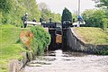
 Big Lock, Middlewich - geograph.org.uk - 51097.jpg 640 × 480; 129 KB
-

-
-
-
-
 Bosley Lock Number 10 and Lock Pound 2.jpg 3,456 × 2,304; 3.52 MB
-
 Bosley Lock Number 10 and Lock Pound.jpg 3,456 × 2,304; 3.66 MB
-
 Bosley Lock Number 2 and Lock Pound.jpg 3,456 × 2,304; 2.99 MB
-
 Bosley Lock Number 9 and Lock Pound.jpg 3,456 × 2,304; 4.86 MB
-
 Bosley Locks 9 and 10, Macclesfield Canal, Cheshire - geograph.org.uk - 550317.jpg 1,280 × 960; 1.43 MB
-
 Bosley Locks, Macclesfield Canal - geograph.org.uk - 89205.jpg 640 × 480; 75 KB
-
 Bosley School.jpg 4,320 × 3,240; 2.97 MB
-
 Bosleylock11.jpg 3,648 × 2,736; 6.24 MB
-
 Boundary Beacon? - geograph.org.uk - 152142.jpg 480 × 640; 132 KB
-
 Boundary Stone NHLE1138964.jpg 3,000 × 4,000; 3.14 MB
-
 Boundary Stone, Culcheth.jpg 640 × 480; 130 KB
-
 Boundary Stone, Kerridge.jpg 1,800 × 1,350; 2.4 MB
-
 Boundary stone, Norbury Hollow - geograph.org.uk - 4028959.jpg 1,280 × 906; 235 KB
-
 Box Hedge Hall Barn 01.jpg 4,000 × 3,000; 1.1 MB
-
 Box Hedge Hall Barn 02.jpg 4,000 × 3,000; 4.89 MB
-
 BrasseyGreenBarn.jpg 4,356 × 1,636; 1.17 MB
-
 Brick barn at Park House Farm - geograph.org.uk - 532783.jpg 640 × 480; 126 KB
-
 Bridge and weir on River Wheelock near Middlewich - geograph.org.uk - 5318221.jpg 4,032 × 3,024; 5.26 MB
-
 Bridgewater Canal - geograph.org.uk - 2855849.jpg 640 × 480; 404 KB
-
 Bridgewater Canal - geograph.org.uk - 2856277.jpg 640 × 480; 359 KB
-
 Bridgewater Street, Lymm.jpg 640 × 480; 438 KB
-
 British Waterways Clock, Northwich.JPG 3,240 × 4,320; 3.23 MB
-
-
 Bruen Stapleford - Stapleford Hall.jpg 640 × 480; 141 KB
-
 Buerton Windmill - geograph.org.uk - 1594606.jpg 426 × 640; 47 KB
-
 Building at Haughton Hall - geograph.org.uk - 126360.jpg 640 × 480; 53 KB
-
 Buildings at Broadhey Farm, Lower Kinnerton.jpg 4,000 × 3,000; 1.73 MB
-
 Bunbury Locks stables.jpg 640 × 480; 84 KB
-
 Bunbury Primary School.jpg 2,635 × 1,757; 686 KB
-
 Bunbury School.jpg 4,000 × 3,000; 4.83 MB
-
 Bunbury sundial.jpg 1,800 × 1,350; 643 KB
-
 Burford land warehouse and cottage from the back.jpg 4,928 × 3,264; 10.37 MB
-
 Burland - Swanley Number 2 Lock.jpg 640 × 429; 112 KB
-
 Camellia Walk, Eaton Hall.jpg 5,088 × 3,295; 3.22 MB
-
 Canal distance marker near Clarence Mill.jpg 4,000 × 3,000; 2.02 MB
-
 Canal distance stone in Bollington 01.jpg 4,000 × 3,000; 6.04 MB
-
 Canal distance stone in Bollington 02.jpg 4,000 × 3,000; 5.83 MB
-
 Canal milepost at Hack Green, Cheshire - geograph.org.uk - 1326581.jpg 479 × 640; 142 KB
-
 Canal Milepost at SJ79665797.jpg 1,350 × 1,800; 645 KB
-
 Canal milepost east of Wheelock Wharf.jpg 4,000 × 3,000; 6.53 MB
-
 Canal milepost near bridge 206, Trent and Mersey Canal.jpg 2,304 × 3,456; 2.36 MB
-
 Canal milepost near Wheelock.jpg 1,024 × 768; 474 KB
-
 Canal Milepost near Wheelock.jpg 3,000 × 4,000; 4.81 MB
-
 Canal milestone above Saltersford Tunnel.jpg 1,350 × 1,800; 623 KB
-
 Canal Milestone at NGR 7322 6056.jpg 4,000 × 3,000; 4.88 MB
-
 Canal milestone near Marbury Country Park 01.jpg 4,000 × 3,000; 4 MB
-
 Canal milestone near Marbury Country Park 02.jpg 3,000 × 4,000; 4.61 MB
-
 Canal milestone, Bollington.jpg 3,816 × 2,862; 4.51 MB
-
 Canal milestone, Trent and Mersey Canal.jpg 1,350 × 1,800; 737 KB
-
 Canal Salt Shed at Lion Salt Works.jpg 4,000 × 3,000; 4.73 MB
-
 Canal ventilation shaft, Dutton.jpg 4,000 × 3,000; 4.69 MB
-
 Carden Lodge 01.jpg 4,000 × 3,000; 4.74 MB
-
 Carden Lodge 02.jpg 4,000 × 3,000; 4.73 MB
-
 Carden Lodge 03.jpg 4,000 × 3,000; 4.72 MB
-
 Carriage house at Ashley Hall 01.jpg 4,000 × 3,000; 6.32 MB
-
 Carriage house at Ashley Hall 02.jpg 4,000 × 3,000; 6.13 MB
-
 Carriage house at Ashley Hall 03.jpg 4,000 × 3,000; 6.22 MB
-
 Cast iron milepost on A49, Appleton.jpg 1,473 × 1,954; 929 KB
-
 Catalyst 2.jpg 2,592 × 1,944; 1.1 MB
-
 Causeway on Eccleston Approach Drive, Eaton Hall 01.jpg 4,000 × 3,000; 5.02 MB
-
 Causeway on Eccleston Approach Drive, Eaton Hall 02.jpg 4,000 × 3,000; 5.15 MB
-
 Cawley tomb, Plemstall 01.jpg 4,000 × 3,000; 4.77 MB
-
 Cawley tomb, Plemstall 02.jpg 4,000 × 3,000; 4.88 MB
-
 Cawley tomb, Plemstall 03.jpg 4,000 × 3,000; 5.07 MB
-

-

-
 Chesshyre Library Gates.jpg 1,944 × 2,592; 1.06 MB
-
 Bell Tower Walk past the Addleshaw Tower - geograph.org.uk - 787486.jpg 480 × 640; 211 KB
-
 Archway, Grosvenor Park, Chester - DSC08005.JPG 3,648 × 2,736; 3.63 MB
-
 Chestergate bollard, Macclesfield.jpg 64 × 212; 26 KB
-
 Christleton Village - geograph.org.uk - 497372.jpg 640 × 480; 93 KB
-
 Church gate, Church Minshull.jpg 1,800 × 1,350; 586 KB
-
 Church of St James the Great, Ince (11).JPG 3,240 × 4,320; 4.76 MB
-
 Church Road walls, Eccleston.jpg 1,800 × 1,350; 1.34 MB
-
 Churchyard cross at St Helen's Church, Tarporley.jpg 1,800 × 1,350; 806 KB
-
 Churchyard cross, St Lawrence's, Peover.jpg 2,304 × 3,456; 747 KB
-
 Churchyard Cross, Warmingham.JPG 1,800 × 1,200; 1.13 MB
-
 Churchyard wall and Big Mere, Marbury, Cheshire.jpg 1,800 × 1,350; 1 MB
-
 Churchyard wall, Acton, Cheshire.jpg 1,800 × 1,350; 408 KB
-
 Churchyard wall, Great Budworth.jpg 4,000 × 3,000; 4.59 MB
-
 Churchyard walls to St Mary's, Nether Alderley 01.jpg 4,000 × 3,000; 6.04 MB
-
 Churchyard walls to St Mary's, Nether Alderley 02.jpg 4,000 × 3,000; 6 MB
-
 Churchyard walls to St Mary's, Nether Alderley 03.jpg 4,000 × 3,000; 6.21 MB
-
 Clayton's chimney - geograph.org.uk - 61836.jpg 640 × 480; 136 KB
-
 Clayton's Tower.jpg 1,800 × 1,377; 868 KB
-
 Clock Tower, Queen's Park, Crewe - geograph.org.uk - 247615.jpg 479 × 640; 78 KB
-
 Coach House Court, Eaton Hall.jpg 4,027 × 3,035; 1.21 MB
-
 Coach House, Peover Hall.jpg 2,474 × 1,839; 1.09 MB
-
 Cockshuts, Congleton 01.jpg 3,000 × 4,000; 4.92 MB
-
 Cockshuts, Congleton 02.jpg 4,000 × 3,000; 5.08 MB
-
 Coddington - Parish Room.jpg 640 × 480; 177 KB
-
 Coddington Village Institute.jpg 4,000 × 3,000; 4.87 MB
-
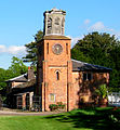 Combermere clocktower.jpg 707 × 762; 529 KB
-
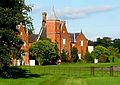
 Combermere service blocks.jpg 1,533 × 705; 693 KB
-
 Combermere stables.jpg 344 × 243; 107 KB


.jpg)


.JPG)


.JPG)


