Category:Grade II listed buildings in Powys

Wikimedia category | |||||
| Upload media | |||||
| Instance of | |||||
|---|---|---|---|---|---|
| |||||
Subcategories
This category has the following 42 subcategories, out of 42 total.
*
B
- Bridgend Flannel Mill (7 F)
- Builth Wells war memorial (12 F)
- Butter Market, Hay-on-Wye (7 F)
C
- Capel-y-ffin Monastery (16 F)
D
- Dolwar Fach (15 F)
- Dragon Hotel (8 F)
F
- Ffordd-las fawr (5 F)
- Ffynnon Ishow, Patrishow (4 F)
H
- Hay-on-Wye Clock Tower (34 F)
K
- Knighton clock tower (27 F)
L
- Lake Vyrnwy Dam Memorials (14 F)
- Llandrindod Wells Signal Box (12 F)
- Llanidloes railway station (9 F)
- Llanidloes Town Hall (8 F)
M
- Machynlleth clock tower (49 F)
- Machynlleth War Memorial (5 F)
- Montgomery War Memorial (14 F)
N
- NatWest Bank, Llanidloes (3 F)
- Neuadd Arms Hotel (9 F)
P
R
- Red Lion Hotel, Llanidloes (4 F)
- Regent Cinema, Newtown (3 F)
- Rhayader Clock Tower (33 F)
- Richard Booth's Bookshop (39 F)
- Robert Owen Museum (7 F)
S
- The Swan at Hay (4 F)
T
- Tomb of Howell Harris (2 F)
W
Media in category "Grade II listed buildings in Powys"
The following 73 files are in this category, out of 73 total.
-
 22 Station Road, Knighton.jpg 4,000 × 3,000; 1.43 MB
-
 Adeilad ym Machynlleth ger y fynwent.JPG 3,648 × 2,048; 2.25 MB
-
 Agrii, Knighton - geograph.org.uk - 3625432.jpg 800 × 618; 151 KB
-
 Angelina's Sweet Shop, Knighton - geograph.org.uk - 3725469.jpg 795 × 800; 154 KB
-
 Art Gallery, Machynlleth - geograph.org.uk - 1432205.jpg 425 × 640; 65 KB
-
 Barn conversion work in progress - geograph.org.uk - 1267286.jpg 640 × 480; 134 KB
-
 Brimford House, Crewgreen.jpg 4,000 × 3,000; 4.58 MB
-
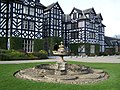
 Craig y nos fountain.jpg 2,471 × 1,391; 676 KB
-
 Drinking fountain, Llansilin - geograph.org.uk - 553069.jpg 480 × 640; 109 KB
-
 Ebenezer - geograph.org.uk - 2852864.jpg 640 × 427; 48 KB
-
 Eglwys St Padarn's Church, Llanbadarn Fawr, Powys, Cymru, Wales 24.JPG 4,272 × 2,848; 6.25 MB
-
 Farm buildings at Burfa.jpg 4,000 × 3,000; 1.43 MB
-
 Former salt warehouse near Llandysilio 01.jpg 4,000 × 3,000; 1.99 MB
-
 Former salt warehouse near Llandysilio 02.jpg 4,000 × 3,000; 1.11 MB
-
 Former vicarage, Llanspyddid (geograph 4489006).jpg 5,690 × 3,524; 2.71 MB
-
 Fountain (north-east).jpg 1,431 × 954; 1.4 MB
-
 Fountain (south-west).jpg 2,304 × 1,728; 1.29 MB
-
 Fountain in Craig-y-nos courtyard.jpg 3,345 × 2,997; 1.94 MB
-
 Garden Bridge.jpg 4,928 × 3,264; 7.62 MB
-
 HSBC - Middleton Street - geograph.org.uk - 3454466.jpg 640 × 480; 86 KB
-
 K6 telephone box by Knighton Clock Tower.jpg 3,138 × 4,103; 1.21 MB
-
 Knighton Community Support Charity Shop - geograph.org.uk - 4024275.jpg 800 × 721; 150 KB
-
 Knighton Hotel - geograph.org.uk - 3730466.jpg 4,000 × 3,000; 1.65 MB
-
 Knighton Music Centre - geograph.org.uk - 3875908.jpg 800 × 606; 134 KB
-
 Knighton Youth Hostel, 1984 - geograph.org.uk - 4355518.jpg 1,600 × 1,066; 426 KB
-
 Knighton's Plaice - geograph.org.uk - 3876177.jpg 600 × 800; 105 KB
-
 Lime kilns at Buttington Wharf - geograph.org.uk - 1323515.jpg 640 × 480; 86 KB
-
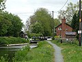
 Lower lock at Carreghofa Locks.jpg 4,000 × 3,000; 4.96 MB
-
 Lower Lock Chamber, Carreghofa Locks.jpg 4,000 × 3,000; 5.27 MB
-
 Lychgate, Llanfilo - geograph.org.uk - 2608644.jpg 3,456 × 2,592; 3.97 MB
-
 Lychgate, Partrishow church (geograph 3757017).jpg 680 × 1,024; 248 KB
-
 Mandarin House, Knighton - geograph.org.uk - 3962906.jpg 548 × 800; 111 KB
-
 Mellington Gatehouse.jpg 4,000 × 3,000; 1.38 MB
-
 Milestone - Brecon 2 - geograph.org.uk - 5455186.jpg 502 × 640; 160 KB
-
 Milestone near Dyffryn Restaurant.jpg 3,587 × 2,592; 8.91 MB
-
 Milestone on A470.jpg 4,608 × 2,592; 12.37 MB
-
 No.11 Heol Penrallt.jpg 3,643 × 2,428; 1.56 MB
-
 Nos.11-13 (Consec) (H.J. & D.Webb & Sons) High Street.jpg 3,232 × 2,160; 3.78 MB
-
 Observatory Point on The Elan Valley Aqueduct - geograph.org.uk - 1801454.jpg 3,000 × 4,000; 2.35 MB
-
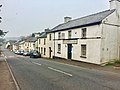
 Old building in Knighton - geograph.org.uk - 2846676.jpg 640 × 480; 66 KB
-

-

-

-
 Old Milk Factory, Four Crosses.jpg 4,000 × 3,000; 776 KB
-
 Old-style signpost in Knighton - geograph.org.uk - 3721239.jpg 800 × 623; 105 KB
-
-
 Penybontfawr Post Office - geograph.org.uk - 241768.jpg 640 × 480; 91 KB
-
 Plynlimon House - geograph.org.uk - 1278113.jpg 480 × 640; 78 KB
-
 Plynlimon House, Longbridge Street - geograph.org.uk - 622395.jpg 640 × 480; 84 KB
-
 Post Office,Strand Street.jpg 4,072 × 3,387; 4.08 MB
-
 Prince & Pugh, Knighton - geograph.org.uk - 3875814.jpg 800 × 607; 138 KB
-
 RAFA club, Knighton - geograph.org.uk - 3725366.jpg 765 × 800; 101 KB
-
 Saffron, Knighton - geograph.org.uk - 3623677.jpg 800 × 600; 101 KB
-
 Severn Hospice shop, Knighton - geograph.org.uk - 3876160.jpg 800 × 764; 145 KB
-
 Spectrum Gallery - geograph.org.uk - 379277.jpg 480 × 640; 94 KB
-
 St. Issui's Well Partrishow - geograph.org.uk - 1395143.jpg 480 × 640; 124 KB
-
 Station Road Knighton - geograph.org.uk - 3134408.jpg 640 × 413; 87 KB
-
 The Boathouse near Llanfrynach - geograph.org.uk - 3123152.jpg 640 × 480; 112 KB
-
 The Crown Hotel, Newbridge-on-Wye - geograph.org.uk - 3088181.jpg 4,320 × 3,240; 2.88 MB
-
 The Elephant, Llanidloes - geograph.org.uk - 1010377.jpg 640 × 480; 92 KB
-
 The Knighton Hotel, Knighton - geograph.org.uk - 3725509.jpg 800 × 546; 115 KB
-
 The old Llanfyllin Intermediate School - geograph.org.uk - 3098641.jpg 640 × 480; 117 KB
-
 The Smithy, Manafon, Wales.jpg 1,200 × 874; 359 KB
-
 The stable in Partrishow churchyard - geograph.org.uk - 1212668.jpg 640 × 480; 110 KB
-
 The Wynnstay Hotel.jpg 800 × 534; 160 KB
-
 Three Horse Shoes, Trecastell (geograph 6123843).jpg 3,264 × 2,448; 2.85 MB
-
 Top Lock, Montgomery Canal 01.jpg 4,000 × 3,000; 4.88 MB
-
 Top Lock, Montgomery Canal 02.jpg 4,000 × 3,000; 1.71 MB
-
 Ty Illtyd - geograph.org.uk - 5120745.jpg 3,264 × 2,448; 2.76 MB
-
 Upper Lock, Carreghofa Locks.jpg 4,000 × 3,000; 4.89 MB
-
 War memorial at Llandinam - geograph.org.uk - 2423703.jpg 3,872 × 2,592; 6.4 MB
-

-
 Ysgubor Coed-oer-le - geograph.org.uk - 4387632.jpg 640 × 360; 68 KB


.jpg)
.jpg)
.jpg)


.jpg)


_(H.J._%26_D.Webb_%26_Sons)_High_Street.jpg)


.jpg)


.jpg)


