Category:Grade II listed buildings in the Metropolitan Borough of Tameside
Wikimedia category | |||||
| Upload media | |||||
| Instance of | |||||
|---|---|---|---|---|---|
| |||||
Subcategories
This category has the following 16 subcategories, out of 16 total.
A
- Ashton-under-Lyne market hall (36 F)
- Ashton-under-Lyne town hall (13 F)
F
H
M
- Mossley Hall (2 F)
N
- Newton Hall, Tameside (19 F)
O
R
S
- Stalybridge Civic Hall (14 F)
- Stalybridge Town Hall (13 F)
T
- Tameside Central Library (5 F)
- Tameside Hippodrome (7 F)
- Theatre Royal, Hyde (30 F)
Media in category "Grade II listed buildings in the Metropolitan Borough of Tameside"
The following 74 files are in this category, out of 74 total.
-
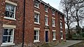
 10 and 10A Fairfield Square.jpg 4,608 × 2,592; 5.38 MB
-
 11 and 12 Fairfield Square.jpg 4,608 × 2,592; 4.08 MB
-
 15, 16 and 17 Fairfield Square.jpg 4,608 × 2,592; 4.11 MB
-
 18 Fairfield Square.jpg 4,608 × 2,592; 4.33 MB
-
 19 Fairfield Square.jpg 4,608 × 2,592; 4.83 MB
-
 24, 25, 26 and 27 Fairfield Square.jpg 4,608 × 2,592; 3.68 MB
-
 3, 4 and 5 Fairfield Square.jpg 4,608 × 2,592; 3.69 MB
-
 32A and 32B Fairfield Square.jpg 4,608 × 2,592; 3.58 MB
-
 33-36 Fairfield Square.jpg 4,608 × 2,592; 3.46 MB
-
 37 Fairfield Square.jpg 4,608 × 2,592; 3.45 MB
-
 37A, 38, 39, 40 and 40B Fairfield Square.jpg 4,608 × 2,592; 4 MB
-
 41 (The Orchards) and 42 Fairfield Square.jpg 4,608 × 2,592; 4.38 MB
-
 46 Fairfield Square.jpg 4,608 × 2,592; 4.12 MB
-
 47 and 48 Fairfield Square.jpg 4,608 × 2,592; 3.72 MB
-
 49 Fairfield Square.jpg 4,608 × 2,592; 3.27 MB
-
 7 Fairfield Square.jpg 4,608 × 2,592; 4.64 MB
-
 8 Fairfield Square.jpg 4,608 × 2,592; 4.67 MB
-
 9 Fairfield Square.jpg 4,608 × 2,592; 5.45 MB
-
 Ashtoncanal3.jpg 3,648 × 2,736; 5.42 MB
-
 Black Rock Bridge, Mossley.jpg 1,024 × 768; 197 KB
-
 Bridge at Lock 16W, Mossley.jpg 640 × 481; 601 KB
-
 Bridge No. 16, Ashton Canal.jpg 640 × 481; 576 KB
-
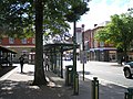
 Bus shelter, Hyde.jpg 640 × 853; 303 KB
-
 Bus Stop Closed - geograph.org.uk - 1121304.jpg 640 × 480; 142 KB
-
 Canal milestone near Mossley.jpg 1,024 × 768; 161 KB
-
 Caroline Street - geograph.org.uk - 1480520.jpg 640 × 564; 169 KB
-
 Fairfield High School for Girls.jpg 768 × 1,024; 207 KB
-
 Fairfield Moravian Settlement (36).JPG 4,320 × 3,240; 3.37 MB
-
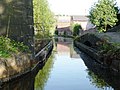
 Fairfield Top Lock, Ashton Canal.jpg 640 × 480; 540 KB
-
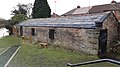
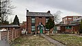
 Farm buildings, Hyde Hall.jpg 3,888 × 2,069; 1.64 MB
-
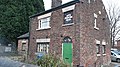
 Former canal warehouse, Hyde.jpg 640 × 508; 174 KB
-
 Former Methodist Church (geograph 3206925).jpg 640 × 458; 145 KB
-
 Former Moravian College.jpg 4,608 × 2,592; 4.81 MB
-
 Former packet boathouse, Droylsden.jpg 4,608 × 2,592; 4.84 MB
-
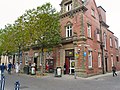 Former Post Office, Ashton-under-Lyne.jpg 640 × 480; 173 KB
-
 Godley Hall Inn - geograph.org.uk - 1471839.jpg 640 × 480; 90 KB
-
 Gun Inn, Hollingworth (cropped).jpg 682 × 512; 267 KB
-
 Gun Inn, Hollingworth.jpg 1,000 × 750; 582 KB
-
 Heritage Stop - geograph.org.uk - 834823.jpg 640 × 480; 138 KB
-
 Heyrod Bridge.jpg 1,280 × 960; 765 KB
-
 Heyrod Hall Bridge.jpg 1,280 × 960; 1.03 MB
-
 Hodge Lane, Broadbottom.jpg 1,024 × 768; 369 KB
-
 Holy Trinity drinking fountain, Ashton-under-Lyne.jpg 640 × 396; 116 KB
-
 Holy Trinity School, Ashton-under-Lyne.jpg 640 × 480; 124 KB
-
 Landslow Green Farmhouse.jpg 4,000 × 3,000; 1.28 MB
-
 Listed Shelter - geograph.org.uk - 1005986.jpg 640 × 480; 139 KB
-
 Lock Cottage.jpg 4,608 × 2,592; 5.05 MB
-
 Lockside.jpg 4,608 × 2,592; 3.62 MB
-
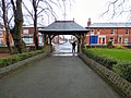 Lychgate, St George's Church, Hyde.jpg 1,000 × 750; 656 KB
-
 Lychgate, St George's, Mossley.jpg 640 × 480; 190 KB
-
-
 Oddfellows Hall, Ashton-under-Lyne.jpg 1,000 × 1,309; 382 KB
-
 Office, Dukinfield Cemetery.jpg 1,280 × 1,707; 1.05 MB
-
 Original house at Old Mottram.jpg 600 × 366; 122 KB
-
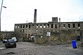
 Oxford Mills, Ashton-under-Lyne.jpg 640 × 480; 156 KB
-
 Park Parade Viaduct, Dukinfield.jpg 640 × 480; 119 KB
-
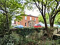 Pole Bank Hall, Hyde.jpg 1,000 × 750; 903 KB
-
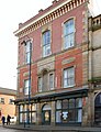
 Public library, Stalybridge.jpg 640 × 480; 72 KB
-
 Quickwood, Mossley.jpg 3,583 × 2,328; 3.73 MB
-
 Railway Viaduct over the River Tame (geograph 3493313).jpg 640 × 481; 596 KB
-
 Stalybridge, Market Street - geograph.org.uk - 1028340.jpg 640 × 480; 117 KB
-
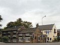
 Stamford Arms, Stalybridge.jpg 800 × 600; 130 KB
-
 Tame aqueduct, Stalybridge.jpg 1,024 × 768; 153 KB
-
 Taunton Hall, Ashton-under-Lyne.jpg 1,280 × 960; 997 KB
-
 The Bungalow.jpg 4,608 × 2,592; 3.6 MB
-
 The Colliers Arms, Hartshead Pike - geograph.org.uk - 203595.jpg 640 × 484; 111 KB
-

-
 Thorn House, Stalybridge.jpg 1,600 × 1,299; 619 KB
-
 Tower Mill, Dukinfield.jpg 1,280 × 960; 842 KB
-
 Town Hall, Hyde.jpg 1,000 × 1,000; 768 KB
-
 Twelve Apostles Terrace, Ashton-under-Lyne.jpg 1,280 × 845; 234 KB
-
 Village Stocks - geograph.org.uk - 1013168.jpg 640 × 480; 164 KB
-
 Werneth Bredbury Boundary Stone - geograph.org.uk - 1518286.jpg 640 × 592; 180 KB
-
 Winterford Bridge, Mossley.jpg 2,048 × 1,536; 544 KB


_and_42_Fairfield_Square.jpg)


.JPG)


.jpg)


.jpg)


.jpg)


