Category:Grafton and Radcot
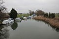
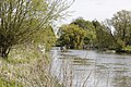
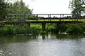
English: Grafton and Radcot is a civil parish in West Oxfordshire. The parish includes the hamlets of Radcot (Ordnance Survey grid reference SU285995) on the River Thames and Grafton (OS grid ref. SP268007).
civil parish in West Oxfordshire, England | |||||
| Upload media | |||||
| Instance of | |||||
|---|---|---|---|---|---|
| Location | West Oxfordshire, Oxfordshire, South East England, England | ||||
 | |||||
Subcategories
This category has the following 3 subcategories, out of 3 total.
G
- Grafton Lock (6 F)
- Grafton, Oxfordshire (3 F)
R
Media in category "Grafton and Radcot"
The following 156 files are in this category, out of 156 total.
-
 A narrowboat passes under Radcot Bridge - geograph.org.uk - 2401629.jpg 1,500 × 1,000; 255 KB
-
 A type 24 - geograph.org.uk - 2946382.jpg 1,024 × 683; 248 KB
-
 Across the bridges - geograph.org.uk - 2289612.jpg 1,024 × 683; 161 KB
-
 Adventuress approaching The Swan under Canal Bridge, Radcot - geograph.org.uk - 3706078.jpg 4,000 × 3,000; 2.86 MB
-
 Along Grafton lock - geograph.org.uk - 2946237.jpg 1,024 × 683; 209 KB
-
 Along Radcot Bridge - geograph.org.uk - 2288477.jpg 1,024 × 683; 118 KB
-
 Any food - geograph.org.uk - 2945166.jpg 1,024 × 683; 225 KB
-
 Approaching Grafton Lock - geograph.org.uk - 2424456.jpg 1,024 × 680; 232 KB
-
 Back of a type 28 - geograph.org.uk - 2288420.jpg 1,024 × 683; 254 KB
-
 Benchmark on Radcot Bridge - geograph.org.uk - 2276410.jpg 1,024 × 683; 319 KB
-
 Bend from Grafton Lock - geograph.org.uk - 2946249.jpg 1,024 × 683; 160 KB
-
 Boat by the pillbox - geograph.org.uk - 2289637.jpg 1,024 × 683; 217 KB
-
 Boats along the bank - geograph.org.uk - 2289975.jpg 1,024 × 683; 275 KB
-
 Boats along the bank - geograph.org.uk - 2947875.jpg 1,024 × 683; 155 KB
-
 Boats moored at Radcot - geograph.org.uk - 2426233.jpg 1,024 × 680; 215 KB
-
 Boom across the weir - geograph.org.uk - 2945024.jpg 1,024 × 683; 274 KB
-
 Breastwork from the gate - geograph.org.uk - 2288090.jpg 1,024 × 683; 359 KB
-
 Breastwork over the fence - geograph.org.uk - 2288071.jpg 1,024 × 683; 249 KB
-
 Bridge across the River Thames at Radcot - geograph.org.uk - 5124517.jpg 4,000 × 3,000; 4.93 MB
-
 Bridge from Upstream - geograph.org.uk - 2289692.jpg 1,024 × 683; 217 KB
-
 Bridge to the campsite - geograph.org.uk - 2290020.jpg 1,024 × 683; 271 KB
-
 Bridleway to Chapel Farm - geograph.org.uk - 1566075.jpg 640 × 480; 105 KB
-
 Camden Farm - geograph.org.uk - 5074678.jpg 2,592 × 1,944; 1.93 MB
-
 Canal Bridge, Radcot - geograph.org.uk - 2549360.jpg 640 × 480; 141 KB
-

-
 Coming to the lock - geograph.org.uk - 2947728.jpg 1,024 × 683; 295 KB
-
 Cowslips and grass - geograph.org.uk - 2946482.jpg 1,024 × 683; 203 KB
-

-
 Cradle Bridge, Radcot - geograph.org.uk - 911651.jpg 640 × 451; 109 KB
-
 Cross section at the entrance - geograph.org.uk - 2288376.jpg 1,024 × 683; 286 KB
-
 Danger keep Away - geograph.org.uk - 2945029.jpg 1,024 × 683; 193 KB
-
 Dinghy by the entrance - geograph.org.uk - 2289987.jpg 1,024 × 683; 310 KB
-
 Downstream from the bridge - geograph.org.uk - 2289588.jpg 1,024 × 683; 146 KB
-
 Downstream to the Thames - geograph.org.uk - 2946479.jpg 1,024 × 683; 140 KB
-
 Ducks at the lock - geograph.org.uk - 2947725.jpg 1,024 × 683; 280 KB
-
 Ducks, Swan Hotel, Radcot - geograph.org.uk - 5225721.jpg 3,264 × 2,448; 2.82 MB
-
 Edge of the field - geograph.org.uk - 2946481.jpg 1,024 × 683; 273 KB
-
 Entering Grafton from the north west - geograph.org.uk - 2384769.jpg 640 × 480; 170 KB
-
 Entrance from the field - geograph.org.uk - 2946480.jpg 1,024 × 683; 206 KB
-
 Entrance to the Breastworks - geograph.org.uk - 2288101.jpg 1,024 × 683; 359 KB
-
 Field of buttercups - geograph.org.uk - 2426208.jpg 1,024 × 680; 284 KB
-
 Field of buttercups - geograph.org.uk - 2426224.jpg 1,024 × 680; 394 KB
-
 Fields beside the River Thames - geograph.org.uk - 5074690.jpg 2,592 × 1,944; 1.8 MB
-
 First and last - geograph.org.uk - 2276415.jpg 1,024 × 683; 245 KB
-
 First look at the weir - geograph.org.uk - 2944858.jpg 1,024 × 683; 291 KB
-
 Flood heights marker - geograph.org.uk - 2945164.jpg 1,024 × 683; 291 KB
-
 Flood mark on the bridge - geograph.org.uk - 2289670.jpg 533 × 800; 96 KB
-
 Flowing to the weir - geograph.org.uk - 2944862.jpg 1,024 × 683; 179 KB
-
 Footbridge on the Thames Path - geograph.org.uk - 911559.jpg 640 × 426; 89 KB
-
 Front from the end - geograph.org.uk - 2288367.jpg 1,024 × 683; 175 KB
-
 Further along the Thames - geograph.org.uk - 2946374.jpg 1,024 × 683; 174 KB
-
 Gate to Grafton Lock - geograph.org.uk - 2947872.jpg 1,024 × 683; 268 KB
-
 Goose by the slipway - geograph.org.uk - 2946243.jpg 1,024 × 683; 266 KB
-

-
 Small road bridge in Grafton - geograph.org.uk - 1566041.jpg 640 × 480; 105 KB
-
 The road through Grafton - geograph.org.uk - 894640.jpg 640 × 480; 164 KB
-
 Grafton Lock - geograph.org.uk - 2424452.jpg 1,024 × 680; 229 KB
-
 Grafton Lock - geograph.org.uk - 2945156.jpg 1,024 × 683; 236 KB
-
 Grafton Lock - geograph.org.uk - 5074683.jpg 2,592 × 1,944; 1.56 MB
-
 Grafton Lock cottage - geograph.org.uk - 2945158.jpg 533 × 800; 127 KB
-
 Grafton lock round the bend - geograph.org.uk - 2944738.jpg 1,024 × 683; 232 KB
-
 Grafton Weir - geograph.org.uk - 2947879.jpg 1,024 × 683; 178 KB
-
 Heading towards Langford - geograph.org.uk - 1566024.jpg 640 × 480; 51 KB
-
 House and keeper's hut - geograph.org.uk - 2947735.jpg 1,024 × 683; 182 KB
-
 In the centre - geograph.org.uk - 2276398.jpg 1,024 × 683; 262 KB
-
 Ivy covering this side - geograph.org.uk - 2288448.jpg 1,024 × 683; 272 KB
-
 Lane to Grafton near Homeleaze Farm - geograph.org.uk - 5735551.jpg 4,000 × 3,000; 4.76 MB
-
 Last look back - geograph.org.uk - 2947717.jpg 1,024 × 683; 206 KB
-
 Line of pylons - geograph.org.uk - 1235285.jpg 640 × 480; 50 KB
-
 Lock in the distance - geograph.org.uk - 2945013.jpg 1,024 × 683; 209 KB
-
 Long wall - geograph.org.uk - 2288057.jpg 1,024 × 683; 307 KB
-
 Looking back - geograph.org.uk - 2288391.jpg 1,024 × 683; 133 KB
-
 Looking from the downstream side - geograph.org.uk - 2946473.jpg 1,024 × 683; 202 KB
-
 Looking out of the lock - geograph.org.uk - 2947733.jpg 1,024 × 683; 196 KB
-

-
 Looking upstream - geograph.org.uk - 2946477.jpg 1,024 × 683; 157 KB
-
 Manor Farm, Grafton - geograph.org.uk - 2384786.jpg 640 × 480; 181 KB
-
 Marker by the lock - geograph.org.uk - 2947731.jpg 1,024 × 683; 174 KB
-
 Mooring for the lock - geograph.org.uk - 2946239.jpg 1,024 × 683; 205 KB
-
 Muddy drain - geograph.org.uk - 2947721.jpg 533 × 800; 130 KB
-

-
 Nearing Grafton - geograph.org.uk - 1566037.jpg 640 × 480; 60 KB
-
 Odd Platform - geograph.org.uk - 2290043.jpg 1,024 × 683; 334 KB
-
 Old Radcot Bridge - geograph.org.uk - 2425801.jpg 1,024 × 680; 296 KB
-
 Old Radcot Bridge - geograph.org.uk - 2425804.jpg 1,024 × 680; 235 KB
-
 Old Toll House, Radcot (geograph 6115159).jpg 640 × 436; 112 KB
-
 Open stretch - geograph.org.uk - 2946381.jpg 1,024 × 683; 240 KB
-
 Paddling upstream - geograph.org.uk - 2289968.jpg 1,024 × 683; 250 KB
-
 Pillbox at Radcot - geograph.org.uk - 2425809.jpg 640 × 425; 67 KB
-
 Pillbox at Radcot - geograph.org.uk - 2426230.jpg 1,024 × 680; 230 KB
-
 Pillbox by the river - geograph.org.uk - 2288466.jpg 1,024 × 683; 270 KB
-
 Pillbox in sight - geograph.org.uk - 2946378.jpg 1,024 × 683; 243 KB
-
 Pillbox near Grafton - geograph.org.uk - 2424464.jpg 1,024 × 680; 242 KB
-
 Pillbox near Grafton Lock - geograph.org.uk - 2424462.jpg 1,024 × 680; 254 KB
-
 Pillbox on the corner - geograph.org.uk - 2289621.jpg 1,024 × 683; 335 KB
-
 Poplar Farmhouse, Grafton - geograph.org.uk - 5733613.jpg 4,000 × 3,000; 4.85 MB
-
 Public bridleway, Grafton - geograph.org.uk - 5733600.jpg 4,000 × 3,000; 4.68 MB
-
 Pylon in the rape - geograph.org.uk - 2946371.jpg 1,024 × 683; 172 KB
-
 Above Radcot Lock - geograph.org.uk - 911615.jpg 640 × 426; 73 KB
-
 Pillbox - geograph.org.uk - 911552.jpg 640 × 426; 98 KB
-
 Pillbox, Radcot - geograph.org.uk - 911642.jpg 640 × 426; 100 KB
-
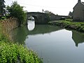
 Radcot (canal) Bridge - geograph.org.uk - 2425825.jpg 1,749 × 1,160; 454 KB
-
 Radcot Bridge - geograph.org.uk - 2060441.jpg 640 × 345; 56 KB
-
 Radcot bridge - geograph.org.uk - 2288459.jpg 1,024 × 683; 168 KB
-
 Radcot Bridge - geograph.org.uk - 2289664.jpg 1,024 × 683; 211 KB
-
 Radcot Bridge - geograph.org.uk - 2401624.jpg 1,500 × 989; 263 KB
-
 Radcot Bridge - geograph.org.uk - 2425793.jpg 1,024 × 680; 192 KB
-
 Radcot Bridge - geograph.org.uk - 2425864.jpg 1,024 × 680; 184 KB
-
 Radcot bridge - geograph.org.uk - 2549163.jpg 640 × 480; 209 KB
-
 Radcot Bridge - geograph.org.uk - 5074673.jpg 2,592 × 1,944; 1.4 MB
-
 Radcot Bridge and River Thames - geograph.org.uk - 5124520.jpg 3,968 × 2,976; 3.73 MB
-
 Radcot Bridge from the SW - geograph.org.uk - 2549334.jpg 640 × 480; 192 KB
-
 Ramp to the platform - geograph.org.uk - 2290061.jpg 1,024 × 683; 280 KB
-
 River and Bridge - geograph.org.uk - 2289683.jpg 1,024 × 683; 210 KB
-
 River Bank below Old Man's Bridge - geograph.org.uk - 911463.jpg 640 × 417; 93 KB
-
 River past the lock - geograph.org.uk - 2946245.jpg 1,024 × 683; 193 KB
-
 River Thames - geograph.org.uk - 2682534.jpg 640 × 480; 90 KB
-
 River Thames - geograph.org.uk - 2682554.jpg 640 × 480; 58 KB
-
 River Thames - geograph.org.uk - 2682574.jpg 640 × 480; 82 KB
-
 River Thames at Radcot - geograph.org.uk - 2426258.jpg 1,024 × 680; 171 KB
-
 River Thames near Grafton - geograph.org.uk - 2424444.jpg 1,024 × 680; 256 KB
-
 River Thames near Radcot - geograph.org.uk - 2424474.jpg 1,024 × 680; 213 KB
-
 Road through Grafton - geograph.org.uk - 1566045.jpg 640 × 480; 108 KB
-
 Road through the village of Grafton - geograph.org.uk - 2384776.jpg 640 × 480; 192 KB
-
 Roadside Ditches at Radcot - geograph.org.uk - 4839860.jpg 4,000 × 3,000; 4.66 MB
-
 Second section - geograph.org.uk - 2291431.jpg 1,024 × 683; 316 KB
-
 Side on view - geograph.org.uk - 2946475.jpg 1,024 × 683; 265 KB
-

-
 Stream from the river - geograph.org.uk - 2289962.jpg 1,024 × 683; 343 KB
-
 Swans at Radcot Bridge - geograph.org.uk - 4839886.jpg 4,000 × 3,000; 2.97 MB
-
 Thames Backwaters at Radcot - geograph.org.uk - 4839893.jpg 4,000 × 3,000; 3.4 MB
-
 Thames Path - geograph.org.uk - 2682544.jpg 640 × 480; 83 KB
-
 Thames path to Grafton Lock - geograph.org.uk - 2946978.jpg 1,024 × 683; 273 KB
-
 The other end - geograph.org.uk - 2288356.jpg 1,024 × 683; 180 KB
-
 The Radcot Cut - geograph.org.uk - 4839983.jpg 1,600 × 1,200; 908 KB
-
 The river Thames near Grafton Lock - geograph.org.uk - 2946367.jpg 1,024 × 683; 125 KB
-
 The River Thames, Grafton Lock - geograph.org.uk - 448820.jpg 640 × 480; 158 KB
-
 The road to Grafton - geograph.org.uk - 1566018.jpg 640 × 480; 45 KB
-
 The Thames Path at Radcot Bridge - geograph.org.uk - 2401620.jpg 1,500 × 1,000; 162 KB
-
 The Thames Path National Trail near Cradle Bridge - geograph.org.uk - 5887720.jpg 4,608 × 3,456; 5.23 MB
-
 The Thames Path National Trail near Grafton Lock - geograph.org.uk - 5887655.jpg 4,608 × 3,456; 5.42 MB
-
 The Thames Path National Trail near Radcot Bridge - geograph.org.uk - 5887717.jpg 4,608 × 3,456; 5.17 MB
-
 This way to Radcot - geograph.org.uk - 2946484.jpg 1,024 × 683; 170 KB
-
 Topiary at Grafton Lock - geograph.org.uk - 2060447.jpg 640 × 480; 107 KB
-
 Track beside the A4095 - geograph.org.uk - 1530814.jpg 640 × 427; 72 KB
-
 Traffic lights at Radcot bridge - geograph.org.uk - 4007312.jpg 3,168 × 4,752; 3.01 MB
-
 Tree in front - geograph.org.uk - 2288473.jpg 1,024 × 683; 255 KB
-
 Type 28A by Radcot Bridge - geograph.org.uk - 2276718.jpg 1,024 × 683; 223 KB
-
 Upstream from Radcot - geograph.org.uk - 2289599.jpg 1,024 × 683; 144 KB
-
 Vee shaped defence - geograph.org.uk - 2291440.jpg 1,024 × 683; 370 KB
-
 View across the fields towards Grafton - geograph.org.uk - 2518515.jpg 640 × 480; 180 KB
-

-

-
 View from the river - geograph.org.uk - 2288112.jpg 1,024 × 683; 274 KB
-
 Wall cross section - geograph.org.uk - 2291426.jpg 1,024 × 683; 246 KB
-
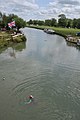 Wild swimmer in the Thames, Radcot - geograph.org.uk - 2426249.jpg 680 × 1,024; 139 KB


.jpg)


_Bridge_-_geograph.org.uk_-_2425825.jpg)


