Category:Gragareth
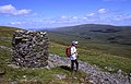
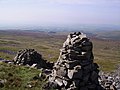
English: Gragareth is a mountain in Lancashire, England. At it is claimed to be the highest point in Lancashire. The summit of Gragareth lies about 200m west of the boundary between Lancashire and North Yorkshire, and thus lies just outside the Yorkshire Dales National Park (whose boundary follows the county boundary at this point). The south eastern slopes are known as Leck Fell and the southern slopes form Ireby Fell.

mountain in United Kingdom  | |||||
| Upload media | |||||
| Instance of | |||||
|---|---|---|---|---|---|
| Part of | |||||
| Made from material | |||||
| Located in protected area | |||||
| Location | Lancashire, North West England, England | ||||
| Mountain range | |||||
| Topographic prominence |
| ||||
| Elevation above sea level |
| ||||
| Parent peak | |||||
 | |||||
Media in category "Gragareth"
The following 17 files are in this category, out of 17 total.
-
 Boundary wall - geograph.org.uk - 205445.jpg 640 × 468; 132 KB
-
 Cairn on the slopes of Gragareth - geograph.org.uk - 958283.jpg 640 × 409; 89 KB
-
 Climbing Gragareth - geograph.org.uk - 958308.jpg 440 × 640; 140 KB
-
 Cotton grass on summit of Gragareth - geograph.org.uk - 958331.jpg 640 × 411; 104 KB
-
 Gragareth three men.jpg 640 × 480; 100 KB
-
 Gragareth trig point.jpg 640 × 480; 136 KB
-
 Gragareth trig. - geograph.org.uk - 141645.jpg 640 × 429; 58 KB
-
 Gragareth west slope - geograph.org.uk - 849831.jpg 640 × 480; 74 KB
-
 Small pool on summit of Gragareth - geograph.org.uk - 958322.jpg 640 × 399; 88 KB
-
 Three Men of Gragareth - geograph.org.uk - 631560.jpg 640 × 429; 74 KB
-
 Wall Junction - geograph.org.uk - 236672.jpg 640 × 480; 104 KB
-
 1.5 Men Gragareth - geograph.org.uk - 236693.jpg 640 × 480; 89 KB
-
 Another Three Men on Gragareth - geograph.org.uk - 236692.jpg 640 × 480; 96 KB
-
 High points - geograph.org.uk - 205454.jpg 640 × 480; 106 KB
-
 North Flank of Gragareth - geograph.org.uk - 284257.jpg 640 × 480; 105 KB
-
 On the Gragareth ridge - geograph.org.uk - 205448.jpg 640 × 480; 105 KB
-
 Tree growing out of limestone rocks. - geograph.org.uk - 114603.jpg 640 × 480; 105 KB


