Category:Grain fields in England
Subcategories
This category has the following 35 subcategories, out of 35 total.
B
C
D
E
G
H
K
L
M
N
O
S
W
Media in category "Grain fields in England"
The following 25 files are in this category, out of 25 total.
-

-
 Barley field (49263586148).jpg 4,020 × 6,036; 12.76 MB
-
 Barley field (49263586708).jpg 6,036 × 4,020; 7.78 MB
-
 Brecks Farm - geograph.org.uk - 225933.jpg 640 × 362; 24 KB
-
 Claas Lexion 580 and Bailey trailer at harvest in England.jpg 4,000 × 2,672; 4.5 MB
-
 Cornfield and Sky - geograph.org.uk - 484995.jpg 640 × 480; 97 KB
-
 Cornfield at Walton Gates - geograph.org.uk - 490100.jpg 640 × 478; 135 KB
-
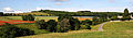 Cotswolds Panorama Fields.jpg 4,188 × 1,228; 3.45 MB
-
 Downland scene near Weston Patrick - geograph.org.uk - 168398.jpg 480 × 640; 90 KB
-
 Ear to Ear - geograph.org.uk - 471869.jpg 640 × 480; 139 KB
-
 Farmland near Knottingley - geograph.org.uk - 2476395.jpg 1,600 × 1,200; 518 KB
-
 Farmland near Pontefract - geograph.org.uk - 2476189.jpg 1,600 × 1,200; 525 KB
-
 Field and old railway embankment - geograph.org.uk - 908873.jpg 640 × 480; 79 KB
-
 Field of barley near Pilton - geograph.org.uk - 209895.jpg 640 × 427; 83 KB
-
 Flax-poppy-cotswolds.jpg 4,238 × 1,229; 2.63 MB
-

-
 Grain field in Derbyshire.jpg 4,000 × 2,232; 1.39 MB
-
 Growing well - geograph.org.uk - 417369.jpg 640 × 429; 81 KB
-
 Looking SW along the Stour Valley Walk - geograph.org.uk - 1280189.jpg 640 × 480; 186 KB
-
 Meadow tracks.jpg 3,997 × 1,890; 1.38 MB
-
 The route of the Stour Valley Walk - geograph.org.uk - 1280182.jpg 640 × 480; 193 KB
-
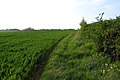
 Tractor tracks in the field - geograph.org.uk - 2154877.jpg 1,024 × 768; 120 KB
-
 Transient Pooh Heap - geograph.org.uk - 780618.jpg 640 × 480; 77 KB
-
 Well defined footpath towards Ashford - geograph.org.uk - 794845.jpg 640 × 480; 217 KB
-


.jpg)
.jpg)


