Category:Grass paths in Northumberland
Ceremonial counties of England: Bedfordshire · Buckinghamshire · Cambridgeshire · Cheshire · Cornwall · Cumbria · Derbyshire · Devon · Dorset · Durham · East Riding of Yorkshire · East Sussex · Essex · Gloucestershire · Greater London · Hampshire · Herefordshire · Hertfordshire · Isle of Wight · Kent · Lancashire · Leicestershire · Lincolnshire · Norfolk · North Yorkshire · Northamptonshire · Northumberland · Nottinghamshire · Oxfordshire · Rutland · Shropshire · Somerset · South Yorkshire · Staffordshire · Suffolk · Surrey · Warwickshire · West Sussex · West Yorkshire · Wiltshire · Worcestershire
City-counties:
Former historic counties:
Other former counties:
City-counties:
Former historic counties:
Other former counties:
Media in category "Grass paths in Northumberland"
The following 20 files are in this category, out of 20 total.
-
 Coast Path South of Amble - geograph.org.uk - 1198214.jpg 640 × 480; 79 KB
-

-
 Footpath above Frankham Fell - geograph.org.uk - 1583132.jpg 600 × 450; 93 KB
-
 Footpath across Longhorsley Moor - geograph.org.uk - 962947.jpg 640 × 480; 87 KB
-

-
 Footpath and arable fields - geograph.org.uk - 1116105.jpg 640 × 480; 81 KB
-
 Footpath by the side of Square Wood - geograph.org.uk - 1557395.jpg 600 × 450; 93 KB
-
 Footpath just north of Heugh - geograph.org.uk - 1191520.jpg 640 × 360; 59 KB
-

-
 Footpath north of Lysdon Farm - geograph.org.uk - 902243.jpg 640 × 480; 99 KB
-
 Footpath on Holy Island - geograph.org.uk - 728789.jpg 640 × 480; 81 KB
-
 Footpath past the end of the woodland - geograph.org.uk - 909939.jpg 640 × 480; 84 KB
-
 Footpath to Haydon Bridge - geograph.org.uk - 818788.jpg 640 × 480; 89 KB
-
 Footpath to nowhere - geograph.org.uk - 1520225.jpg 640 × 426; 214 KB
-
 Grass path to Thirlings - geograph.org.uk - 409617.jpg 640 × 480; 131 KB
-
 Grassy Path, Holy Island - geograph.org.uk - 410549.jpg 640 × 480; 69 KB
-
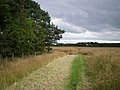
 Path approaching Peatrigg Plantation - geograph.org.uk - 1410971.jpg 640 × 480; 89 KB
-
 Path towards St. Cuthbert'sCave - geograph.org.uk - 125336.jpg 480 × 640; 149 KB
-
 Public Footpath From Hole House - geograph.org.uk - 720623.jpg 480 × 638; 115 KB
-


