Category:Gratton, Derbyshire
civil parish in Derbyshire Dales district, Derbyshire, England | |||||
| Upload media | |||||
| Instance of | |||||
|---|---|---|---|---|---|
| Location | Derbyshire Dales, Derbyshire, East Midlands, England | ||||
| Population |
| ||||
| Different from | |||||
 | |||||
Media in category "Gratton, Derbyshire"
The following 107 files are in this category, out of 107 total.
-
 A footpath across the fields - geograph.org.uk - 5870287.jpg 2,000 × 1,333; 2.16 MB
-
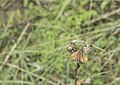
 A hovering Kestrel - geograph.org.uk - 5870225.jpg 2,000 × 1,333; 1.19 MB
-
 A poem set in stone - geograph.org.uk - 5870218.jpg 2,000 × 1,333; 3.25 MB
-
 A Small Skipper butterfly - geograph.org.uk - 5870265.jpg 2,000 × 1,420; 1.36 MB
-
 Above two dales - geograph.org.uk - 3758711.jpg 800 × 533; 113 KB
-
 An interesting barn - geograph.org.uk - 5870285.jpg 2,000 × 1,333; 2.49 MB
-
 Barn at Gratton Grange Farm - geograph.org.uk - 1184268.jpg 640 × 480; 62 KB
-
 Boulders seen from Mawstone Lane - geograph.org.uk - 4314519.jpg 4,000 × 3,000; 3.49 MB
-
 Bridleway in Gratton Dale - geograph.org.uk - 3433188.jpg 640 × 427; 216 KB
-
 Bridleway in Gratton Dale - geograph.org.uk - 3433291.jpg 640 × 427; 211 KB
-
 Bridleway through Long Dale - geograph.org.uk - 3433136.jpg 640 × 427; 206 KB
-
 Cart shed at Gratton Grange.jpg 4,000 × 3,000; 1.47 MB
-
 Cattle grazing - geograph.org.uk - 4850744.jpg 640 × 426; 47 KB
-
 Derbyshire UK parish map highlighting Gratton.svg 888 × 1,308; 2.34 MB
-
 Descending from the north into Long Dale - geograph.org.uk - 3162118.jpg 3,009 × 4,212; 2.76 MB
-
 Dry grasslands - geograph.org.uk - 5870288.jpg 2,000 × 1,333; 2.24 MB
-
 Farmland seen from Mawstone Lane - geograph.org.uk - 4314512.jpg 4,000 × 3,000; 3.37 MB
-

-
 Field barn - geograph.org.uk - 2269959.jpg 2,735 × 1,934; 1.69 MB
-
 Field of Sheep near the Black Nursery Plantation - geograph.org.uk - 2542380.jpg 3,296 × 2,472; 1.14 MB
-
 Flooded road at Rowlow Brook - geograph.org.uk - 6298521.jpg 3,776 × 2,520; 3.05 MB
-
 Flowers in Gratton Dale - geograph.org.uk - 3433180.jpg 640 × 427; 274 KB
-
 Footpath heading north to Windygap Plantation - geograph.org.uk - 3587328.jpg 3,646 × 2,430; 2.13 MB
-
 Footpath into Gratton Dale - geograph.org.uk - 3529116.jpg 1,600 × 1,064; 505 KB
-
 Footpath splits - geograph.org.uk - 6298478.jpg 3,776 × 2,520; 3.28 MB
-
 Footpath to Elton - geograph.org.uk - 5870244.jpg 2,000 × 1,333; 3.17 MB
-
 Footpath way markers - geograph.org.uk - 5870173.jpg 2,000 × 1,333; 2.85 MB
-
 Former Cheese Factory - geograph.org.uk - 1184277.jpg 640 × 480; 84 KB
-

-
 Gate into Field - geograph.org.uk - 2527406.jpg 640 × 427; 284 KB
-
 Good grazing land - geograph.org.uk - 5870291.jpg 2,000 × 1,333; 2.51 MB
-
 Gratton Dale - geograph.org.uk - 1529192.jpg 640 × 480; 143 KB
-
 Gratton Dale - geograph.org.uk - 2466909.jpg 640 × 427; 248 KB
-
 Gratton Dale - geograph.org.uk - 3433171.jpg 640 × 427; 224 KB
-
 Gratton Dale - geograph.org.uk - 3433285.jpg 427 × 640; 218 KB
-
 Gratton Dale - geograph.org.uk - 3762727.jpg 4,000 × 2,248; 6.13 MB
-
 Gratton Dale - geograph.org.uk - 4314599.jpg 4,000 × 3,000; 2.83 MB
-
 Gratton Dale - geograph.org.uk - 4314603.jpg 4,000 × 3,000; 3.26 MB
-
 Gratton Dale - geograph.org.uk - 4314607.jpg 640 × 480; 73 KB
-
 Gratton Dale - geograph.org.uk - 563773.jpg 640 × 480; 124 KB
-
 Gratton Dale - geograph.org.uk - 5870255.jpg 2,000 × 1,333; 2.58 MB
-
 Gratton Dale - peak District National Park - geograph.org.uk - 59766.jpg 640 × 480; 170 KB
-
 Gratton Dale and Long Dale Junction - geograph.org.uk - 59770.jpg 640 × 480; 168 KB
-
 Gratton Dale bridleway - geograph.org.uk - 3433314.jpg 640 × 427; 204 KB
-
 Gratton Dale bridleway - geograph.org.uk - 3433324.jpg 640 × 427; 214 KB
-
 Gratton Dale Farm - geograph.org.uk - 3433339.jpg 640 × 427; 214 KB
-
 Gratton Dale Farm - geograph.org.uk - 5870278.jpg 2,000 × 1,333; 2.74 MB
-
 Gratton Dale Footpath - geograph.org.uk - 563775.jpg 640 × 480; 124 KB
-
 Gratton Dale north of Mouldridge Grange - geograph.org.uk - 5598671.jpg 5,184 × 3,888; 5.18 MB
-
 Gratton Grange Farm - geograph.org.uk - 1184284.jpg 640 × 480; 82 KB
-
 Gratton Grange Farm - geograph.org.uk - 2546807.jpg 1,024 × 768; 230 KB
-
 Gratton Grange Farm - geograph.org.uk - 4314535.jpg 3,455 × 2,468; 2.42 MB
-
 Gratton Grange Farm - geograph.org.uk - 5009348.jpg 5,184 × 3,456; 1.85 MB
-
 Gratton Moor Farm - geograph.org.uk - 1613915.jpg 640 × 480; 67 KB
-
 Gritstone outcrops - geograph.org.uk - 4850747.jpg 640 × 426; 36 KB
-
 Hay Bags at Gratton Grange Farm - geograph.org.uk - 4314528.jpg 4,000 × 3,000; 2.53 MB
-
 Hikers in Gratton Dale - geograph.org.uk - 2358915.jpg 950 × 702; 451 KB
-
 In Gratton Dale - geograph.org.uk - 2358909.jpg 950 × 713; 461 KB
-
 In Gratton Dale - geograph.org.uk - 3758710.jpg 800 × 533; 131 KB
-
 In Grattondale - geograph.org.uk - 5598578.jpg 5,184 × 3,888; 6.93 MB
-
 In Long Dale - geograph.org.uk - 3429024.jpg 640 × 427; 226 KB
-
 Junction of two dry valleys below Pikehall in Long Dale - geograph.org.uk - 3762724.jpg 4,000 × 2,248; 5.51 MB
-
 Lane from Gratton to Smerrill - geograph.org.uk - 1240775.jpg 640 × 480; 98 KB
-
 Lane passing Gratton Grange Farm - geograph.org.uk - 1239671.jpg 640 × 480; 86 KB
-
 Limekiln in Gratton Dale - geograph.org.uk - 2317772.jpg 2,736 × 3,648; 2.99 MB
-
 Long Dale - geograph.org.uk - 2466863.jpg 640 × 427; 282 KB
-
 Long Dale - geograph.org.uk - 4314765.jpg 4,000 × 3,000; 3.43 MB
-
 Long Dale - geograph.org.uk - 4314772.jpg 4,000 × 3,000; 2.77 MB
-
 Long Dale - geograph.org.uk - 525436.jpg 640 × 480; 126 KB
-
 Long dale - geograph.org.uk - 5870222.jpg 2,000 × 1,333; 2.28 MB
-
 Long Dale - Peak District National Park - geograph.org.uk - 59771.jpg 640 × 480; 147 KB
-
 Long Dale sculpture - geograph.org.uk - 2317759.jpg 2,736 × 3,648; 4.25 MB
-
 Long Dale to the left, Gratton Dale to the right - geograph.org.uk - 3762730.jpg 4,000 × 2,248; 6.2 MB
-
 Looking back up Long Dale - geograph.org.uk - 5870241.jpg 2,000 × 1,333; 2.89 MB
-
 Looking into Long Dale - geograph.org.uk - 5870210.jpg 2,000 × 1,333; 2.65 MB
-
 Looking towards Gratton Grange Farm - geograph.org.uk - 1240772.jpg 640 × 480; 90 KB
-
 Mawston Lane climbing towards Rock Farm - geograph.org.uk - 6298482.jpg 3,776 × 2,520; 3.21 MB
-
 Mawstone Lane heavy shower - geograph.org.uk - 5430434.jpg 1,600 × 1,200; 203 KB
-
 Near the end of Long Dale - geograph.org.uk - 5870236.jpg 2,000 × 1,333; 2.37 MB
-
 North-western end of Long Dale - geograph.org.uk - 630450.jpg 640 × 480; 40 KB
-
 Not a place I would choose to cycle - geograph.org.uk - 5870238.jpg 2,000 × 1,333; 2.83 MB
-
 Parish boundary marker stone - geograph.org.uk - 3587316.jpg 2,736 × 3,648; 2.2 MB
-
 Path in Long Dale - geograph.org.uk - 4314779.jpg 4,000 × 3,000; 3.05 MB
-
 Power cables across the dale - geograph.org.uk - 5870261.jpg 2,000 × 1,333; 2.05 MB
-
 Random public art in Long Dale - geograph.org.uk - 3162126.jpg 3,072 × 4,608; 3.67 MB
-
 Rock climber on rocks below Cliff farm - geograph.org.uk - 2702675.jpg 1,600 × 902; 517 KB
-
 Rock Farm - geograph.org.uk - 2546815.jpg 1,024 × 768; 243 KB
-
 Rock Farm, Spout House - geograph.org.uk - 1184259.jpg 640 × 480; 84 KB
-
 Rock outcrops - geograph.org.uk - 2269949.jpg 3,072 × 2,304; 2.7 MB
-

-
 Sites of Meaning Sculpture - geograph.org.uk - 2542371.jpg 3,296 × 2,472; 1.16 MB
-
 Small Copper butterfly - geograph.org.uk - 5870268.jpg 2,000 × 1,489; 1.58 MB
-
 Smerrill Dale - branch of Long Dale, Derbyshire - geograph.org.uk - 3162124.jpg 4,120 × 2,943; 2.39 MB
-
 Spot the climber - geograph.org.uk - 2269941.jpg 3,072 × 2,304; 3.22 MB
-
 Stones in Long Dale - geograph.org.uk - 3429050.jpg 640 × 427; 210 KB
-
 Stream and lane to Middleton - geograph.org.uk - 2363308.jpg 950 × 713; 456 KB
-
 The Cheese Factory - geograph.org.uk - 5009350.jpg 5,184 × 2,547; 2.01 MB
-
 The Cheese Factory - geograph.org.uk - 5870282.jpg 2,000 × 1,333; 2.01 MB
-
 The dale gets more woody - geograph.org.uk - 5870276.jpg 2,000 × 1,333; 3.2 MB
-
 The Guardian of the Path - geograph.org.uk - 5598692.jpg 3,514 × 4,832; 5.52 MB
-
 Tree on the crest of a hill - geograph.org.uk - 3587319.jpg 2,736 × 3,648; 2.31 MB
-
 Trees on the skyline, Gratton Moor - geograph.org.uk - 1614990.jpg 640 × 480; 22 KB
-
 Typical scene in Gratton Dale - geograph.org.uk - 5598584.jpg 3,888 × 5,184; 7.36 MB
-
 Very muddy path in Gratton Dale - geograph.org.uk - 5598689.jpg 3,772 × 5,020; 6.22 MB
-
 View from lane north of Rock Farm - geograph.org.uk - 2363319.jpg 950 × 621; 334 KB
-
 View North West from Anthony Hill - geograph.org.uk - 6286515.jpg 5,184 × 3,456; 6.19 MB
-
 Weaddow Lane - geograph.org.uk - 5541371.jpg 640 × 489; 78 KB


