Category:Great Ribston with Walshford
civil parish in Harrogate, North Yorkshire, England, UK  | |||||
| Upload media | |||||
| Instance of | |||||
|---|---|---|---|---|---|
| Location | Harrogate, North Yorkshire, Yorkshire and the Humber, England | ||||
 | |||||
English: Great Ribston with Walshford is a civil parish in the Harrogate District district, in the county of North Yorkshire, England.
Subcategories
This category has the following 2 subcategories, out of 2 total.
G
W
Media in category "Great Ribston with Walshford"
The following 78 files are in this category, out of 78 total.
-
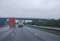
 A1(M) - geograph.org.uk - 4793180.jpg 640 × 426; 39 KB
-
 A1(M) at Walshford - geograph.org.uk - 4577680.jpg 1,920 × 1,234; 563 KB
-
 A1(M) northbound - geograph.org.uk - 2647831.jpg 640 × 428; 70 KB
-
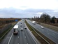 A1(M) southbound - geograph.org.uk - 3798468.jpg 640 × 480; 53 KB
-

-
 A168 approaching Walshford - geograph.org.uk - 4577645.jpg 1,920 × 1,313; 618 KB
-
 A168 bridge, A1(M) - geograph.org.uk - 3040647.jpg 640 × 430; 38 KB
-
 A168 overbridge, A1(M) - geograph.org.uk - 2568749.jpg 640 × 430; 38 KB
-
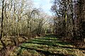
 Along the Southern Boundary of Parsonage Wood - geograph.org.uk - 4800897.jpg 1,600 × 1,067; 693 KB
-
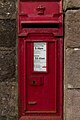 Anonymous Postbox, Walshford - geograph.org.uk - 6120837.jpg 683 × 1,024; 254 KB
-
 Approaching High Wood - geograph.org.uk - 4801389.jpg 1,600 × 1,067; 565 KB
-
 Beside Langshawe Wood - geograph.org.uk - 4800870.jpg 1,600 × 1,067; 726 KB
-
 Beside Parsonage Wood - geograph.org.uk - 4800184.jpg 1,600 × 1,067; 677 KB
-
 Bridge over Nidd, Ribston Park - geograph.org.uk - 4426690.jpg 1,920 × 1,205; 613 KB
-
 Bridge over the A1(M) - geograph.org.uk - 2040878.jpg 640 × 480; 43 KB
-

-
 Cut off road - geograph.org.uk - 4751105.jpg 640 × 480; 53 KB
-
 Drainage at Great Wood - geograph.org.uk - 2933252.jpg 1,600 × 1,200; 449 KB
-
 Drainage channel, High Wood - geograph.org.uk - 4572651.jpg 1,920 × 1,440; 1.12 MB
-
 Drive to New Forest Farm - geograph.org.uk - 4427030.jpg 1,920 × 1,444; 589 KB
-
 End of the Road - geograph.org.uk - 6120844.jpg 1,024 × 683; 278 KB
-
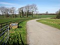
 Farm access road - geograph.org.uk - 4751116.jpg 640 × 480; 48 KB
-
 Farm track - geograph.org.uk - 4751122.jpg 640 × 480; 139 KB
-
 Field boundaries, Walshford - geograph.org.uk - 4577771.jpg 1,920 × 1,373; 848 KB
-
 Footpath in High Wood - geograph.org.uk - 4572556.jpg 1,920 × 1,440; 1.14 MB
-
 Footpath in High Wood - geograph.org.uk - 4572667.jpg 1,920 × 1,440; 1.42 MB
-
 Footpath to Knaresborough at Ribston Park - geograph.org.uk - 3283701.jpg 2,048 × 1,536; 700 KB
-
 Former Great North Road, Walshford - geograph.org.uk - 6120841.jpg 1,024 × 683; 210 KB
-
 Gate, Parsonage Wood - geograph.org.uk - 2543596.jpg 640 × 499; 137 KB
-
 Hotel and Spa - geograph.org.uk - 5573677.jpg 6,000 × 4,000; 4.17 MB
-
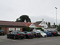
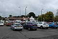 Hotel car park - geograph.org.uk - 5573673.jpg 6,000 × 4,000; 3.83 MB
-
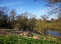
 Lake and pool, Ribston Park - geograph.org.uk - 4572839.jpg 1,920 × 1,225; 482 KB
-
 Langshawe Woods - geograph.org.uk - 4800195.jpg 1,600 × 1,067; 823 KB
-
 Lodge View Cottage, Walshford - geograph.org.uk - 6120847.jpg 1,024 × 683; 218 KB
-

-
 Muddy Track in Langshawe Wood - geograph.org.uk - 4800861.jpg 1,600 × 1,067; 830 KB
-

-
 Northbound A1M near Walshford - geograph.org.uk - 6399715.jpg 800 × 533; 205 KB
-
 Old Forest Farm Bridge, A1(M) - geograph.org.uk - 2568755.jpg 640 × 315; 29 KB
-
 Old Forest Farm Bridge, A1(M) - geograph.org.uk - 3040658.jpg 640 × 430; 33 KB
-
 On the Great North Road - geograph.org.uk - 5120961.jpg 1,600 × 1,067; 535 KB
-
 Parallel Lines - geograph.org.uk - 3790129.jpg 1,024 × 768; 188 KB
-
 Parallel roads - geograph.org.uk - 1116906.jpg 640 × 480; 56 KB
-
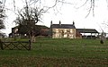 Park House - geograph.org.uk - 1088211.jpg 640 × 400; 72 KB
-
 Park House Farm - geograph.org.uk - 4426476.jpg 1,920 × 1,440; 721 KB
-
 Path leaving High Wood - geograph.org.uk - 4572622.jpg 1,920 × 1,440; 898 KB
-
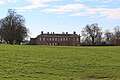 Ribston Hall - geograph.org.uk - 4801405.jpg 1,600 × 1,067; 415 KB
-
 Ribston Park - geograph.org.uk - 4426535.jpg 1,920 × 1,440; 681 KB
-
 Ribston Park - geograph.org.uk - 4572819.jpg 2,816 × 2,112; 1.2 MB
-
 Ribston Park - geograph.org.uk - 4572842.jpg 1,920 × 1,440; 913 KB
-
 Ribston Park - geograph.org.uk - 4801402.jpg 1,600 × 1,067; 336 KB
-
 River Nidd, Ribston Park - geograph.org.uk - 4426725.jpg 1,920 × 2,288; 1,011 KB
-
 River Nidd, Ribston Park - geograph.org.uk - 4573079.jpg 1,920 × 1,297; 680 KB
-
 River Nidd, Ribston Park - geograph.org.uk - 4573661.jpg 1,920 × 1,388; 808 KB
-
 River Nidd, Ribston Park - geograph.org.uk - 4573666.jpg 1,920 × 1,440; 898 KB
-
 Road to nowhere - geograph.org.uk - 5129761.jpg 2,056 × 1,536; 1.35 MB
-
 Roundabout, Walshford - geograph.org.uk - 4576853.jpg 1,920 × 1,342; 582 KB
-
 Sport Relief heroes approaching - geograph.org.uk - 4867977.jpg 4,320 × 3,240; 4.5 MB
-
 Substation enclosure - geograph.org.uk - 5573679.jpg 6,000 × 4,000; 6.01 MB
-
 Substation transformer - geograph.org.uk - 5573682.jpg 6,000 × 4,000; 4.7 MB
-
 The A1 (M) - geograph.org.uk - 3798446.jpg 640 × 480; 73 KB
-
 The A1(M) - geograph.org.uk - 3798449.jpg 640 × 480; 70 KB
-
 The A168 crosses the A1(M) - geograph.org.uk - 2040877.jpg 640 × 480; 53 KB
-
 The A168 roundabout from The Bridge carpark Walshford - geograph.org.uk - 5030754.jpg 4,606 × 3,452; 5.1 MB
-
 The Bridge Hotel and spa - geograph.org.uk - 5697016.jpg 640 × 480; 56 KB
-
 The Bridge Hotel and spa - geograph.org.uk - 5697017.jpg 640 × 480; 52 KB
-
 The Bridge Hotel and spa - geograph.org.uk - 5697018.jpg 640 × 480; 53 KB
-
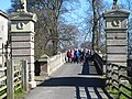
 The Bridge Walshford - geograph.org.uk - 5030745.jpg 3,070 × 2,304; 2.36 MB
-
 Towards Ribston Big Wood - geograph.org.uk - 4800865.jpg 1,600 × 1,067; 795 KB
-
 Track to Lund House Farm - geograph.org.uk - 4578026.jpg 1,920 × 2,420; 912 KB
-
 Track to Lund House Farm - geograph.org.uk - 6120852.jpg 1,024 × 683; 283 KB
-
 Tree guard, Ribston Park - geograph.org.uk - 4573038.jpg 1,920 × 1,440; 1.05 MB
-
 Trees in Ribston Park - geograph.org.uk - 4426429.jpg 1,878 × 1,405; 910 KB
-

-
 Wet day, A1(M) - geograph.org.uk - 3040654.jpg 640 × 430; 38 KB
-
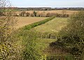
 Wheat by Parsonage Wood - geograph.org.uk - 2543623.jpg 640 × 480; 76 KB
-
 Wheat near Pikeshaw Wood - geograph.org.uk - 2543796.jpg 640 × 447; 97 KB
-
 Woodland beside the Great North Road - geograph.org.uk - 3798463.jpg 640 × 480; 86 KB
_-_geograph.org.uk_-_4793180.jpg)
_at_Walshford_-_geograph.org.uk_-_4577680.jpg)
_northbound_-_geograph.org.uk_-_2647831.jpg)
_southbound_-_geograph.org.uk_-_3798468.jpg)
_southbound_near_Old_Forest_Farm_-_geograph.org.uk_-_5395481.jpg)

_-_geograph.org.uk_-_3040647.jpg)
_-_geograph.org.uk_-_2568749.jpg)


_-_geograph.org.uk_-_2040878.jpg)


_-_geograph.org.uk_-_2568755.jpg)
_-_geograph.org.uk_-_3040658.jpg)


_-_geograph.org.uk_-_3798446.jpg)
_-_geograph.org.uk_-_3798449.jpg)
_-_geograph.org.uk_-_2040877.jpg)


_-_geograph.org.uk_-_3040654.jpg)


