Category:Green River (Colorado River) - historical images
Subcategories
This category has only the following subcategory.
Media in category "Green River (Colorado River) - historical images"
The following 135 files are in this category, out of 135 total.
-
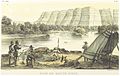 HEAP(1854) p116 PLATE XIII. GREEN RIVER.jpg 2,204 × 1,401; 2.19 MB
-
-

-
 Junction of Yampa and Green River Canyons. Northern Colorado - NARA - 519481.jpg 3,000 × 2,536; 2.18 MB
-
-
-

-
-
 Bluffs of the Green River-LCCN2008678214.jpg 7,360 × 5,545; 7.33 MB
-
 Bonito Bend between Labyrinth and Stillwater Canyons LCCN96510195.jpg 1,536 × 1,145; 161 KB
-
 Brush Creek. On Ashley Fork, Green River. Old nos. 348, 358 - NARA - 517835.jpg 3,000 × 2,307; 5.06 MB
-
 Brush Creek. On Ashley Fork, Green River. Old nos. 348, 358, 1871 - 1878 - NARA - 517835.jpg 3,000 × 2,307; 2.36 MB
-

-
-
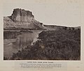
 Castle Rock Green River by Andrew J Russell.jpg 1,536 × 1,212; 193 KB
-
 Castle Rock, Green River Valley. (8704886541).jpg 1,000 × 847; 716 KB
-
 CastleRock.jpg 600 × 509; 101 KB
-
 Center of Horse Shoe Canyon. Green River. Old nos. 286, 417 - NARA - 517836.jpg 3,000 × 1,923; 4.8 MB
-
 Center of Horse Shoe Canyon. Green River. Old nos. 286, 417, 1871 - 1878 - NARA - 517836.jpg 3,000 × 1,923; 2.31 MB
-
 Citadel Rock, Green River Valley (36428529693).jpg 3,344 × 2,400; 793 KB
-
 Detroit Photographic Company (0811).jpg 1,536 × 1,156; 299 KB
-
 ENP Bridge over Green River.jpg 4,736 × 3,709; 1.41 MB
-
 ETR Big Island Bridge.jpg 4,656 × 3,649; 2.18 MB
-

-

-
 Flaming Gorge. Green River, Wyoming - NARA - 519464.jpg 3,000 × 2,510; 1.6 MB
-
 Flaming Gorge. Green River, Wyoming - NARA - 519466.jpg 3,000 × 2,499; 1.68 MB
-
 Flaming Gorge. Green River, Wyoming - NARA - 519467.jpg 2,499 × 3,000; 1.7 MB
-

-
 Fort Bridger 1852.jpg 820 × 484; 232 KB
-

-

-
 Green River at Brown's Hole. Daggett County, Utah - NARA - 516941.jpg 3,000 × 2,205; 2 MB
-
 Green River Basin geologic structure map.png 624 × 549; 206 KB
-
 Green River Butte, Utah, 1898.jpg 7,160 × 5,382; 11.76 MB
-
 Green River Butte-LCCN2008678213.jpg 7,387 × 5,621; 6.79 MB
-
 Green River Canyon, Northern Colorado - NARA - 519479.jpg 2,541 × 3,000; 1.49 MB
-
 Green River Canyon. Northern Colorado - NARA - 519478.jpg 2,573 × 3,000; 1.88 MB
-
 Green River Canyon. Summit Valley, Uintas Mountains - NARA - 519480.jpg 3,000 × 2,491; 1.54 MB
-

-

-

-
 Green River, and U.P.R.R. Bridge, Wyoming.jpg 2,136 × 1,311; 487 KB
-
 Green River, Beehive Point. Old No. 414. (Beaman neg.) - NARA - 517808.jpg 3,000 × 1,887; 4.24 MB
-
 Green River, Beehive Point. Old No. 414. (Beaman neg.), 1871 - 1878 - NARA - 517808.jpg 3,000 × 1,887; 1.96 MB
-

-

-

-

-
 Green River, in Brown's Hole. Daggett County, Utah - NARA - 517404.jpg 3,000 × 1,880; 1.18 MB
-

-

-
 Green River. A tributary to Red Canyon. Old nos. 291, 408 - NARA - 517868.jpg 3,000 × 1,883; 4.1 MB
-
 Green River. A tributary to Red Canyon. Old nos. 291, 408, 1871 - 1878 - NARA - 517868.jpg 3,000 × 1,883; 1.91 MB
-

-

-

-

-

-

-

-
-

-

-
 Green River. Chimney Rock. Old nos. 303, 425 - NARA - 517848.jpg 3,000 × 1,866; 3.4 MB
-
 Green River. Chimney Rock. Old nos. 303, 425, 1871 - 1878 - NARA - 517848.jpg 3,000 × 1,866; 1.5 MB
-

-
-

-

-

-

-
 Green River. Glen Canyon. Old nos. 392, 402 - NARA - 517863.jpg 3,000 × 1,872; 4.49 MB
-
 Green River. Glen Canyon. Old nos. 392, 402, 1871 - 1878 - NARA - 517863.jpg 3,000 × 1,872; 2.12 MB
-
 Green River. Horseshoe Canyon, looking up stream. Old nos. 285, 418. - NARA - 517852.jpg 3,000 × 1,887; 4.07 MB
-

-
-

-

-
 Green River. Near Bonito Bend. Old nos. 320, 376, 779 - NARA - 517958.jpg 3,000 × 1,858; 2.62 MB
-

-

-

-

-

-

-

-

-

-

-
 Green River. Red Canyon. Old nos. 301, 407 - NARA - 517858.jpg 3,000 × 1,855; 3.51 MB
-
 Green River. Red Canyon. Old nos. 301, 407, 1871 - 1878 - NARA - 517858.jpg 3,000 × 1,855; 1.55 MB
-

-
-
-

-

-

-
 Green River. Split Mountain Canyon. Old nos. 364, 345, 441, 740. - NARA - 517939.jpg 3,000 × 1,896; 4.25 MB
-

-

-
 Horseshoe Canyon, Curve, Big Bend of Green River, Wyoming - NARA - 519564.jpg 3,000 × 1,931; 1.44 MB
-
 Horseshoe Canyon, Green River, Wyoming - NARA - 519565.jpg 3,000 × 1,912; 1.39 MB
-
 Horseshoe Canyon. Green River - NARA - 519468.jpg 3,000 × 2,492; 1.31 MB
-

-
 Island park. Green River, Beaman photo, 1871. Old nos. 338, 724, 367. - NARA - 517932.jpg 3,000 × 1,870; 2.52 MB
-
 Maury Geography 014B Green river.jpg 980 × 510; 59 KB
-
 Moran river-wyoming.jpg 2,152 × 1,095; 649 KB
-
 Near Junction of Green and Yampa Rivers, Colorado - NARA - 519574.jpg 3,000 × 1,838; 1.38 MB
-
 OldSpanishTrailUT.gif 765 × 600; 84 KB
-

-

-
 PSM V07 D405 Northern slope of the uinta mountains.jpg 2,356 × 1,099; 801 KB
-
 Red Canyon, Green River, Wyoming. Old nos. 402, 293 - NARA - 517820.jpg 1,853 × 3,000; 3.74 MB
-
 Red Canyon, Green River, Wyoming. Old nos. 402, 293, 1871 - 1878 - NARA - 517820.jpg 1,853 × 3,000; 1.67 MB
-

-

-
 Site of Gunnison Massacre BHoU-p469.png 2,952 × 1,982; 137 KB
-
 Steamboat Rock 1871.jpg 644 × 908; 320 KB
-

-
-

-
-
 Green River. Stillwater Canyon. Old nos. 321, 379, 814 - NARA - 517971.jpg 3,000 × 1,869; 3.9 MB
-
 Green River. Stillwater Canyon. Old nos. 322, 380, 871 - NARA - 517992.jpg 3,000 × 1,862; 3.59 MB
-
 The Book Cliffs near Green River, Utah - NARA - 517709.jpg 3,000 × 2,287; 1.56 MB
-

-

-
 Timpanogos Valley BHoU-p13.png 2,870 × 4,082; 225 KB
-
 View on the Greene River at the crossing of the U.P.R.R., Wyoming.jpg 2,274 × 1,698; 1.39 MB
-
 VIEW OVER THE CANYONLANDS, LOOKING WEST TO THE GREEN RIVER GORGE - NARA - 545794.jpg 2,035 × 3,000; 860 KB
-
 West bank of Green River. Sweetwater County, Wyoming - NARA - 516625.jpg 3,000 × 2,368; 1.52 MB
-
 Near Junction of Green and Yampa Rivers, Colorado - NARA - 519573.jpg 3,000 × 1,908; 1.33 MB
-
 Green River, Brown's hole, by Jackson, William Henry, 1843-1942.jpg 2,737 × 1,595; 1.74 MB
-
 Green River, Brown's hole, by Jackson, William Henry, 1843-1942.png 2,737 × 1,595; 5.64 MB
_p116_PLATE_XIII._GREEN_RIVER.jpg)


.jpg)


.jpg)


.jpg)
.jpg)


_and_wearing_the_usual_-_NARA_-_517872.jpg)


_-_NARA_-_517808.jpg)
,_1871_-_1878_-_NARA_-_517808.jpg)


,_422.,_1871_-_1878_-_NARA_-_517813.jpg)


_and_down_(right)_the_river._6..._-_NARA_-_517823.jpg)
_and_down_-_NARA_-_517823.jpg)


._Old_nos._-_NARA_-_517881.jpg)


_with_boats_after_they_had_been_run_down_from_-_NARA_-_517827.jpg)
_with_boats_after_they_had_been_run_down_from_unloading_at_bridge...._-_NARA_-_517827.jpg)


._The_camp_tent_is_on_the_left_-_NARA_-_517869.jpg)
._The_camp_tent_is_on_the_left_and_5_men_are..._-_NARA_-_517869.jpg)


_feet_at_entrance,_looking_downstream._Old_-_NARA_-_517934.jpg)
_feet_at_entrance,_looking_downstream._Old_nos._342,_361,_727._-_NARA_-_517934.jpg)


_(14573270307).jpg)


_(14759291342).jpg)


.jpg)
.jpg)


_Green_River,_Utah.jpeg)