Category:Groot Kasteel, Deurne
| Object location | | View all coordinates using: OpenStreetMap |
|---|
 | |||||
| Upload media | |||||
| Instance of | |||||
|---|---|---|---|---|---|
| Location | Deurne, North Brabant, Netherlands | ||||
| Street address |
| ||||
| Heritage designation |
| ||||
 | |||||
|
This is a category about rijksmonument number 12366
|
| Address |
|
Subcategories
This category has the following 3 subcategories, out of 3 total.
D
R
- Groot Kasteel, Deurne (ruin) (47 F)
Media in category "Groot Kasteel, Deurne"
The following 32 files are in this category, out of 32 total.
-
 DeSmethHaageind 1.jpg 2,448 × 3,264; 3.41 MB
-
 DeSmethHaageind 28.jpg 2,448 × 3,264; 3.34 MB
-
 DeSmethHaageind 29.jpg 3,264 × 2,448; 3.46 MB
-
 DeSmethHaageind 3.jpg 2,448 × 3,264; 3.5 MB
-
 DeSmethHaageind 36.jpg 2,448 × 3,264; 3.36 MB
-
 Detail metselwerk - Deurne - 20536360 - RCE.jpg 956 × 1,200; 396 KB
-
 Detail metselwerk - Deurne - 20536361 - RCE.jpg 1,200 × 805; 319 KB
-
 Exterieur vanuit het noord-westen - Deurne - 20053739 - RCE.jpg 1,200 × 875; 122 KB
-
 Exterieur vanuit het oosten - Deurne - 20053740 - RCE.jpg 899 × 1,200; 197 KB
-
 Exterieur vanuit het zuiden - Deurne - 20053741 - RCE.jpg 1,200 × 894; 276 KB
-
 Grootkasteeldeurne.jpg 654 × 482; 223 KB
-

-
 Kasteel met Dinghuis-Deurne.jpg 5,260 × 3,507; 19.45 MB
-
 Kasteeldeurne.jpg 800 × 584; 85 KB
-
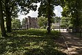
 KasteeltuinDeurne.jpg 1,600 × 1,200; 436 KB
-
-

-
 Park naast en rond het kasteel met dierenparkje - Deurne - 20536367 - RCE.jpg 1,200 × 800; 266 KB
-
 Reproductie door Antoni de Haen, 1640 - Deurne - 20053711 - RCE.jpg 1,200 × 942; 260 KB
-
 Reproductie van foto van Wolfgang Bingel - Deurne - 20053726 - RCE.jpg 1,200 × 949; 291 KB
-
 Reproductie van foto van Wolfgang Bingel - Deurne - 20053727 - RCE.jpg 1,200 × 940; 306 KB
-
 Reproductie van foto van Wolfgang Bingel - Deurne - 20053728 - RCE.jpg 946 × 1,200; 297 KB
-
 Reproductie van foto van Wolfgang Bingel - Deurne - 20053729 - RCE.jpg 945 × 1,200; 336 KB
-
 Reproductie van foto van Wolfgang Bingel - Deurne - 20053730 - RCE.jpg 937 × 1,200; 285 KB
-
 Reproductie van foto van Wolfgang Bingel - Deurne - 20053731 - RCE.jpg 941 × 1,200; 225 KB
-
 Reproductie van foto van Wolfgang Bingel - Deurne - 20053732 - RCE.jpg 1,200 × 931; 225 KB
-

-
 Schouw - Deurne - 20053706 - RCE.jpg 1,200 × 960; 256 KB
-
 Zijgevel - Deurne - 20322664 - RCE.jpg 1,200 × 957; 176 KB
-
 Zuidwesthoek tijdens restauratie - Deurne - 20322665 - RCE.jpg 957 × 1,200; 160 KB
-
 Zuidzijde tijdens restauratie - Deurne - 20322666 - RCE.jpg 1,200 × 957; 174 KB
-
 Zuidzijde tijdens restauratie - Deurne - 20322667 - RCE.jpg 959 × 1,200; 175 KB


_-_Deurne_-_20053738_-_RCE.jpg)


