Category:Grote Kerk, Hoorn
| Object location | | View all coordinates using: OpenStreetMap |
|---|
church building in Hoorn, Netherlands  | |||||
| Upload media | |||||
| Instance of | |||||
|---|---|---|---|---|---|
| Location | Hoorn, North Holland, Netherlands | ||||
| Street address |
| ||||
| Located on street | |||||
| Heritage designation |
| ||||
| Religion or worldview | |||||
 | |||||
|
This is a category about rijksmonument number 333542
|
| Address |
|
Subcategories
This category has the following 3 subcategories, out of 3 total.
G
- Grote Kerk, Hoorn (1369-1838) (20 F)
- Grote Kerk, Hoorn (1842-1878) (10 F)
H
- Voormalige Grote Kerk, Hoorn (1 F)
Media in category "Grote Kerk, Hoorn"
The following 64 files are in this category, out of 64 total.
-

-

-
 Binnenstad Hoorn, 1621 Hoorn, Netherlands - panoramio (125).jpg 4,896 × 3,264; 6.02 MB
-
 Binnenstad met kermis, Hoorn.jpg 5,472 × 3,648; 6.29 MB
-
EEN NIEUW CARILLON-PGM4011579.webm 1 min 23 s, 720 × 576; 11.13 MB
-
 Exterieur met nieuwe spits - Hoorn - 20115895 - RCE.jpg 878 × 1,200; 162 KB
-
 Exterieur met oorspronkelijke spits - Hoorn - 20115896 - RCE.jpg 1,200 × 842; 162 KB
-
 Exterieur OVERZICHT EERSTE VERDIEPING - Hoorn - 20301645 - RCE.jpg 1,197 × 1,200; 246 KB
-
 Exterieur OVERZICHT ZUIDZIJDE - Hoorn - 20301641 - RCE.jpg 1,200 × 1,197; 347 KB
-
 Exterieur tijdens de bouw van de nieuwe spits - Hoorn - 20115898 - RCE.jpg 875 × 1,200; 186 KB
-
 Exterieur voor de bouw van de nieuwe spits - Hoorn - 20115897 - RCE.jpg 890 × 1,200; 186 KB
-
 Exterieur ZUID, WESTGEVEL - Hoorn - 20301642 - RCE.jpg 960 × 1,200; 253 KB
-
 Exterieur ZUIDOOST GEVEL - Hoorn - 20301643 - RCE.jpg 1,200 × 949; 361 KB
-
 Graftombe van de zeeheld P.Florisz. - Hoorn - 20115934 - RCE.jpg 960 × 1,200; 199 KB
-
 Grote Kerk (Hoorn).JPG 2,592 × 3,888; 2.75 MB
-
 Grote Kerk en Koepelkerk (3874758162).jpg 4,257 × 2,827; 1.85 MB
-
 Grote Kerk, Hoorn.JPG 2,592 × 3,888; 2.75 MB
-

-
-
 Hoorn 027.JPG 3,264 × 2,448; 1.83 MB
-
 Hoorn Grote Kerk hnapel 001.jpg 7,360 × 4,912; 5.94 MB
-
 Hoorn, the Grote Kerk.jpg 1,614 × 2,395; 820 KB
-
 Hoorn, the square "Roode Steen", view to the Grote Kerk.jpg 2,551 × 1,701; 1.07 MB
-
 Hoornse Hop met Hoorn op de achtergrond.jpg 3,888 × 2,592; 3.41 MB
-
 Ingang Grote Kerk, Hoorn.JPG 2,592 × 3,888; 3.73 MB
-
 INTERIEUR, OVERZICHT - Hoorn - 20301644 - RCE.jpg 1,190 × 1,200; 217 KB
-
 INTERIEUR, OVERZICHT EERSTE VERDIEPING - Hoorn - 20301646 - RCE.jpg 1,200 × 1,192; 261 KB
-
 Kerkinterieur van de Grote Kerk in Hoorn, RP-P-1939-940.jpg 4,902 × 5,710; 5.73 MB
-
 Kerkplein 33 te Hoorn.jpg 960 × 1,280; 170 KB
-
 Kermisbord Kerkplein, Hoorn 1.jpg 5,472 × 3,648; 6.86 MB
-
 Kermisbord Kerkplein, Hoorn 2.jpg 3,648 × 5,472; 7.4 MB
-
 Kroonluchter, Grote Kerk, Hoorn 04.JPG 2,592 × 3,888; 4.05 MB
-
 Muuranker, Grote Kerk, Hoorn.JPG 2,592 × 3,888; 3.17 MB
-
 Nederland Hoorn 02.jpg 6,016 × 4,016; 5.59 MB
-
 Neobarok ornament, Grote Kerk, Hoorn 02.JPG 3,888 × 2,592; 2.32 MB
-
 Neobarok ornament, Grote Kerk, Hoorn 03.JPG 3,888 × 2,592; 3.32 MB
-
 Neobarok ornament, Grote Kerk, Hoorn 04.JPG 3,888 × 2,592; 2.74 MB
-
 Neobarok ornament, Grote Kerk, Hoorn.JPG 3,888 × 2,592; 2.07 MB
-
 Niet uitgevoerd ontwerp van de kerk door C.Muysken - Hoorn - 20115930 - RCE.jpg 1,200 × 955; 159 KB
-
 Niet uitgevoerd ontwerp van de nieuwe kerk - Hoorn - 20115926 - RCE.jpg 1,200 × 955; 136 KB
-
 Niet uitgevoerd ontwerp van de nieuwe kerk - Hoorn - 20115927 - RCE.jpg 1,200 × 963; 178 KB
-
 Nieuwstraat, Hoorn.jpg 5,472 × 3,648; 4.31 MB
-
 Nordholland Hoorn 2004 024.jpg 1,728 × 2,304; 784 KB
-

-

-

-
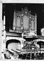 Orgel in de Grote Kerk te Hoorn. - Hoorn - 20172760 - RCE.jpg 872 × 1,200; 214 KB
-

-
 Plafond van de Grote Kerk, Hoorn 01.jpg 5,472 × 3,648; 6.36 MB
-
 Plafond van de Grote Kerk, Hoorn 02.jpg 5,472 × 3,648; 6.68 MB
-
 Plafond van de Grote Kerk, Hoorn 03.jpg 5,472 × 3,648; 6.29 MB
-
 Plafond, Grote Kerk, Hoorn.JPG 2,592 × 3,888; 2.35 MB
-
 Rechter portaal van de Grote Kerk in de kerktoren.JPG 1,944 × 2,592; 2.61 MB
-
 Schetsontwerp J.Metzelaer - Hoorn - 20115931 - RCE.jpg 1,200 × 957; 159 KB
-
 Slinger en mechanisch uurwerk Grote Kerk, Hoorn.JPG 2,592 × 3,888; 3.7 MB
-
 The great church Hoorn, now in use as a shop - panoramio.jpg 3,264 × 4,928; 6.32 MB
-
 Toren Grote Kerk Hoorn.jpg 3,672 × 4,896; 1.26 MB
-
 Twee studies te Hoorn, RP-T-1996-8-22(V).jpg 1,640 × 2,768; 350 KB
-
 Venster noordelijke dwarsarm, Grote Kerk, Hoorn 01.JPG 2,592 × 3,888; 2.76 MB
-
 Venster noordelijke dwarsarm, Grote Kerk, Hoorn 02.JPG 2,592 × 3,888; 2.99 MB
-
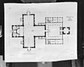
 Wel uitgevoerd ontwerp van de nieuwe kerk - Hoorn - 20115925 - RCE.jpg 1,001 × 1,200; 194 KB
-
 Wel uitgevoerd ontwerp van de nieuwe kerk - Hoorn - 20115929 - RCE.jpg 1,200 × 956; 180 KB
-
 Wel uitgevoerd ontwerp van de nog bestaande kerk - Hoorn - 20115928 - RCE.jpg 963 × 1,200; 170 KB
-
 Zeemeermin Grote Kerk Hoorn.jpg 3,497 × 4,662; 671 KB
.jpg)


.JPG)
.jpg)


.jpg)


