Category:Grotekerksbuurt 80, Dordrecht
| Object location | | View all coordinates using: OpenStreetMap |
|---|
house in Dordrecht, Netherlands  | |||||
| Upload media | |||||
| Instance of | |||||
|---|---|---|---|---|---|
| Location | Dordrecht, South Holland, Netherlands | ||||
| Located on street | |||||
| Heritage designation |
| ||||
 | |||||
|
This is a category about rijksmonument number 13409
|
| Address |
|
Media in category "Grotekerksbuurt 80, Dordrecht"
The following 7 files are in this category, out of 7 total.
-
 Achtergevels - Dordrecht - 20061996 - RCE.jpg 928 × 1,200; 303 KB
-
 Boogjes, 3311 Dordrecht, Netherlands - panoramio (2).jpg 2,048 × 1,375; 391 KB
-
 Groenmarkt, 3311 Dordrecht, Netherlands - panoramio (47).jpg 4,896 × 3,264; 2 MB
-
 Met zijgevel van nr. 80 - Dordrecht - 20061995 - RCE.jpg 956 × 1,200; 231 KB
-
 Nieuwe Haven, Dordrecht, Netherlands - panoramio (21).jpg 2,048 × 1,148; 487 KB
-
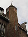 RM13409 Dordrecht - Grotekerksbuurt 80 (traptoren).jpg 2,448 × 3,264; 1.58 MB
-
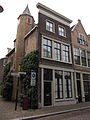 RM13409 Dordrecht - Grotekerksbuurt 80.jpg 2,448 × 3,264; 1.89 MB

.jpg)
.jpg)

.jpg)
.jpg)