Category:Grutterstraat 3, Loenen aan de Vecht
| Object location | | View all coordinates using: OpenStreetMap |
|---|
building in Stichtse Vecht, Netherlands  | |||||
| Upload media | |||||
| Instance of | |||||
|---|---|---|---|---|---|
| Location | Loenen aan de Vecht, Stichtse Vecht, Utrecht, Netherlands | ||||
| Street address |
| ||||
| Located on street |
| ||||
| Heritage designation |
| ||||
 | |||||
|
This is a category about rijksmonument number 26049
|
| Address |
|
Media in category "Grutterstraat 3, Loenen aan de Vecht"
The following 4 files are in this category, out of 4 total.
-
 Loenen aan de Vecht - Grutterstraat 3 RM26049.JPG 2,190 × 4,095; 593 KB
-
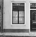 Schuifraam in voorgevel begane grond - Loenen aan de Vecht - 20141725 - RCE.jpg 1,188 × 1,200; 258 KB
-
 Voorgevel - Loenen aan de Vecht - 20141723 - RCE.jpg 803 × 1,200; 175 KB
-
 Voorgevel - Loenen aan de Vecht - 20141724 - RCE.jpg 953 × 1,200; 200 KB


