Category:Gsohlweg
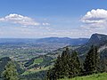
Deutsch: Der Gsohlweg führt von Hohenems auf die Alpe Gsohl (rund 900 m.ü.A.).
English: The Gsohlweg (hiking path) leads from Hohenems to Alp Gsohl (around 900 masl).
Français : Le Gsohlweg (chemin de randonnée) mène de Hohenems à l'Alp Gsohl (environ 900 m d'altitude).
hiking trail to Alps Gsohl in Hohenems, Vorarlberg, Austria  | |||||
| Upload media | |||||
| Instance of | |||||
|---|---|---|---|---|---|
| Location | Hohenems, Dornbirn District, Vorarlberg, Austria | ||||
| |||||
Media in category "Gsohlweg"
The following 15 files are in this category, out of 15 total.
-
 Hohenems-former Landmark-03ESD.jpg 3,456 × 4,608; 2.54 MB
-
 Hohenems-former Landmark-13ESD.jpg 3,456 × 4,608; 3.1 MB
-
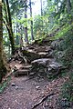
 Hohenems-Gsohlweg-01ASD.jpg 3,056 × 4,592; 2.66 MB
-
 Hohenems-Gsohlweg-02ESD.jpg 3,456 × 4,608; 3.28 MB
-
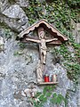 Hohenems-Gsohlweg-wayside cross-02ESD.jpg 3,456 × 4,608; 2.42 MB
-
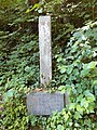
 Hohenems-Gsohlweg-wayside cross-memorial Anton Wehinger-01ASD.jpg 3,056 × 4,592; 2.2 MB
-
 Hohenems-Gsohlweg-wayside cross-memorial Karl Schlachter-Alois Vogl-01ASD.jpg 3,056 × 4,592; 2.28 MB
-
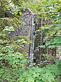
 Hohenems-hiking path Gsohl-rotes baecheli-01ASD.jpg 3,056 × 4,592; 2.37 MB
-
 Hohenems-hiking path Gsohl-rotes baecheli-03ASD.jpg 3,056 × 4,592; 2.34 MB
-
 Hohenems-hiking path Gsohl-rotes baecheli-04ASD.jpg 3,056 × 4,592; 2.76 MB
-
 Hohenems-hiking path Gsohl-rotes baecheli-05ASD.jpg 4,592 × 3,056; 2.9 MB
-
 Hohenems-hiking path Gsohl-rotes baecheli-06ESD.jpg 3,456 × 4,608; 2.67 MB
-
 Hohenems-Montainbike rules Vorarlberg-01ASD.jpg 2,598 × 1,634; 456 KB
-
 Hohenems-view to Schlossberg-Breitenberg-Reute from Gsohl-02ESD.jpg 4,608 × 3,456; 1.75 MB
-
 Hohenems-view to Staufen from Gsohl-02ESD.jpg 4,608 × 3,456; 2.22 MB


