Category:Gwadar satellite view showing island created by 2013 earthquake
Media in category "Gwadar satellite view showing island created by 2013 earthquake"
The following 10 files are in this category, out of 10 total.
-
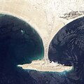 Gwadar satellite view showing island created by 2013 earthquake.jpg 2,000 × 2,000; 861 KB
-
 Gwadar satellite view.jpg 2,000 × 2,000; 636 KB
-
 Gwadarview.jpg 816 × 612; 23 KB
-
 Pakistan Balochistan province - Gwadar and Demi Zirr bay IMG 7953.jpg 3,792 × 2,785; 1,003 KB
-
 Pakistan Balochistan province - Gwadar IMG 7931.jpg 4,025 × 2,619; 1.11 MB
-
 Pakistan Balochistan province - Gwadar IMG 7934.jpg 4,017 × 3,013; 1.01 MB
-
 Pakistan Balochistan province - Gwadar IMG 7936.jpg 4,003 × 3,001; 1.14 MB
-
 Pakistan Balochistan province - Gwadar IMG 7942.jpg 4,032 × 3,024; 1.2 MB
-
 Pakistan Balochistan province - Gwadar IMG 7946.jpg 3,773 × 2,831; 926 KB
-
 Zalzala Jazeera 2013 Gwadar.jpg 720 × 480; 94 KB


