Category:Gyügye
| Object location | | View all coordinates using: OpenStreetMap |
|---|
village in Hungary  | |||||
| Upload media | |||||
| Instance of |
| ||||
|---|---|---|---|---|---|
| Location | Fehérgyarmat District, Szabolcs-Szatmár-Bereg County, Hungary | ||||
| Population |
| ||||
| Area |
| ||||
| official website | |||||
 | |||||
Media in category "Gyügye"
The following 3 files are in this category, out of 3 total.
-
 Gyugye rovastabla.png 81 × 40; 5 KB
-
 Gyügye légifotó.jpg 321 × 480; 36 KB
-
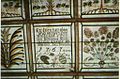 Gyügye, festett, kazettás mennyezet 1767-ből.jpg 512 × 336; 48 KB

