Category:Häg-Ehrsberg
municipality in Germany    | |||||
| Upload media | |||||
| Instance of |
| ||||
|---|---|---|---|---|---|
| Location |
| ||||
| Population |
| ||||
| Area |
| ||||
| Elevation above sea level |
| ||||
| official website | |||||
 | |||||
Subcategories
This category has the following 7 subcategories, out of 7 total.
Media in category "Häg-Ehrsberg"
The following 40 files are in this category, out of 40 total.
-
 Angenbach bei Rohmatt.JPG 3,264 × 2,448; 4.03 MB
-
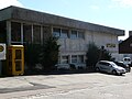 Angenbachtalschule Häg.JPG 3,264 × 2,448; 3.71 MB
-
 Belchen von Ehrsberg crop4.JPG 1,332 × 1,000; 483 KB
-
 Belchen von Ehrsberg Zuschnitt1.jpg 805 × 1,263; 945 KB
-
 Belchen von Ehrsberg Zuschnitt2.jpg 1,242 × 456; 482 KB
-
 Belchen von Ehrsberg Zuschnitt3.jpg 1,417 × 1,101; 1.47 MB
-
 Belchen von Ehrsberg.JPG 3,264 × 2,448; 3.64 MB
-
 Bio-Milch Weiden, Südschwarzwald.jpg 3,000 × 1,687; 2.6 MB
-
 Blick auf Ehrsberg.jpg 6,305 × 3,546; 5.39 MB
-
 Ehrsberg 2.JPG 3,264 × 2,448; 3.71 MB
-
 Ehrsberg-Wühre.jpg 4,650 × 2,733; 1.74 MB
-
 Ehrsberg.JPG 3,264 × 2,448; 3.28 MB
-
 Flagge Häg-Ehrsberg.svg 600 × 1,500; 6 KB
-
 Flurkreuz Häg-Altenstein 1757.JPG 4,000 × 6,000; 11.34 MB
-
 Happach.JPG 3,264 × 2,448; 3.49 MB
-
 Häg 2.JPG 3,264 × 2,448; 3.77 MB
-
 Häg-Ehrsberg - Ortsschild Häg.jpg 3,840 × 2,692; 3.08 MB
-
 Häg-Ehrsberg - Sonnenmatt.jpg 3,732 × 2,488; 5.9 MB
-
 Häg-Ehrsberg Blick auf Ehrsberg Bild 2.jpg 5,472 × 3,648; 13.57 MB
-
 Häg-Ehrsberg Blick auf Ehrsberg.jpg 4,848 × 3,232; 14.06 MB
-
 Häg-Ehrsberg Hinterstadel.jpg 4,662 × 3,108; 15.23 MB
-
 Häg-Ehrsberg Häger Wasserfall Bild 1.jpg 7,952 × 5,304; 4.78 MB
-
 Häg-Ehrsberg Häger Wasserfall Bild 2.jpg 7,952 × 5,304; 7.26 MB
-
 Häg-Ehrsberg Häger Wasserfall Bild 3.jpg 7,952 × 5,304; 6.33 MB
-
Häg-Ehrsberg Häger Wasserfall.webm 2 min 37 s, 1,280 × 720; 73.76 MB
-
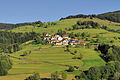
 Häg-Ehrsberg Landschaft Bild 1.jpg 4,907 × 3,271; 6.9 MB
-
 Häg-Ehrsberg Landschaft Bild 2.jpg 4,873 × 3,248; 15.67 MB
-
 Häg-Ehrsberg Landschaft Bild 3.jpg 5,472 × 3,648; 9.52 MB
-
 Häg-Ehrsberg Landschaft Bild 4.jpg 5,472 × 3,648; 8.77 MB
-
 Häg-Ehrsberg Landschaft Bild 5.jpg 5,470 × 3,646; 20.18 MB
-
 Häg-Ehrsberg Landschaft Bild 6.jpg 5,472 × 3,648; 8.98 MB
-
 Häg-Ehrsberg Landschaft Klopfsäge.jpg 5,472 × 3,648; 10.16 MB
-
 Häg-Ehrsberg Vorderstadel.jpg 5,472 × 3,648; 10.72 MB
-
 Häg.JPG 3,264 × 2,448; 3.53 MB
-
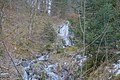
 Häger Wasserfälle 1.JPG 2,448 × 3,264; 4.15 MB
-
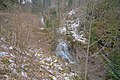
 Häger Wasserfälle 2.JPG 2,448 × 3,264; 4.64 MB
-
 Häger Wasserfälle 3.JPG 2,448 × 3,264; 4.76 MB
-
 Sonnenmatt 2.JPG 3,264 × 2,448; 3.83 MB
-
 Sonnenmatt.JPG 3,264 × 2,448; 3.87 MB
-
 Zeller Bergland 3.JPG 3,264 × 2,448; 2.63 MB


