Category:Habergham Eaves
English: Habergham Eaves is a civil parish in the borough of Burnley, in Lancashire, England. The parish consists of a rural area south of Burnley, and suburban areas on the outskirts of the town, including a large industrial estate in the north-west corner of the parish. Habergham is also the name of an area west of Burnley, although it is not within the parish. In the 2001 census the parish had a population of 1,581. The A646 Padiham to Todmorden road runs approximately along the northern boundary of the parish. Surrounding areas include the unparished areas of Burnley and Rossendale, and the parishes of Hapton, Dunnockshaw and Clowbridge and Cliviger. (→Habergham Eaves)
Nederlands: Habergham Eaves is een plaats en civil parish in het bestuurlijke gebied Burnley, in het Engelse graafschap Lancashire met 1.581 inwoners. (→Habergham Eaves)

civil parish in Lancashire, UK  | |||||
| Upload media | |||||
| Instance of | |||||
|---|---|---|---|---|---|
| Location | Burnley, Lancashire, North West England, England | ||||
 | |||||
Subcategories
This category has the following 2 subcategories, out of 2 total.
H
- Habergham Eaves War Memorial (3 F)
S
- Singing ringing tree (10 F)
Media in category "Habergham Eaves"
The following 200 files are in this category, out of 239 total.
(previous page) (next page)-
 2 ready 2 to go - geograph.org.uk - 747418.jpg 608 × 456; 178 KB
-
 A646 New Road at Copy Wood - geograph.org.uk - 1247827.jpg 640 × 427; 83 KB
-
 A682 heading towards Burnley - geograph.org.uk - 616414.jpg 640 × 425; 48 KB
-
 A682, Manchester Road - geograph.org.uk - 2102427.jpg 800 × 480; 176 KB
-
 A682, Manchester Road - geograph.org.uk - 2102439.jpg 640 × 480; 144 KB
-

-
 Access Lane to Further Barn - geograph.org.uk - 5302823.jpg 5,184 × 3,456; 7 MB
-
 Access Lane to Lower Mickelhurst - geograph.org.uk - 5302821.jpg 5,184 × 3,456; 6.2 MB
-
 Across Burnley to Pendle - geograph.org.uk - 3380489.jpg 2,736 × 3,648; 4.58 MB
-
 Across Limy Valley to Dunnockshaw - geograph.org.uk - 3964402.jpg 3,648 × 2,736; 4.93 MB
-
 Across the wood to the water - geograph.org.uk - 3964430.jpg 3,648 × 2,736; 4.89 MB
-
 Along the A682 - geograph.org.uk - 616413.jpg 640 × 425; 61 KB
-

-
 Below the brow on Crown Point - geograph.org.uk - 5391274.jpg 6,000 × 4,000; 3.88 MB
-
 Beyond the future - geograph.org.uk - 616415.jpg 640 × 425; 49 KB
-
 Billington Road Entrance to VEKA Factory - geograph.org.uk - 4394475.jpg 640 × 427; 216 KB
-
 Boggart Brig 1.jpg 4,006 × 3,005; 5.12 MB
-
 Boggart Brig 2.jpg 4,008 × 3,005; 7.5 MB
-
 Boggart Brig 3.jpg 4,004 × 3,005; 5.33 MB
-
 Boggart Brig 4.jpg 4,005 × 3,005; 4.09 MB
-
 Boggart Brig 5.jpg 4,004 × 3,005; 6.15 MB
-
 Bruised Sky over Dunnockshaw Community Woodland - geograph.org.uk - 5761037.jpg 5,184 × 3,456; 7.47 MB
-
 Burnley and Pendle - geograph.org.uk - 3386288.jpg 3,648 × 2,736; 4.69 MB
-
 Burnley Golf Course, Crown Point - geograph.org.uk - 3345538.jpg 640 × 478; 513 KB
-
 Burnley Golf Course, looking towards Crown Point - geograph.org.uk - 2217460.jpg 3,872 × 2,592; 1.36 MB
-
 Burnley Road-Bacup Road Junction - geograph.org.uk - 2104578.jpg 640 × 480; 257 KB
-
 Burnley Way below Higher Timber Hill - geograph.org.uk - 4980320.jpg 1,600 × 1,067; 762 KB
-
 Burnley Way descending through Copy Clough Plantation - geograph.org.uk - 5760735.jpg 5,184 × 3,456; 7.35 MB
-
 Burnley Way entering Burnley Golf Course.jpg 3,899 × 2,925; 3.68 MB
-
 Burnley Way heading for the A682, Manchester Road - geograph.org.uk - 5761045.jpg 5,184 × 3,456; 6.03 MB
-
 Burnley Way heading towards Higher Nutshaw - geograph.org.uk - 5761073.jpg 5,184 × 3,456; 5.46 MB
-
 Burnley Way near Lower Small Hazels.jpg 3,005 × 4,007; 6.26 MB
-
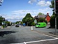
 Burnley, Harold Avenue - geograph.org.uk - 4394859.jpg 640 × 480; 320 KB
-
 Burnley, The 'Waggoners', Manchester Road - geograph.org.uk - 3178664.jpg 4,320 × 3,240; 6.08 MB
-
 Buttercross, Habergham Eaves.jpg 4,011 × 3,008; 6.5 MB
-
 Cattle grid at Crown Point - geograph.org.uk - 2227379.jpg 3,872 × 2,592; 2.93 MB
-
 Cattle Grid at Crown Point - geograph.org.uk - 3347047.jpg 640 × 481; 500 KB
-
 Cattle grid on Crown Point Road - geograph.org.uk - 2217477.jpg 3,872 × 2,592; 2.27 MB
-
 Cattle grid on Crown Point Road - geograph.org.uk - 5939891.jpg 640 × 480; 67 KB
-
 Cattle grid on Crown Point Road - geograph.org.uk - 5982089.jpg 1,024 × 768; 84 KB
-
 Clowbridge Reservoir - geograph.org.uk - 5757165.jpg 5,184 × 3,456; 6.66 MB
-
 Copy Clough - geograph.org.uk - 5391238.jpg 6,000 × 4,000; 6.04 MB
-
 Copy Clough - geograph.org.uk - 5391252.jpg 6,000 × 4,000; 7.52 MB
-
 Copy Farm - geograph.org.uk - 2393573.jpg 608 × 456; 102 KB
-
 Copy Wood Culvert, Burnley - geograph.org.uk - 3749127.jpg 1,600 × 1,200; 283 KB
-
 Covered Reservoir between Lower and Higher Small Hazels - geograph.org.uk - 5349328.jpg 4,000 × 3,000; 2.85 MB
-
 Crown Point - geograph.org.uk - 1248118.jpg 640 × 427; 62 KB
-
 Crown Point - geograph.org.uk - 1248161.jpg 640 × 427; 83 KB
-
 Crown Point - geograph.org.uk - 3283733.jpg 1,600 × 1,200; 1.25 MB
-
 Crown Point - geograph.org.uk - 3346113.jpg 640 × 480; 522 KB
-
 Crown Point car park - geograph.org.uk - 5982092.jpg 1,024 × 768; 80 KB
-
 Crown Point car park - picnic bench - geograph.org.uk - 5982094.jpg 1,024 × 768; 239 KB
-
 Crown Point Plaque - geograph.org.uk - 4501463.jpg 1,085 × 1,681; 124 KB
-
 Crown Point Road - geograph.org.uk - 3346079.jpg 640 × 481; 493 KB
-
 Crown Point Road - geograph.org.uk - 3346101.jpg 640 × 478; 468 KB
-
 Crown Point Road - geograph.org.uk - 3346128.jpg 640 × 481; 592 KB
-
 Crown Point Road - geograph.org.uk - 3380543.jpg 3,648 × 2,736; 4.22 MB
-
 Crown Point Road - geograph.org.uk - 3964443.jpg 3,648 × 2,736; 4.86 MB
-
 Crown Point Road - geograph.org.uk - 3976175.jpg 1,024 × 768; 156 KB
-
 Crown Point Road - geograph.org.uk - 674783.jpg 640 × 427; 43 KB
-
 Crown Point Road towards Burnley - geograph.org.uk - 5939931.jpg 640 × 480; 68 KB
-
 Damaged factory premises on Manchester Road - geograph.org.uk - 2217261.jpg 3,872 × 2,592; 2.47 MB
-

-
 Demolition of The Coaching Inn - geograph.org.uk - 1919075.jpg 1,632 × 1,224; 414 KB
-
 Digger clearing snowdrifts A682 - geograph.org.uk - 3380285.jpg 640 × 480; 68 KB
-
 Distressed Wall beside The Burnley Way - geograph.org.uk - 5761050.jpg 5,184 × 3,456; 4.25 MB
-
 Dunnockshaw and its woodland - geograph.org.uk - 3810868.jpg 3,648 × 2,736; 4.59 MB
-
 Dunnockshaw Community Woodland - geograph.org.uk - 3810860.jpg 3,648 × 2,736; 4.68 MB
-
 Dunnockshaw to Pendle - geograph.org.uk - 4322666.jpg 3,648 × 2,736; 3.68 MB
-
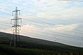 Electricity - geograph.org.uk - 616411.jpg 640 × 425; 56 KB
-
 Electricity Pylons stretching over Dunnockhaw Community Wood - geograph.org.uk - 5761061.jpg 5,184 × 3,456; 6.02 MB
-
 Enclosure on summit by Crown Point House near Burnley - geograph.org.uk - 5607505.jpg 5,184 × 2,920; 5.36 MB
-

-
 Everage Clough - geograph.org.uk - 5982095.jpg 1,024 × 768; 165 KB
-

-
 Farmland off New Road (A646) - geograph.org.uk - 5251374.jpg 640 × 480; 60 KB
-

-

-
 Fire Damaged Factory - geograph.org.uk - 1911206.jpg 480 × 640; 82 KB
-
 Footpath at the side of Iron House - geograph.org.uk - 4394904.jpg 640 × 481; 321 KB
-
 Footpath crossing Crown Point Road, Habergham Eaves - geograph.org.uk - 6224136.jpg 2,000 × 1,500; 874 KB
-
 Footpath junction post - geograph.org.uk - 2217607.jpg 3,872 × 2,592; 1.41 MB
-
 Footpath off Crown Point Road, Habergham Eaves - geograph.org.uk - 6224140.jpg 2,000 × 1,500; 1.17 MB
-
 Footpath off Crown Point Road, Habergham Eaves - geograph.org.uk - 6224143.jpg 2,000 × 1,500; 1.27 MB
-
 Footpath off New Road (A646) - geograph.org.uk - 5251371.jpg 480 × 640; 80 KB
-
 Footpath, Crown Point - geograph.org.uk - 5939893.jpg 640 × 480; 76 KB
-
 Former reservoir dam - geograph.org.uk - 5391260.jpg 6,000 × 4,000; 7.11 MB
-
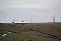
 From Copy Clough Plantation to Coal Clough Wind Farm - geograph.org.uk - 3810907.jpg 3,648 × 2,736; 4.16 MB
-
 From Copy Clough to Crown Point - geograph.org.uk - 3860344.jpg 3,648 × 2,736; 4.02 MB
-
 From Copy Clough to Pendle - geograph.org.uk - 3860341.jpg 3,648 × 2,736; 4.37 MB
-
 From Crown Point to Pendle - geograph.org.uk - 3386257.jpg 3,648 × 2,736; 3.95 MB
-
 Further Barn Farm - geograph.org.uk - 2217635.jpg 3,872 × 2,592; 6.25 MB
-

-
 Grazing near Higher Oaken Eaves - geograph.org.uk - 5922890.jpg 640 × 480; 51 KB
-
 Grazing near the New Waggoners - geograph.org.uk - 5922882.jpg 640 × 480; 51 KB
-
 Grazing off Crown Point Road - geograph.org.uk - 5939928.jpg 5,184 × 3,888; 5.81 MB
-

-

-
 Habergham Clough - geograph.org.uk - 4394896.jpg 640 × 480; 318 KB
-
 Habergham Hall Farm - geograph.org.uk - 4395046.jpg 640 × 481; 331 KB
-
 Hameldon and Hapton - geograph.org.uk - 3810946.jpg 3,648 × 2,736; 3.05 MB
-
 Hameldon Hill - geograph.org.uk - 3386264.jpg 3,648 × 2,736; 4.09 MB
-
 Hameldon Hill from Crown Point Road - geograph.org.uk - 3810873.jpg 3,648 × 2,736; 3.58 MB
-
 Helicopter taking off from Nutshaw Hill - geograph.org.uk - 2217501.jpg 3,583 × 2,429; 2.32 MB
-
 Higher Micklehurst - geograph.org.uk - 5922884.jpg 640 × 480; 53 KB
-
 Houses on Rossendale Road (A646) - geograph.org.uk - 5251358.jpg 640 × 480; 62 KB
-
 Limey Lane - geograph.org.uk - 5922868.jpg 640 × 480; 73 KB
-
 Limy Lane - a track leading to Clowbridge Reservoir - geograph.org.uk - 5349094.jpg 4,000 × 3,000; 4.15 MB
-
 Limy Lane - geograph.org.uk - 1193591.jpg 640 × 480; 77 KB
-
 Limy Valley - geograph.org.uk - 4322657.jpg 3,648 × 2,736; 3.75 MB
-
 Lower Micklehurst Farm - geograph.org.uk - 2217624.jpg 3,596 × 2,443; 3.5 MB
-
 Lower Micklehurst Farm.jpg 2,640 × 1,980; 997 KB
-
 Lower Oaken Eaves - geograph.org.uk - 5922893.jpg 640 × 480; 88 KB
-
 Lower Oaken Eaves Farm - geograph.org.uk - 2217614.jpg 3,662 × 2,438; 2.69 MB
-
 Lower Small Hazels Farm - geograph.org.uk - 2217272.jpg 3,872 × 2,592; 2.25 MB
-
 Manchester Road (A682) entering Habergham Eaves - geograph.org.uk - 5349098.jpg 4,000 × 3,000; 2.32 MB
-

-

-
 Manchester Road - geograph.org.uk - 2102422.jpg 800 × 600; 214 KB
-
 Manchester Road, Burnley (A682) - geograph.org.uk - 2217207.jpg 3,872 × 2,592; 2.66 MB
-
 Mind the Hole^ - geograph.org.uk - 3751358.jpg 2,848 × 2,136; 1.46 MB
-
 Mist Over Pendle - geograph.org.uk - 1189698.jpg 604 × 453; 37 KB
-
 Moorland at Crown Point - geograph.org.uk - 3346073.jpg 640 × 481; 529 KB
-
 Moorland off Manchester Road (A682) - geograph.org.uk - 5922871.jpg 640 × 480; 61 KB
-
 New Barn Clough - geograph.org.uk - 2217600.jpg 3,480 × 2,461; 3.28 MB
-
 New Copy Farm - geograph.org.uk - 5391224.jpg 6,000 × 4,000; 4.47 MB
-
 New Road (A646) - geograph.org.uk - 5251378.jpg 640 × 480; 100 KB
-
 Old Wayside Cross in Habergham Eaves parish (geograph 7018372).jpg 1,536 × 2,048; 1 MB
-
 On Crown Point - geograph.org.uk - 3386249.jpg 3,648 × 2,736; 4.81 MB
-
 Path leading off the Burnley Way - geograph.org.uk - 2217507.jpg 3,858 × 2,475; 3.48 MB
-

-
 Path towards Burnley from Crown Point - geograph.org.uk - 3346242.jpg 640 × 481; 542 KB
-
 Pendle Hill - geograph.org.uk - 3380527.jpg 3,648 × 2,736; 4.16 MB
-
 Pendle Hill - geograph.org.uk - 4036656.jpg 2,034 × 893; 359 KB
-
 Pendle Hill - geograph.org.uk - 4322693.jpg 3,648 × 2,736; 4.18 MB
-
 Pendle Hill from Crown Point Road - geograph.org.uk - 3373822.jpg 3,648 × 2,736; 4.56 MB
-
 Pendle Hill with a dusting - geograph.org.uk - 3380850.jpg 640 × 389; 27 KB
-
 Pendle with numbers - geograph.org.uk - 3095337.jpg 640 × 480; 220 KB
-
 Picnic area, Crown Point - geograph.org.uk - 5939900.jpg 640 × 480; 83 KB
-
 Plantation near Crown Point - geograph.org.uk - 5982098.jpg 1,024 × 768; 186 KB
-
 Public Footpath heading for the A682, Manchester Road - geograph.org.uk - 5302819.jpg 5,184 × 3,456; 7.75 MB
-
 Radio Mast, Woodplumpton Road, Habergham Eaves - geograph.org.uk - 6223146.jpg 2,000 × 1,500; 665 KB
-
 Reynolds Street, Burnley - geograph.org.uk - 2217232.jpg 3,872 × 2,592; 2.7 MB
-
 Road from Copy Farm to New Road - geograph.org.uk - 2393586.jpg 640 × 480; 125 KB
-

-
 Road to Further Barn Farm - geograph.org.uk - 1611586.jpg 640 × 465; 58 KB
-
 Rossendale Avenue - geograph.org.uk - 1611588.jpg 640 × 480; 58 KB
-

-

-
 Seat next to Crown Point Road, Habergham Eaves - geograph.org.uk - 6223142.jpg 2,000 × 1,500; 936 KB
-
 Sheep above Burnley - geograph.org.uk - 2217593.jpg 3,564 × 2,452; 2.84 MB
-
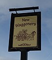 Sign for the New Waggoners - geograph.org.uk - 5922878.jpg 560 × 640; 44 KB
-
 Singing Ringing Tree - A Panopticon for Burnley - geograph.org.uk - 5939881.jpg 2,945 × 2,205; 1.8 MB
-
 Singing Ringing Tree - geograph.org.uk - 3380558.jpg 3,648 × 2,736; 4.53 MB
-
 Singing whistling tree.jpg 2,448 × 3,264; 1.53 MB
-
 Small wood on the slope of White Hill - geograph.org.uk - 5982090.jpg 1,024 × 768; 142 KB
-
 Snowdrifts A682 - geograph.org.uk - 3380275.jpg 640 × 480; 63 KB
-

-
 Stile and Signpost, The Burnley Way - geograph.org.uk - 3346088.jpg 640 × 481; 551 KB
-
 Stile next to Iron House - geograph.org.uk - 4394902.jpg 640 × 480; 343 KB
-

-
 Summit Works - geograph.org.uk - 5923081.jpg 5,184 × 3,888; 3.87 MB
-
 Swampy area on the edge of Burnley - geograph.org.uk - 5390922.jpg 6,000 × 4,000; 5.32 MB
-
 The A646, Rossendale Road, Burnley - geograph.org.uk - 2211430.jpg 3,718 × 2,372; 2.29 MB
-
 The Bull - geograph.org.uk - 2102455.jpg 800 × 600; 281 KB
-
 The Bull - not open... - geograph.org.uk - 3919639.jpg 1,800 × 1,197; 447 KB
-
 The Bull Public House - geograph.org.uk - 4506194.jpg 3,765 × 2,171; 854 KB
-
 The Bull, Manchester Road - geograph.org.uk - 1526553.jpg 640 × 480; 57 KB
-
 The Bull, Manchester Road - geograph.org.uk - 2102451.jpg 800 × 600; 295 KB
-
 The Burnley Loop Line - geograph.org.uk - 5390879.jpg 6,000 × 4,000; 5.93 MB
-
 The Burnley Way - geograph.org.uk - 5922874.jpg 640 × 462; 96 KB
-

-
 The Burnley Way at Burnley Golf Club - geograph.org.uk - 2217448.jpg 3,872 × 2,592; 1.56 MB
-
 The Burnley Way below Lower Small Hazels Farm - geograph.org.uk - 2217286.jpg 3,872 × 2,592; 1.73 MB
-

-
 The Burnley Way coming off Crown Point - geograph.org.uk - 2217490.jpg 3,872 × 2,592; 3.17 MB
-
 The Burnley Way Footpath approaching Burnt Hill - geograph.org.uk - 5349100.jpg 4,000 × 3,000; 2.6 MB
-
 The Burnley Way Footpath heading to Higher Nutshaw - geograph.org.uk - 5349106.jpg 4,000 × 3,000; 2.94 MB
-
 The Burnley Way near Burnley - geograph.org.uk - 5390939.jpg 6,000 × 4,000; 5.76 MB
-
 The Burnley Way where it crosses the A682 - geograph.org.uk - 2217483.jpg 3,872 × 2,592; 4.79 MB
-
 The crossroads of the A682 and A646 - geograph.org.uk - 2217218.jpg 3,872 × 2,592; 2.84 MB
-
 The Forest of Pendle - geograph.org.uk - 3810931.jpg 3,648 × 2,736; 3.71 MB
-
 The junction of the A682 and A646 - geograph.org.uk - 449357.jpg 640 × 480; 101 KB
-
 The Kilns - geograph.org.uk - 5390910.jpg 6,000 × 4,000; 4.36 MB
-
 The Kilns, Habergham Eaves.jpg 4,008 × 3,006; 3.04 MB
-
 The New Waggoners - geograph.org.uk - 4036651.jpg 3,512 × 1,691; 1.11 MB
-
 The New Waggoners - geograph.org.uk - 5922877.jpg 640 × 480; 57 KB
-
 The New Waggoners - geograph.org.uk - 5922881.jpg 640 × 480; 67 KB
-

-
 The remains of the Bull - geograph.org.uk - 4898342.jpg 640 × 480; 97 KB
-
 The site of the Coaching Inn and a telephone box - geograph.org.uk - 2217248.jpg 3,872 × 2,592; 1.39 MB
-

-
 The Waggoners Inn on Manchester Road - geograph.org.uk - 2217480.jpg 3,611 × 2,438; 2.59 MB
-
 Thieveley Scout from Crown Point - geograph.org.uk - 1123425.jpg 640 × 427; 45 KB
-
 To Padiham and Whalley - geograph.org.uk - 3810917.jpg 3,648 × 2,736; 3.51 MB
-
 To the Burnley Way - geograph.org.uk - 3810856.jpg 3,648 × 2,736; 4.8 MB
-
 Tour of Britain Cycle Race - geograph.org.uk - 3508489.jpg 640 × 471; 98 KB
-
 Towneley Colliery 1.jpg 4,008 × 3,005; 5.42 MB
-
 Towneley Colliery 2.jpg 4,008 × 3,005; 5.05 MB
-
 Towneley Colliery coke oven 1.jpg 3,005 × 4,006; 4.96 MB


_-_geograph.org.uk_-_5922895.jpg)


_-_geograph.org.uk_-_5251374.jpg)


_-_geograph.org.uk_-_5251371.jpg)


_-_geograph.org.uk_-_5251358.jpg)


_entering_Habergham_Eaves_-_geograph.org.uk_-_5349098.jpg)
_towards_Burnley_-_geograph.org.uk_-_5922869.jpg)
_towards_Burnley_-_geograph.org.uk_-_5922872.jpg)

_-_geograph.org.uk_-_2217207.jpg)


_-_geograph.org.uk_-_5922871.jpg)


_-_geograph.org.uk_-_5251378.jpg)
.jpg)


_-_geograph.org.uk_-_5922866.jpg)


_-_geograph.org.uk_-_5922887.jpg)


