Category:Haigh, Greater Manchester
English: Haigh (pronounced "Hay") is a village and civil parish of the Metropolitan Borough of Wigan in Greater Manchester, England. Historically a part of Lancashire, it is located next to the village of Aspull. On the west it is bounded by the River Douglas, and on the north a small brook running into the Douglas divides it from Blackrod. At the 2001 census it had a population of 594.
village and civil parish of the Metropolitan Borough of Wigan in Greater Manchester, England  | |||||
| Upload media | |||||
| Instance of | |||||
|---|---|---|---|---|---|
| Location | Wigan, Greater Manchester, North West England, England | ||||
| Population |
| ||||
| Area |
| ||||
 | |||||
Subcategories
This category has the following 4 subcategories, out of 4 total.
D
H
- Haigh Windmill (11 F)
- Haigh Hall, Wigan (30 F)
Media in category "Haigh, Greater Manchester"
The following 200 files are in this category, out of 344 total.
(previous page) (next page)-
 1-3, Lakeside Cottages, Haigh.jpg 1,600 × 1,200; 1.43 MB
-
 1-4 School Lane, Haigh.jpg 1,024 × 747; 656 KB
-
 11-12, Lakeside Cottages, Haigh.jpg 1,600 × 1,200; 1.4 MB
-
 13-16, Lakeside Cottages, Haigh.jpg 1,600 × 1,200; 1.65 MB
-
 17-20, Lakeside Cottages, Haigh.jpg 1,600 × 1,222; 1.76 MB
-
 5-8, Lakeside Cottages, Haigh.jpg 1,600 × 1,200; 1.39 MB
-
 9-10, Lakeside Cottages, Haigh.jpg 1,600 × 1,200; 1.48 MB
-
 A ruined milking parlour - geograph.org.uk - 2396724.jpg 4,592 × 3,056; 5.2 MB
-
 Adlington Reservoir causeway - geograph.org.uk - 2697358.jpg 1,600 × 1,198; 445 KB
-
 An overflow for Arley Reservoir - geograph.org.uk - 2396494.jpg 4,592 × 3,056; 6.97 MB
-
 Aqueduct - geograph.org.uk - 2265239.jpg 1,200 × 803; 322 KB
-
 Arley Aqueduct - geograph.org.uk - 4617950.jpg 2,560 × 1,920; 2.63 MB
-
 Arley Brook - geograph.org.uk - 6097243.jpg 1,600 × 1,200; 749 KB
-
 Arley Lane Bridge - geograph.org.uk - 2265274.jpg 1,200 × 803; 477 KB
-
 Arley Lane Bridge - geograph.org.uk - 2265286.jpg 1,200 × 803; 407 KB
-
 Arley Lane bridge crossing cycle trail - geograph.org.uk - 4409975.jpg 640 × 480; 119 KB
-
 Arley Lane bridge crossing cycle trail - geograph.org.uk - 4409983.jpg 640 × 480; 126 KB
-
 Aspull Sough Minewater Treatment Plant - geograph.org.uk - 4351083.jpg 1,024 × 768; 233 KB
-
 Aspull Sough Minewater Treatment Scheme - geograph.org.uk - 4351090.jpg 1,024 × 768; 284 KB
-
 At Red Rock Lodge, one of the approaches to Haigh Hall - geograph.org.uk - 2102413.jpg 4,592 × 3,056; 3.8 MB
-
 Autumn foliage at Haigh Woodland Park in Greater Manchester.jpg 640 × 479; 154 KB
-
 Balcarres Arms - geograph.org.uk - 1537081.jpg 640 × 494; 74 KB
-
 Balcarres Arms - geograph.org.uk - 2636941.jpg 1,280 × 960; 667 KB
-
 Balcarres Arms - geograph.org.uk - 3844117.jpg 2,560 × 1,920; 2.5 MB
-
 Balcarres Arms, Haigh - geograph.org.uk - 700159.jpg 640 × 503; 151 KB
-
 Boats on the Leeds and Liverpool Canal - geograph.org.uk - 3942901.jpg 640 × 480; 391 KB
-
 Bridge 63 - geograph.org.uk - 2265230.jpg 1,200 × 803; 585 KB
-
 Bridge 63 - geograph.org.uk - 4409477.jpg 640 × 480; 70 KB
-
 Bridge 63 - Red Rock - geograph.org.uk - 1948351.jpg 4,224 × 3,168; 5.67 MB
-
 Bridge 63 pub at Red Rock - geograph.org.uk - 3918058.jpg 1,600 × 1,200; 413 KB
-
 Bridge At The Former Wigan Rowing Club Basin - geograph.org.uk - 4619417.jpg 2,484 × 1,638; 2.15 MB
-
 Bridge near Crawford Arms - geograph.org.uk - 469502.jpg 640 × 479; 101 KB
-
 Bridge No 60a - geograph.org.uk - 5704128.jpg 800 × 480; 119 KB
-
 Bridge Over Cut Between Canal ^ Canal Basin - Haigh - geograph.org.uk - 2000756.jpg 3,264 × 2,448; 1.94 MB
-

-
 Bridge over entrance to canal basin - geograph.org.uk - 1034681.jpg 640 × 479; 114 KB
-
 Bridge over Leeds Liverpool canal - geograph.org.uk - 1034675.jpg 640 × 479; 139 KB
-

-
 Bridge over the old railway line - geograph.org.uk - 2265235.jpg 1,200 × 803; 331 KB
-
 Bridge taking Red Rock Lane over the Leeds-Liverpool Canal - geograph.org.uk - 4757115.jpg 3,264 × 2,448; 1.68 MB
-
 Bridges over the old railway - geograph.org.uk - 2265283.jpg 1,200 × 803; 363 KB
-
 Butcherfield Row, Haigh - geograph.org.uk - 2781806.jpg 640 × 480; 458 KB
-
 Canal boat at Sennicar Lane Bridge - geograph.org.uk - 4589929.jpg 1,024 × 769; 231 KB
-
 Capped off Mine Shaft at Dairy Pit - geograph.org.uk - 5705681.jpg 1,600 × 1,200; 1,002 KB
-
 Car Park at Red Rock - geograph.org.uk - 2265232.jpg 1,200 × 800; 420 KB
-
 Copperas Lane on the Haigh Hall estate - geograph.org.uk - 3932115.jpg 1,024 × 767; 718 KB
-
 Copse South of Meadow Pit Lane, Haigh - geograph.org.uk - 6097227.jpg 1,600 × 1,202; 469 KB
-

-
 Cycle Route 55, Arley Lane Bridge - geograph.org.uk - 3942841.jpg 640 × 481; 394 KB
-
 Danger Keep Out - geograph.org.uk - 4147192.jpg 640 × 480; 140 KB
-

-
 Disused Mineshaft - geograph.org.uk - 6097263.jpg 1,200 × 1,600; 766 KB
-
 Disused Mineshaft at Red Rock Farm - geograph.org.uk - 6097130.jpg 1,600 × 1,200; 506 KB
-

-
 Disused Sandstone Quarry off School Lane, Haigh - geograph.org.uk - 6097216.jpg 1,551 × 1,166; 1.07 MB
-
 Entrance to Walker Gardens, Haigh Country Park - geograph.org.uk - 6299531.jpg 1,024 × 768; 196 KB
-
 Farmland south of Blackrod - geograph.org.uk - 5702966.jpg 800 × 583; 119 KB
-
 Field gates on New Road - geograph.org.uk - 3932209.jpg 1,024 × 768; 538 KB
-
 Fir Tree Farm House - geograph.org.uk - 3495914.jpg 1,280 × 853; 494 KB
-

-
 Footbridge over Arley Brook, Haigh - geograph.org.uk - 6097237.jpg 1,200 × 1,600; 726 KB
-
 Footpath in Haigh Country Park - geograph.org.uk - 3442521.jpg 640 × 481; 765 KB
-
 Footpath leading to Pendlebury Lane - geograph.org.uk - 4589872.jpg 1,024 × 768; 392 KB
-
 Footpath off National Cycle Route 55 - geograph.org.uk - 4409979.jpg 640 × 480; 133 KB
-
 Footpath to Patchcroft Farm - geograph.org.uk - 4409267.jpg 640 × 480; 86 KB
-
 Forgotten railway - geograph.org.uk - 1706627.jpg 640 × 427; 57 KB
-
 Former Post Office, Haigh - geograph.org.uk - 956001.jpg 640 × 480; 190 KB
-

-
 Freezeland Farm - geograph.org.uk - 50219.jpg 640 × 480; 157 KB
-
 Gate and public footpath sign at Water Works Farm - geograph.org.uk - 2698488.jpg 1,600 × 1,198; 620 KB
-
 Grazing near Willoughby Farm - geograph.org.uk - 4409259.jpg 640 × 480; 69 KB
-
 Grazing off Meadow Pit Lane (B5239) - geograph.org.uk - 4409265.jpg 640 × 480; 69 KB
-
 Haigh - Wigan - geograph.org.uk - 5699413.jpg 3,264 × 1,836; 2.1 MB
-
 Haigh and Aspull primary school - geograph.org.uk - 6561076.jpg 640 × 320; 242 KB
-
 Haigh Country Park - geograph.org.uk - 3442297.jpg 640 × 481; 653 KB
-
 Haigh Country Park - geograph.org.uk - 3442519.jpg 640 × 481; 746 KB
-
 Haigh Country Park - geograph.org.uk - 3442527.jpg 640 × 481; 763 KB
-

-

-

-

-

-
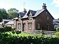
 Haigh Country Park, Hall Lane Lodge - geograph.org.uk - 3442663.jpg 640 × 481; 710 KB
-
 Haigh Country Park, Lower Plantation - geograph.org.uk - 3442745.jpg 640 × 480; 764 KB
-
 Haigh Country Park, Main Drive - geograph.org.uk - 3442762.jpg 640 × 480; 648 KB
-
 Haigh Country Park, Mowpin Lodge - geograph.org.uk - 3442506.jpg 640 × 481; 639 KB
-
 Haigh Country Park, Play Area - geograph.org.uk - 3442225.jpg 640 × 480; 666 KB
-
 Haigh Country Park, Sennicar Lane - geograph.org.uk - 4263232.jpg 640 × 480; 434 KB
-
 Haigh Country Park, Shedfield Bridge - geograph.org.uk - 3442530.jpg 640 × 481; 672 KB
-

-
 Haigh Country Park, Stocks Gate Entrance - geograph.org.uk - 3442820.jpg 640 × 481; 604 KB
-
 Haigh Country Park, Swan Pond - geograph.org.uk - 3442498.jpg 640 × 481; 614 KB
-
 Haigh Country Park, Upper Plantation - geograph.org.uk - 3442503.jpg 640 × 481; 778 KB
-
 Haigh Country Park, Yellow Brook - geograph.org.uk - 3442719.jpg 640 × 481; 739 KB
-
 Haigh Gargoyles - geograph.org.uk - 2795804.jpg 639 × 640; 57 KB
-
 Haigh Hall - geograph.org.uk - 4374525.jpg 1,632 × 918; 461 KB
-
 Haigh Hall Golf Complex - geograph.org.uk - 5022845.jpg 640 × 481; 488 KB
-
 Haigh Hall Miniature Railway - geograph.org.uk - 3442493.jpg 640 × 480; 718 KB
-
 Haigh Hall, The Lower Walled Garden - geograph.org.uk - 3442277.jpg 640 × 481; 721 KB
-
 Haigh Road, approaching Haigh - geograph.org.uk - 2102390.jpg 4,592 × 3,056; 4.95 MB
-
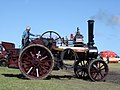 Haigh Steam Rally - geograph.org.uk - 121878.jpg 640 × 480; 145 KB
-
 Haigh Summit - geograph.org.uk - 3844122.jpg 2,560 × 1,920; 3.25 MB
-
 Haigh Upper Plantation, Swan Pond - geograph.org.uk - 3442497.jpg 640 × 481; 763 KB
-
 Haigh Windmill - geograph.org.uk - 4500191.jpg 2,000 × 1,327; 617 KB
-
 Haigh, Copperas Lane - geograph.org.uk - 3442968.jpg 640 × 481; 640 KB
-
 Haigh, School Lane - geograph.org.uk - 3442950.jpg 640 × 481; 674 KB
-
 Haighlands, Haigh.jpg 1,670 × 1,259; 2.06 MB
-
 Home Farmhouse, Haigh.jpg 2,208 × 1,648; 2.75 MB
-

-
 House at Fir Tree Farm - geograph.org.uk - 3495910.jpg 1,280 × 853; 238 KB
-
 House at Home Farm - geograph.org.uk - 3932102.jpg 1,024 × 767; 809 KB
-
 Houses on Sennicar Lane, Haigh - geograph.org.uk - 6097190.jpg 1,600 × 1,200; 674 KB
-
 Issues West of Harts Wood, Haigh - geograph.org.uk - 6097232.jpg 1,600 × 1,200; 563 KB
-
 Leaving Little Scotland - geograph.org.uk - 4409253.jpg 640 × 480; 50 KB
-
 Leeds - Liverpool Canal at Red Rock - geograph.org.uk - 6097141.jpg 1,600 × 1,203; 400 KB
-
 Leeds - Liverpool Canal at Red Rock - geograph.org.uk - 6097306.jpg 1,600 × 1,200; 753 KB
-
 Leeds and Liverpool Canal - geograph.org.uk - 3942870.jpg 640 × 481; 334 KB
-
 Leeds and Liverpool Canal - geograph.org.uk - 3942878.jpg 640 × 482; 317 KB
-
 Leeds and Liverpool Canal - geograph.org.uk - 3942883.jpg 640 × 480; 398 KB
-
 Leeds and Liverpool Canal - geograph.org.uk - 3943604.jpg 640 × 481; 299 KB
-
 Leeds and Liverpool Canal - geograph.org.uk - 4374533.jpg 1,632 × 918; 516 KB
-

-

-
 Leeds and Liverpool Canal at Red Rock - geograph.org.uk - 921722.jpg 640 × 461; 142 KB
-
 Leeds and Liverpool Canal at Red Rock - geograph.org.uk - 921724.jpg 640 × 450; 140 KB
-

-

-
 Leeds and Liverpool Canal near Red Rock - geograph.org.uk - 4263307.jpg 640 × 480; 381 KB
-

-

-
 Leeds and Liverpool Canal south of Red Rock - geograph.org.uk - 3918036.jpg 1,600 × 1,200; 704 KB
-
 Leeds and Liverpool Canal Towpath - geograph.org.uk - 4263299.jpg 640 × 480; 330 KB
-

-

-

-
 Leeds and Liverpool Canal, Haigh - geograph.org.uk - 3442538.jpg 640 × 481; 467 KB
-

-

-

-
 Leeds and Liverpool Canal, Red Rock - geograph.org.uk - 2351612.jpg 1,280 × 960; 769 KB
-

-
 Leeds Liverpool Canal - geograph.org.uk - 3910923.jpg 1,024 × 768; 792 KB
-
 Leeds Liverpool Canal - geograph.org.uk - 3932069.jpg 1,024 × 767; 514 KB
-
 Leeds ^ Liverpool Canal - geograph.org.uk - 2351572.jpg 1,280 × 960; 766 KB
-
 Leeds ^ Liverpool Canal - geograph.org.uk - 2351577.jpg 1,280 × 960; 817 KB
-
 Leeds ^ Liverpool Canal - geograph.org.uk - 2351583.jpg 1,280 × 960; 797 KB
-
 Leeds ^ Liverpool Canal - geograph.org.uk - 2351586.jpg 1,280 × 960; 744 KB
-
 Leeds ^ Liverpool Canal - geograph.org.uk - 6181181.jpg 1,600 × 1,065; 805 KB
-
 Leeds ^ Liverpool Canal - geograph.org.uk - 6181186.jpg 1,600 × 1,065; 848 KB
-
 Leeds ^ Liverpool Canal - geograph.org.uk - 6181188.jpg 1,600 × 1,065; 873 KB
-
 Leeds ^ Liverpool Canal - geograph.org.uk - 6181194.jpg 1,600 × 1,065; 675 KB
-
 Leeds ^ Liverpool Canal - geograph.org.uk - 6181197.jpg 1,065 × 1,600; 731 KB
-
 Leeds ^ Liverpool Canal - geograph.org.uk - 6181200.jpg 1,600 × 1,065; 684 KB
-
 Leeds ^ Liverpool Canal - geograph.org.uk - 6181201.jpg 1,600 × 1,065; 516 KB
-
 Leeds ^ Liverpool Canal - geograph.org.uk - 6181204.jpg 1,600 × 1,065; 554 KB
-
 Leeds ^ Liverpool Canal - geograph.org.uk - 6181208.jpg 1,600 × 1,065; 624 KB
-
 Leeds ^ Liverpool Canal - geograph.org.uk - 6181216.jpg 1,600 × 1,065; 540 KB
-
 Leeds ^ Liverpool Canal - geograph.org.uk - 6181217.jpg 1,600 × 1,065; 535 KB
-
 Leeds ^ Liverpool Canal - geograph.org.uk - 6181220.jpg 1,600 × 1,065; 458 KB
-
 Leeds ^ Liverpool Canal - geograph.org.uk - 6181222.jpg 1,600 × 1,065; 479 KB
-
 Leeds ^ Liverpool Canal - geograph.org.uk - 6181224.jpg 1,600 × 1,065; 465 KB
-
 Leeds ^ Liverpool Canal - geograph.org.uk - 6181227.jpg 1,600 × 1,065; 731 KB
-
 Leeds ^ Liverpool Canal - geograph.org.uk - 6181232.jpg 1,600 × 1,065; 556 KB
-
 Leeds ^ Liverpool Canal - geograph.org.uk - 6181242.jpg 1,600 × 1,065; 578 KB
-
 Leeds ^ Liverpool Canal - geograph.org.uk - 6181245.jpg 1,600 × 1,065; 581 KB
-
 Leeds ^ Liverpool Canal - geograph.org.uk - 6181246.jpg 1,600 × 1,065; 607 KB
-
 Leeds ^ Liverpool Canal - geograph.org.uk - 6181249.jpg 1,600 × 1,065; 480 KB
-
 Leeds ^ Liverpool Canal - geograph.org.uk - 6181253.jpg 1,600 × 1,065; 698 KB
-
 Leeds ^ Liverpool Canal - geograph.org.uk - 6181257.jpg 1,600 × 1,065; 582 KB
-
 Leeds ^ Liverpool Canal - geograph.org.uk - 6181308.jpg 1,600 × 1,065; 490 KB
-
 Leeds ^ Liverpool Canal - geograph.org.uk - 6181309.jpg 1,600 × 1,065; 722 KB
-
 Leeds ^ Liverpool Canal - geograph.org.uk - 6181313.jpg 1,600 × 1,065; 588 KB
-
 Leeds ^ Liverpool Canal - geograph.org.uk - 6181316.jpg 1,600 × 1,065; 509 KB
-
 Leeds ^ Liverpool Canal - geograph.org.uk - 6181322.jpg 1,600 × 1,065; 619 KB
-
 Leeds ^ Liverpool Canal - geograph.org.uk - 6181324.jpg 1,600 × 1,065; 525 KB
-
 Leeds ^ Liverpool Canal - geograph.org.uk - 6181328.jpg 1,600 × 1,065; 612 KB
-
 Leeds ^ Liverpool Canal - geograph.org.uk - 6181332.jpg 1,600 × 1,065; 729 KB
-
 Leeds ^ Liverpool Canal - geograph.org.uk - 6181337.jpg 1,600 × 1,065; 779 KB
-
 Leeds ^ Liverpool Canal - geograph.org.uk - 6181385.jpg 1,600 × 1,065; 833 KB
-
 Leeds ^ Liverpool Canal - geograph.org.uk - 6181387.jpg 1,600 × 1,065; 760 KB
-
 Leeds ^ Liverpool Canal - geograph.org.uk - 6181391.jpg 1,600 × 1,065; 711 KB
-
 Leeds ^ Liverpool Canal - geograph.org.uk - 6181394.jpg 1,600 × 1,065; 759 KB
-
 Leeds ^ Liverpool Canal - geograph.org.uk - 6181397.jpg 1,600 × 1,065; 683 KB
-
 Leeds ^ Liverpool Canal - geograph.org.uk - 6181403.jpg 1,600 × 1,065; 660 KB
-
 Leeds ^ Liverpool Canal - geograph.org.uk - 6181630.jpg 1,600 × 1,065; 446 KB
-
 Leeds ^ Liverpool Canal - geograph.org.uk - 6181633.jpg 1,600 × 1,065; 588 KB
-
 Leeds ^ Liverpool Canal - geograph.org.uk - 6181634.jpg 1,600 × 1,065; 470 KB
-

-
 Leeds ^ Liverpool Canal, Red Rock - geograph.org.uk - 2351562.jpg 1,280 × 960; 537 KB
-
 Leeds ^ Liverpool Canal, Red Rock - geograph.org.uk - 2351566.jpg 1,280 × 960; 647 KB
-
 Leeds ^ Liverpool Canal, Red Rock - geograph.org.uk - 2351593.jpg 1,280 × 960; 674 KB
-
 Leeds ^ Liverpool Canal, Red Rock - geograph.org.uk - 4409276.jpg 640 × 480; 65 KB
-
 Little Scotland - geograph.org.uk - 2955965.jpg 4,000 × 2,563; 5.45 MB
-
 Lone Angler - geograph.org.uk - 2781831.jpg 640 × 480; 374 KB
-

-

-
 Making hay while the sun shines - geograph.org.uk - 3495900.jpg 1,280 × 853; 338 KB
-
 Manor house off Hall Lane - geograph.org.uk - 1034646.jpg 640 × 479; 119 KB
-
 Meadow Pit Lane (B5239) - geograph.org.uk - 4409262.jpg 640 × 480; 64 KB
-
 Meadow Pit Lane (B5239) - geograph.org.uk - 4409270.jpg 640 × 480; 55 KB


_-_geograph.org.uk_-_4409263.jpg)


_-_geograph.org.uk_-_4409265.jpg)


_-_geograph.org.uk_-_3942895.jpg)


_-_geograph.org.uk_-_3442568.jpg)
_-_geograph.org.uk_-_3942862.jpg)


_-_geograph.org.uk_-_4409262.jpg)
_-_geograph.org.uk_-_4409270.jpg)