Category:Halland, East Sussex
English: Halland is a hamlet in the civil parish of East Hoathly with Halland, in the Wealden district, in the county of East Sussex, England.
village in the United Kingdom | |||||
| Upload media | |||||
| Instance of | |||||
|---|---|---|---|---|---|
| Location | East Hoathly with Halland, Wealden, East Sussex, South East England, England | ||||
 | |||||
Subcategories
This category has the following 2 subcategories, out of 2 total.
H
- Halland Chapel (9 F)
- Halland Mission Hall (4 F)
Media in category "Halland, East Sussex"
The following 41 files are in this category, out of 41 total.
-
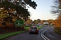 A22 approaching Halland Roundabout - geograph.org.uk - 2697878.jpg 640 × 428; 107 KB
-
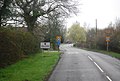
 A22 at Halland - geograph.org.uk - 2118002.jpg 640 × 480; 101 KB
-
 A22, Halland - geograph.org.uk - 4045590.jpg 640 × 469; 57 KB
-
 B2192 entering Halland - geograph.org.uk - 2365297.jpg 640 × 430; 70 KB
-
 B2192 leaving Halland for Lewes - geograph.org.uk - 1924502.jpg 1,600 × 1,200; 597 KB
-
 B2192, leaving Halland for Lewes - geograph.org.uk - 2365309.jpg 640 × 430; 68 KB
-
 Birchwood Ford garage, Halland - geograph.org.uk - 3162209.jpg 1,600 × 1,141; 328 KB
-
 Birchwood Ford, Halland - geograph.org.uk - 2830134.jpg 4,320 × 3,240; 4.05 MB
-
 Black Lion Inn - geograph.org.uk - 323149.jpg 640 × 479; 105 KB
-
 Chapel notice board at Halland - geograph.org.uk - 1924485.jpg 1,600 × 1,200; 661 KB
-
-
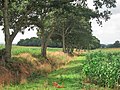
 Corn field near Halland Park Farm - geograph.org.uk - 2540673.jpg 640 × 194; 53 KB
-
 Corn fields near Halland Park Farm - geograph.org.uk - 2538718.jpg 640 × 480; 182 KB
-
 Corn fields near Halland Park Farm - geograph.org.uk - 2538727.jpg 640 × 480; 177 KB
-
 Cottage, Halland - geograph.org.uk - 4045592.jpg 640 × 392; 56 KB
-
 Cottage, Halland - geograph.org.uk - 4045593.jpg 640 × 430; 69 KB
-
 Cottages, Lewes Road, Halland - geograph.org.uk - 2952296.jpg 480 × 640; 83 KB
-
 Drive to Halland Park Farm - geograph.org.uk - 2879668.jpg 480 × 640; 87 KB
-
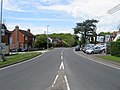 Eastbourne Road, Halland - geograph.org.uk - 2952300.jpg 640 × 480; 83 KB
-
 Farmland near Halland - geograph.org.uk - 2952394.jpg 640 × 480; 74 KB
-
 Footpath to Halland - geograph.org.uk - 2951393.jpg 640 × 480; 88 KB
-
 Footpath to Halland Park Farm - geograph.org.uk - 1175466.jpg 640 × 480; 106 KB
-
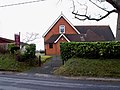 Halland Chapel, East Sussex - geograph.org.uk - 1736486.jpg 800 × 600; 131 KB
-
 Halland Forge - geograph.org.uk - 2365302.jpg 640 × 503; 86 KB
-
 Halland Forge Hotel - geograph.org.uk - 2952329.jpg 640 × 466; 91 KB
-
 Halland Forge sign - geograph.org.uk - 2418269.jpg 481 × 640; 106 KB
-
 Halland Forge, Hotel and Restaurant - geograph.org.uk - 1970327.jpg 1,600 × 1,200; 443 KB
-
 Halland Park farm - geograph.org.uk - 1175482.jpg 640 × 480; 85 KB
-
 Hartfield Farm House, Heathfield Road - geograph.org.uk - 323510.jpg 640 × 479; 132 KB
-
 Harvested maize crop near Halland Park Farm - geograph.org.uk - 2656853.jpg 4,000 × 3,000; 3.48 MB
-
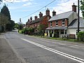 Lewes Road, Halland - geograph.org.uk - 2952283.jpg 640 × 480; 101 KB
-

-
 Old Hartfield, Lewes Road, Halland - geograph.org.uk - 2952270.jpg 480 × 640; 84 KB
-
 Old Health Close - geograph.org.uk - 323489.jpg 640 × 479; 105 KB
-
 Old Walls, Halland Park Farm - geograph.org.uk - 2952504.jpg 640 × 480; 115 KB
-
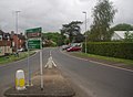
 Roundabout at Halland - geograph.org.uk - 1970302.jpg 1,600 × 1,200; 452 KB
-
 Roundabout on the A22, Halland - geograph.org.uk - 2831457.jpg 4,320 × 3,240; 3.96 MB
-
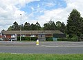
 Staverton Nursery, Halland - geograph.org.uk - 2526724.jpg 1,024 × 768; 169 KB
-
 Tabeel, Lewes Road, Halland - geograph.org.uk - 2951513.jpg 480 × 640; 134 KB
-
 The B2192 entering Halland - geograph.org.uk - 1924472.jpg 1,600 × 1,200; 533 KB
-
 The Black Lion Inn, Halland - geograph.org.uk - 2831456.jpg 4,320 × 3,240; 3.83 MB


