Category:Halton-with-Aughton
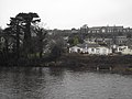
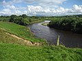
English: Halton-with-Aughton is a civil parish located east of Lancaster, England on the north bank of the River Lune. The main settlement is the village of Halton-on-Lune, commonly just called Halton, in the west, and the parish stretches to the hamlet of Aughton in the east. It lies in the City of Lancaster in Lancashire, and has a population of 2,360. (→Halton-with-Aughton)
Nederlands: Halton-with-Aughton is een civil parish in het bestuurlijke gebied Lancaster, in het Engelse graafschap Lancashire met 2.360 inwoners. (→Halton-with-Aughton)
civil parish in Lancashire, England, UK  | |||||
| Upload media | |||||
| Instance of | |||||
|---|---|---|---|---|---|
| Location | Lancaster, Lancashire, North West England, England | ||||
| Population |
| ||||
 | |||||
Subcategories
This category has the following 7 subcategories, out of 7 total.
Media in category "Halton-with-Aughton"
The following 200 files are in this category, out of 417 total.
(previous page) (next page)-
 A narrow bridge over the River Lune - geograph.org.uk - 3592347.jpg 4,592 × 3,056; 6.71 MB
-
 A weir on the River Lune with a seagull guarding each side - geograph.org.uk - 3592421.jpg 4,508 × 3,005; 7.18 MB
-
 A683 passes under Kellet Lane - geograph.org.uk - 5683461.jpg 640 × 481; 44 KB
-
 Above Monkley Gill Beck - geograph.org.uk - 2170191.jpg 2,560 × 1,920; 1.64 MB
-
 Approaching Aughton Barns - geograph.org.uk - 2060480.jpg 2,816 × 2,112; 2.13 MB
-
 Approaching Middle Highfield - geograph.org.uk - 2919155.jpg 2,592 × 1,944; 1.56 MB
-
 Approaching Waterworks Bridge - geograph.org.uk - 2060443.jpg 2,816 × 2,112; 1.94 MB
-
 Aqueduct over the River Lune - geograph.org.uk - 3391453.jpg 1,600 × 1,200; 437 KB
-
 Artle Beck - geograph.org.uk - 5049235.jpg 1,280 × 958; 990 KB
-
 Aughton Barns - geograph.org.uk - 4671006.jpg 1,024 × 767; 746 KB
-
 Aughton Barns cottages - geograph.org.uk - 1986817.jpg 640 × 426; 298 KB
-
 Aughton Barns cottages - geograph.org.uk - 3302066.jpg 2,048 × 1,536; 571 KB
-
 Aughton Church - geograph.org.uk - 2464044.jpg 1,600 × 1,200; 602 KB
-
 Aughton House.jpg 640 × 425; 299 KB
-
 Aughton Road - geograph.org.uk - 2464032.jpg 1,600 × 1,200; 670 KB
-
 Aughton Road - geograph.org.uk - 2464047.jpg 1,600 × 1,200; 626 KB
-
 Aughton Road heading east - geograph.org.uk - 2464036.jpg 1,600 × 1,200; 630 KB
-
 Aughton Road heading north - geograph.org.uk - 2464053.jpg 1,600 × 1,200; 470 KB
-
 Aughton road verge - geograph.org.uk - 4670997.jpg 1,024 × 768; 607 KB
-
 Aughton Village Hall - geograph.org.uk - 5693721.jpg 1,280 × 850; 405 KB
-
 Aughton Woods, River Lune - geograph.org.uk - 1711500.jpg 480 × 640; 122 KB
-
 Barn at Aughton - geograph.org.uk - 4671003.jpg 1,024 × 768; 820 KB
-
 Barn at Aughton Barns - geograph.org.uk - 2919164.jpg 2,592 × 1,944; 1.62 MB
-
 Barn on Park Lane - geograph.org.uk - 1986791.jpg 640 × 426; 296 KB
-
 Barn on Park Lane - geograph.org.uk - 2919147.jpg 2,592 × 1,944; 1.47 MB
-
 Below Burton Wood - geograph.org.uk - 2060463.jpg 2,816 × 2,112; 2.43 MB
-
 Benchmark on Low Road railway bridge - geograph.org.uk - 5119386.jpg 1,024 × 657; 256 KB
-
 Bend in River Lune - geograph.org.uk - 1231050.jpg 480 × 640; 200 KB
-
 Boundary stone near Beaumont Grange - geograph.org.uk - 2278728.jpg 480 × 640; 112 KB
-
 Bridge 108, Lancaster Canal - geograph.org.uk - 3408622.jpg 640 × 425; 220 KB
-
 Bridge 108, Lancaster Canal - geograph.org.uk - 3408623.jpg 640 × 425; 251 KB
-
 Bridge taking Low Road over former railway - geograph.org.uk - 5119395.jpg 1,024 × 683; 211 KB
-
 Brooklands - geograph.org.uk - 5413266.jpg 5,184 × 3,054; 1.74 MB
-
 Bullocks by the Lune - geograph.org.uk - 2480645.jpg 800 × 600; 112 KB
-
 Carus Bridge - geograph.org.uk - 5215671.jpg 640 × 435; 114 KB
-
 Carus Bridge completed - geograph.org.uk - 4561061.jpg 640 × 425; 179 KB
-
 Carus Bridge completed - geograph.org.uk - 4561064.jpg 640 × 425; 137 KB
-
 Carus Bridge construction (Kellet Lane) - geograph.org.uk - 4458310.jpg 640 × 425; 145 KB
-
 Caton Lune Bridge - geograph.org.uk - 6651322.jpg 1,313 × 876; 1.45 MB
-
 Cattle and barn, Aughton Barns - geograph.org.uk - 2774996.jpg 640 × 425; 355 KB
-
 Cattle grid at entrance to Halton Park - geograph.org.uk - 1986783.jpg 640 × 426; 350 KB
-
 Cattle grid at the entrance to Park Lane - geograph.org.uk - 2919139.jpg 2,592 × 1,944; 1.68 MB
-
 Cattle grid on Park Lane - geograph.org.uk - 2947648.jpg 640 × 480; 192 KB
-
 Cattle in the mud at Aughton Barns - geograph.org.uk - 3302074.jpg 2,048 × 1,536; 588 KB
-
 Cattle Shelter Near Aughton Barns - geograph.org.uk - 3702130.jpg 2,468 × 1,790; 2.8 MB
-
 Clay dam, Lancaster Canal - geograph.org.uk - 2278700.jpg 480 × 640; 153 KB
-
 Conifer stand above Park Lane - geograph.org.uk - 2726386.jpg 640 × 480; 78 KB
-
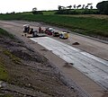
 Construction site by Kellet Lane - geograph.org.uk - 3898545.jpg 640 × 425; 200 KB
-
 Construction site by Kellet Lane - geograph.org.uk - 3898554.jpg 640 × 425; 170 KB
-
 Copse near Kellet Lane - geograph.org.uk - 3244998.jpg 640 × 425; 172 KB
-
 Cottage in Aughton - geograph.org.uk - 2919160.jpg 2,592 × 1,944; 1.27 MB
-
 Crook 'O Lune, Lancaster - panoramio.jpg 3,000 × 1,353; 2.48 MB
-
 Crook O Lune picnic spot - geograph.org.uk - 3391380.jpg 1,600 × 1,200; 488 KB
-
 Crook o' Lune - geograph.org.uk - 4065524.jpg 640 × 330; 95 KB
-
 Crossing The Lune Aqueduct - geograph.org.uk - 5737200.jpg 1,600 × 1,200; 455 KB
-
 Cul de Sac at Aughton - geograph.org.uk - 4671001.jpg 1,024 × 768; 891 KB
-
 Cutting for Heysham to M6 link road - geograph.org.uk - 4192574.jpg 640 × 463; 236 KB
-
 Cutting for Heysham to M6 link road - geograph.org.uk - 4192576.jpg 640 × 486; 211 KB
-
 Cycle track heading east - geograph.org.uk - 2463994.jpg 1,600 × 1,200; 388 KB
-
 Dead Oak - geograph.org.uk - 3570699.jpg 1,600 × 1,200; 547 KB
-
 Diggers on display - geograph.org.uk - 4458317.jpg 640 × 425; 190 KB
-
 Dismantled railway - geograph.org.uk - 2068845.jpg 640 × 480; 206 KB
-
 Dunald Mill Lane - geograph.org.uk - 1986802.jpg 640 × 426; 219 KB
-
 Earthworks for Heysham to M6 link road - geograph.org.uk - 4458299.jpg 640 × 425; 142 KB
-

-
 Entrance to Middle Highfield - geograph.org.uk - 1986812.jpg 640 × 426; 261 KB
-
 Excavations for M6 link road - geograph.org.uk - 4157093.jpg 640 × 425; 142 KB
-
 Far Highfield Farm - geograph.org.uk - 3391418.jpg 1,600 × 1,200; 475 KB
-
 Farm lane to Lower Highfield - geograph.org.uk - 1923579.jpg 800 × 531; 211 KB
-
 Farmland and Whinney Hill Wood - geograph.org.uk - 1923641.jpg 800 × 531; 159 KB
-
 Farmland at Monkley Gill - geograph.org.uk - 1923576.jpg 800 × 531; 156 KB
-
 Farmland near Ancliffe Hall - geograph.org.uk - 4157091.jpg 640 × 425; 97 KB
-
 Farmland near Aughton - geograph.org.uk - 1923648.jpg 800 × 531; 172 KB
-
 Farmland near Green Hill House - geograph.org.uk - 1923503.jpg 800 × 531; 216 KB
-
 Farmland near Halton - geograph.org.uk - 2455105.jpg 640 × 425; 276 KB
-
 Farmland near Halton Green - geograph.org.uk - 2582738.jpg 640 × 425; 269 KB
-
 Farmland near Haverbreaks Farm - geograph.org.uk - 3430799.jpg 640 × 425; 174 KB
-
 Farmland near Haverbreaks Farm - geograph.org.uk - 3430800.jpg 640 × 425; 183 KB
-
 Farmland near Haverbreaks Farm - geograph.org.uk - 4157089.jpg 640 × 459; 139 KB
-
 Farmland north of Park Lane - geograph.org.uk - 2464006.jpg 1,600 × 1,200; 525 KB
-
 Farmland off Aughton Road - geograph.org.uk - 4670994.jpg 1,024 × 768; 612 KB
-
 Farmland off Aughton Road - geograph.org.uk - 4671000.jpg 1,024 × 767; 640 KB
-
 Farmland off Kirkby Lonsdale Road - geograph.org.uk - 2464029.jpg 1,600 × 1,200; 476 KB
-
 Farmland west of Aughton Road - geograph.org.uk - 2464050.jpg 1,600 × 1,200; 449 KB
-
 Farmland, Beaumont Grange - geograph.org.uk - 1906080.jpg 640 × 480; 63 KB
-
 Farmyard at Lower Highfield - geograph.org.uk - 2919152.jpg 2,592 × 1,944; 1.62 MB
-
 Field entrance off Park Lane - geograph.org.uk - 2464016.jpg 1,600 × 1,200; 637 KB
-
 Fields, Halton - geograph.org.uk - 4717028.jpg 1,024 × 576; 254 KB
-
 Flooded field near Crook o' Lune - geograph.org.uk - 4775228.jpg 640 × 518; 268 KB
-
 Flooded footpath near Aughton Barns - geograph.org.uk - 1986814.jpg 640 × 426; 290 KB
-
 Footbridge near Far Highfield - geograph.org.uk - 2919159.jpg 2,592 × 1,944; 1.36 MB
-
 Footbridge near Far Highfield Farm - geograph.org.uk - 3391424.jpg 1,600 × 1,200; 536 KB
-
 Footbridge near Sidegarth - geograph.org.uk - 5698894.jpg 1,280 × 1,280; 1.1 MB
-
 Footbridge over Artle Beck - geograph.org.uk - 5049238.jpg 960 × 1,280; 984 KB
-
 Footbridge over Stamps Gill - geograph.org.uk - 1986815.jpg 640 × 426; 365 KB
-
 Footpath in Lawson's Wood - geograph.org.uk - 3302044.jpg 2,048 × 1,536; 511 KB
-
 Footpath in Lawsons Wood - geograph.org.uk - 1986810.jpg 640 × 426; 465 KB
-
 Footpath through woodland - geograph.org.uk - 5049728.jpg 960 × 1,280; 1.49 MB
-
 Footpath to Caton - geograph.org.uk - 1905969.jpg 480 × 640; 152 KB
-
 Forge Weir View, Halton - geograph.org.uk - 5923908.jpg 1,280 × 720; 425 KB
-
 Former police station, Halton - geograph.org.uk - 2057781.jpg 640 × 480; 145 KB
-

-
 Foundry Lane - geograph.org.uk - 2947641.jpg 640 × 480; 111 KB
-
 Foundry Lane Bridge - geograph.org.uk - 5056245.jpg 640 × 425; 142 KB
-
 Foundry Lane Bridge over the M6 - geograph.org.uk - 3943668.jpg 640 × 427; 253 KB
-
 Foundry Lane Bridge reconstruction - geograph.org.uk - 4581816.jpg 640 × 639; 250 KB
-
 Foundry Lane Bridge reconstruction - geograph.org.uk - 4581817.jpg 640 × 606; 165 KB
-
 Foundry Lane Bridge, M6 - geograph.org.uk - 2637141.jpg 640 × 387; 34 KB
-
 Foundry Lane Bridge, M6 - geograph.org.uk - 3235293.jpg 640 × 467; 43 KB
-
 Foundry Lane crosses the M6 - geograph.org.uk - 3070713.jpg 4,217 × 2,625; 4.95 MB
-
 French drains - geograph.org.uk - 4729973.jpg 640 × 425; 127 KB
-

-
 Gate on footpath towards Hawkshead - geograph.org.uk - 3391399.jpg 1,600 × 1,200; 341 KB
-
 Gateway, Aughton Road - geograph.org.uk - 2774991.jpg 640 × 425; 380 KB
-
 Gathering pens, Halton - geograph.org.uk - 4717026.jpg 1,024 × 576; 222 KB
-
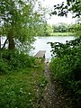
 Gone fishin... - geograph.org.uk - 5049246.jpg 1,280 × 960; 1.02 MB
-

-
 Grazing and pylon off Scargill Road - geograph.org.uk - 4678375.jpg 640 × 480; 32 KB
-
 Grazing land - geograph.org.uk - 5693713.jpg 1,280 × 850; 745 KB
-
 Grazing land - geograph.org.uk - 5693728.jpg 1,280 × 850; 696 KB
-
 Grazing land by River Lune near Aughton - geograph.org.uk - 2775003.jpg 640 × 425; 316 KB
-
 Grazing land near Sidegarth - geograph.org.uk - 5698896.jpg 1,280 × 850; 486 KB
-
 Grazing towards Scargill Wood - geograph.org.uk - 4678373.jpg 640 × 480; 58 KB
-

-
 Green Hill House - geograph.org.uk - 2464021.jpg 1,600 × 1,200; 328 KB
-
 Green Hill House - geograph.org.uk - 5417318.jpg 5,184 × 2,466; 1.58 MB
-
 Green Lane - geograph.org.uk - 2409409.jpg 640 × 425; 274 KB
-
 Green Lane - geograph.org.uk - 2633991.jpg 2,560 × 1,920; 759 KB
-
 Green Lane - geograph.org.uk - 3839432.jpg 640 × 425; 174 KB
-
 Green Lane Bridge - geograph.org.uk - 5370377.jpg 640 × 425; 145 KB
-
 Hairpin bend and steep hill, Park Lane - geograph.org.uk - 1986795.jpg 640 × 426; 436 KB
-
 Halton - geograph.org.uk - 4878573.jpg 5,184 × 2,516; 1.96 MB
-
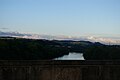
 Halton and the River Lune from Halton Bridge - geograph.org.uk - 3306036.jpg 1,600 × 1,200; 347 KB
-
 Halton bridge - geograph.org.uk - 4443222.jpg 640 × 419; 153 KB
-

-
 Halton Bridge crosses the River Lune - geograph.org.uk - 3306038.jpg 1,600 × 1,200; 311 KB
-
 Halton Bridge over the River Lune - geograph.org.uk - 2185145.jpg 638 × 416; 171 KB
-
 Halton burial ground - geograph.org.uk - 3245000.jpg 640 × 425; 232 KB
-
 Halton Camp - geograph.org.uk - 1905982.jpg 640 × 480; 111 KB
-
 Halton Camp - geograph.org.uk - 1905984.jpg 640 × 480; 137 KB
-
 Halton Lune Hydro - geograph.org.uk - 5693715.jpg 1,280 × 1,280; 934 KB
-
 Halton Lune Hydro - geograph.org.uk - 5693718.jpg 1,280 × 850; 565 KB
-
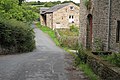
 Halton Mills - geograph.org.uk - 1175045.jpg 640 × 480; 128 KB
-
 Halton Mills - geograph.org.uk - 4009497.jpg 640 × 425; 154 KB
-
 Halton Mills - geograph.org.uk - 4878033.jpg 5,088 × 3,392; 1.7 MB
-
 Halton Park and Hawkshead Farm - geograph.org.uk - 3391388.jpg 1,600 × 1,200; 494 KB
-

-
 Halton Road - geograph.org.uk - 1906005.jpg 640 × 480; 131 KB
-
 Halton Road - geograph.org.uk - 4297680.jpg 640 × 425; 223 KB
-
 Halton Road - geograph.org.uk - 4878040.jpg 5,184 × 3,456; 2.03 MB
-
 Halton Road at Shefferlands Bridge - geograph.org.uk - 4157094.jpg 640 × 425; 188 KB
-
 Halton Road at Shefferlands Bridge - geograph.org.uk - 4157095.jpg 640 × 425; 132 KB
-
 Halton Road at Shefferlands Bridge - geograph.org.uk - 4206752.jpg 640 × 415; 113 KB
-
 Halton Road at Shefferlands Bridge - geograph.org.uk - 4206757.jpg 640 × 417; 125 KB
-
 Halton Road Bridge (Bridge 108) - geograph.org.uk - 4079907.jpg 2,560 × 1,920; 2.9 MB
-
 Halton Training Camp - geograph.org.uk - 1556032.jpg 640 × 426; 82 KB
-
 Halton Training Camp - geograph.org.uk - 4315191.jpg 640 × 436; 117 KB
-
 Halton United Reformed Church - geograph.org.uk - 2057775.jpg 640 × 480; 122 KB
-
 Halton United Reformed Church, Sign - geograph.org.uk - 2057776.jpg 640 × 480; 142 KB
-
 Halton Weir, River Lune - geograph.org.uk - 6449.jpg 640 × 480; 93 KB
-
 Halton-with-Aughton , M6 Motorway - geograph.org.uk - 6300546.jpg 6,000 × 4,000; 4.95 MB
-
 Halton-with-Aughton , M6 Motorway - geograph.org.uk - 6359833.jpg 6,000 × 4,000; 5.3 MB
-
 Halton-with-Aughton - Bradshaw Mausoleum, Halton Churchyard - 20211008103819.jpg 5,824 × 3,883; 11.54 MB
-
 Halton-with-Aughton - Bradshaw Mausoleum, Halton Churchyard - 20211008103852.jpg 6,240 × 6,071; 16.99 MB
-
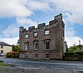
 Halton-with-Aughton - Tower House And Former Stables And Barn Adjoining - 20211008104927.jpg 6,018 × 4,012; 19.46 MB
-
 Halton-with-Aughton - Tower House And Former Stables And Barn Adjoining - 20211008105111.jpg 6,240 × 5,458; 15.39 MB
-
 Halton-with-Aughton - Tower House And Former Stables And Barn Adjoining - 20211008105313.jpg 6,240 × 4,160; 15.19 MB
-

-
 Haverbreaks Farm - geograph.org.uk - 1906069.jpg 640 × 480; 57 KB
-
 Heysham to M6 link road construction - geograph.org.uk - 4591453.jpg 640 × 437; 134 KB
-
 Heysham to M6 link road construction - geograph.org.uk - 4632922.jpg 640 × 576; 206 KB
-
 Heysham to M6 link road construction - geograph.org.uk - 4632925.jpg 640 × 425; 139 KB
-
 Heysham to M6 link road construction - geograph.org.uk - 4969511.jpg 640 × 425; 117 KB
-
 High Road and Low Road junction in Halton - geograph.org.uk - 5095609.jpg 3,420 × 2,526; 5.16 MB
-
 High Road, Halton - geograph.org.uk - 2057777.jpg 640 × 480; 103 KB
-
 House at Haverbreaks Farm - geograph.org.uk - 2348529.jpg 640 × 480; 103 KB
-
 In Lawson's Wood - geograph.org.uk - 2060454.jpg 2,816 × 2,112; 3.2 MB
-
 Incoming bullock^^^ - geograph.org.uk - 2480648.jpg 960 × 579; 126 KB
-
 Islands in the Lune - geograph.org.uk - 2061771.jpg 2,816 × 2,112; 1.85 MB
-
 Jetty south west of Halton Camp - geograph.org.uk - 1905991.jpg 480 × 640; 130 KB
-
 Junction of Laverick Lane and the Kirkby Lonsdale Road - geograph.org.uk - 1946853.jpg 1,600 × 1,200; 498 KB
-
 Kellet Lane - geograph.org.uk - 1373714.jpg 640 × 480; 189 KB
-
 Kellet Lane - geograph.org.uk - 2947634.jpg 640 × 480; 116 KB
-
 Kellet Lane - geograph.org.uk - 4467861.jpg 640 × 425; 167 KB
-
 Kerb and gutter machine - geograph.org.uk - 4730454.jpg 640 × 640; 193 KB
-
 Kirkby Lonsdale Road - geograph.org.uk - 2394317.jpg 640 × 480; 80 KB
-
 Kirkby Lonsdale Road - geograph.org.uk - 2464024.jpg 1,600 × 1,200; 465 KB
-
 Kirkby Lonsdale Road - geograph.org.uk - 5413268.jpg 5,041 × 3,000; 1.64 MB
-
 Lancashire Witches Walk - Tercet 8 (geograph 4060980).jpg 640 × 498; 215 KB
-
 Lancaster Canal - geograph.org.uk - 1906001.jpg 640 × 480; 136 KB
-
 Lancaster Canal - geograph.org.uk - 3244995.jpg 640 × 448; 218 KB
-
 Lancaster Canal repairs - geograph.org.uk - 4561076.jpg 640 × 425; 159 KB
-
 Lancaster Canal repairs - geograph.org.uk - 4561080.jpg 640 × 425; 181 KB
-
 Lancaster canal west of Lune aqueduct - geograph.org.uk - 5342146.jpg 5,202 × 3,465; 4.31 MB
-
 Lane End near Halton - geograph.org.uk - 2394307.jpg 640 × 480; 86 KB
-
 Lane through Aughton village - geograph.org.uk - 1986819.jpg 640 × 426; 367 KB
-
 Laverick Hall - geograph.org.uk - 2394324.jpg 640 × 480; 105 KB
-
 Laverick Hall Farm - geograph.org.uk - 2582739.jpg 640 × 425; 319 KB
-
 Little river meets big river - geograph.org.uk - 5049221.jpg 1,280 × 919; 1,012 KB
-


_-_geograph.org.uk_-_4458310.jpg)


_-_geograph.org.uk_-_4079907.jpg)


.jpg)


