Category:Hamanabuto fishing port
| Object location | | View all coordinates using: OpenStreetMap |
|---|
 | |||||
| Upload media | |||||
| Instance of | |||||
|---|---|---|---|---|---|
| Location |
| ||||
 | |||||
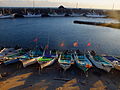
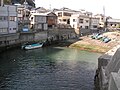
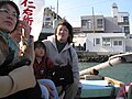
English: Hamanabuto fishing port, also refered to as Futomi fishing port, is a fishing port in Kamogawa, Chiba, Japan.
Media in category "Hamanabuto fishing port"
The following 29 files are in this category, out of 29 total.
-
 Futomihama,Kamogawa,Chiba 千葉県鴨川市太海浜 DSCF7734.JPG 2,304 × 1,728; 919 KB
-
 Futomihama,Kamogawa,Chiba 千葉県鴨川市太海浜 DSCF7736.JPG 2,304 × 1,728; 945 KB
-
 Futomihama,Kamogawa,Chiba 千葉県鴨川市太海浜 DSCF7739.JPG 2,304 × 1,728; 948 KB
-
 Futomihama,Kamogawa,Chiba 千葉県鴨川市太海浜 DSCF7744.JPG 2,304 × 1,728; 908 KB
-
 Futomihama,Kamogawa,Chiba 千葉県鴨川市太海浜 DSCF7745.JPG 2,304 × 1,728; 893 KB
-
 Futomihama,Kamogawa,Chiba 千葉県鴨川市太海浜 DSCF7748.JPG 2,304 × 1,728; 906 KB
-
 Futomihama,Kamogawa,Chiba 千葉県鴨川市太海浜 DSCF7750.JPG 2,304 × 1,728; 939 KB
-
 Futomihama,Kamogawa,Chiba 千葉県鴨川市太海浜 DSCF7752.JPG 2,304 × 1,728; 970 KB
-
 Futomihama,Kamogawa,Chiba 千葉県鴨川市太海浜 DSCF7762.JPG 2,304 × 1,728; 911 KB
-
 Futomihama,Kamogawa,Chiba 千葉県鴨川市太海浜 DSCF7781.JPG 1,728 × 2,304; 942 KB
-
 Futomihama,Kamogawa,Chiba 千葉県鴨川市太海浜 DSCF7784.JPG 2,304 × 1,728; 911 KB
-
 Futomihama,Kamogawa,Chiba 千葉県鴨川市太海浜 DSCF7801.JPG 2,304 × 1,728; 934 KB
-
 Futomihama,Kamogawa,Chiba 千葉県鴨川市太海浜 DSCF7803.JPG 2,304 × 1,728; 931 KB
-
 Futomihama,Kamogawa,Chiba 千葉県鴨川市太海浜 DSCF7804.JPG 2,304 × 1,728; 910 KB
-
 Futomihama,Kamogawa,Chiba 千葉県鴨川市太海浜 DSCF7817.JPG 2,304 × 1,728; 924 KB
-
 Futomihama,Kamogawa,Chiba 千葉県鴨川市太海浜 DSCF7828.JPG 1,728 × 2,304; 936 KB
-
 Futomihama,Kamogawa,Chiba 千葉県鴨川市太海浜 DSCF7871.JPG 2,304 × 1,728; 925 KB
-
 Futomihama,Kamogawa,Chiba 千葉県鴨川市太海浜 DSCF7872.JPG 2,304 × 1,728; 924 KB
-
 Futomihama,Kamogawa,Chiba 千葉県鴨川市太海浜 DSCF7873.JPG 2,304 × 1,728; 953 KB
-
 Futomihama,Kamogawa,Chiba 千葉県鴨川市太海浜 DSCF7903.JPG 2,304 × 1,728; 925 KB
-
 Hutomi-Fishing port Kamogawa, Chiba 千葉県鴨川市太海浜 007.jpg 2,288 × 1,712; 716 KB
-
 Hutomi-Fishing port Kamogawa, Chiba 千葉県鴨川市太海浜 008.jpg 2,288 × 1,712; 781 KB
-
 Hutomi-Fishing port Kamogawa, Chiba 千葉県鴨川市太海浜 010.jpg 2,288 × 1,712; 763 KB
-
 Hutomi-Fishing port Kamogawa, Chiba 千葉県鴨川市太海浜 011.jpg 1,712 × 2,288; 827 KB
-
 Hutomi-Fishing port Kamogawa, Chiba 千葉県鴨川市太海浜 012.jpg 1,712 × 2,288; 774 KB
-
 Hutomi-Fishing port Kamogawa, Chiba 千葉県鴨川市太海浜 022.jpg 2,288 × 1,712; 796 KB
-
 Hutomi-Fishing port Kamogawa, Chiba 千葉県鴨川市太海浜 023.jpg 2,288 × 1,712; 748 KB
-
 Hutomi-Fishing port-Niemonjima Kamogawa, Chiba 千葉県鴨川市太海浜-仁右衛門島 024.jpg 1,712 × 2,288; 719 KB
-
 Niemonjima seen from Futomi Port -July 2009 a.jpg 4,224 × 3,168; 2.94 MB


