Category:Hamburgerstraat 25, Utrecht
| Object location | | View all coordinates using: OpenStreetMap |
|---|
 | |||||
| Upload media | |||||
| Instance of |
| ||||
|---|---|---|---|---|---|
| Location | Utrecht, Netherlands | ||||
| Street address |
| ||||
| Heritage designation |
| ||||
 | |||||
|
This is a category about rijksmonument number 36120
|
| Address |
|
Media in category "Hamburgerstraat 25, Utrecht"
The following 6 files are in this category, out of 6 total.
-
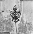
 Exterieur MUURANKER - Utrecht - 20306275 - RCE.jpg 1,195 × 1,200; 494 KB
-
 Exterieur MUURANKER - Utrecht - 20306276 - RCE.jpg 1,190 × 1,200; 495 KB
-
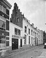 Exterieur OVERZICHT VOORGEVELS - Utrecht - 20306274 - RCE.jpg 958 × 1,200; 220 KB
-
 Exterieur VOORGEVELS - Utrecht - 20306273 - RCE.jpg 960 × 1,200; 206 KB
-
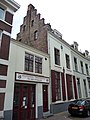 Hamburgerstraat 25.JPG 2,592 × 3,456; 3.41 MB
-
 Voorgevel - Utrecht - 20235687 - RCE.jpg 802 × 1,200; 165 KB


