Category:Hampton Gay and Poyle
English: Hampton Gay and Poyle is a civil parish in Oxfordshire, England. It was formed in 1932 by merger of the parishes of Hampton Gay .
civil parish in Oxfordshire, England | |||||
| Upload media | |||||
| Instance of | |||||
|---|---|---|---|---|---|
| Location | Cherwell, Oxfordshire, South East England, England | ||||
| Population |
| ||||
| Area |
| ||||
 | |||||
Subcategories
This category has the following 2 subcategories, out of 2 total.
H
Media in category "Hampton Gay and Poyle"
The following 118 files are in this category, out of 118 total.
-
 'Corner Cottage', ^4 Bletchingdon Road - geograph.org.uk - 5663427.jpg 1,024 × 683; 183 KB
-
 A gate into St Giles' Church - geograph.org.uk - 6181475.jpg 2,700 × 2,025; 837 KB
-
 A gate into St Giles' Church - geograph.org.uk - 6181478.jpg 2,700 × 2,025; 730 KB
-
 A split willow tree near Hampton Poyle - geograph.org.uk - 2793894.jpg 1,500 × 1,000; 214 KB
-
 A State of Collapse - geograph.org.uk - 4324518.jpg 4,000 × 3,000; 4.59 MB
-
 A34 northbound - geograph.org.uk - 5637928.jpg 640 × 428; 74 KB
-
 A34 south of Field Barn Farm - geograph.org.uk - 3395191.jpg 3,081 × 2,513; 1.09 MB
-

-
 A34, northbound - geograph.org.uk - 5648462.jpg 640 × 393; 44 KB
-
 Access control gate near Hampton Poyle - geograph.org.uk - 1876013.jpg 3,648 × 2,736; 2.23 MB
-
 Allotments, Bletchingdon - geograph.org.uk - 1876098.jpg 3,648 × 2,736; 2.13 MB
-
 Barn opposite Walnut Tree Cottage - geograph.org.uk - 4198182.jpg 1,500 × 999; 213 KB
-
 Batting Into The Wind - geograph.org.uk - 4318224.jpg 1,885 × 2,379; 437 KB
-

-

-

-
 Benchmark on River Cherwell bridge - geograph.org.uk - 4913451.jpg 683 × 1,024; 170 KB
-
 Benchmark on roadside wall of ^30 Church Lane - geograph.org.uk - 5651492.jpg 1,024 × 659; 329 KB
-
 Benchmark on St Giles's Church - geograph.org.uk - 4913505.jpg 683 × 1,024; 274 KB
-
 Benchmark on St Mary the Virgin Church - geograph.org.uk - 5651490.jpg 663 × 1,024; 276 KB
-
 Benchmark on wall fronting the Manor House - geograph.org.uk - 5668693.jpg 1,024 × 683; 306 KB
-

-
 Benchmark on ^55 Oxford Road - geograph.org.uk - 5660910.jpg 1,024 × 667; 224 KB
-

-
-
 Bridge for drain under old A34 - geograph.org.uk - 5657465.jpg 1,024 × 683; 326 KB
-

-
 Bridge over the Cherwell - geograph.org.uk - 4320630.jpg 3,852 × 2,904; 3.05 MB
-

-
 Bridleway going east from Oxford Road - geograph.org.uk - 5651355.jpg 1,024 × 683; 249 KB
-
 Bridleway to Diamond Farm - geograph.org.uk - 6075647.jpg 640 × 480; 129 KB
-
 Buttercups in Hampton Gay - geograph.org.uk - 6171940.jpg 2,700 × 2,025; 563 KB
-
 Cattle by the River Cherwell - geograph.org.uk - 6181532.jpg 2,700 × 2,025; 1.21 MB
-
 Cherwell , The A34 - geograph.org.uk - 6113507.jpg 6,000 × 4,000; 7.51 MB
-
 Cherwell , The A34 - geograph.org.uk - 6113508.jpg 6,000 × 4,000; 6.54 MB
-
 Cross Country train passes St Giles' Church - geograph.org.uk - 5651486.jpg 1,024 × 683; 123 KB
-

-
 Don or Ton^ - geograph.org.uk - 4319172.jpg 3,748 × 2,792; 2.66 MB
-
 Entering Hampton Poyle - geograph.org.uk - 4318222.jpg 3,784 × 2,748; 2.45 MB
-
 Entrance gates of ^30 Church Lane - geograph.org.uk - 5651493.jpg 1,024 × 676; 197 KB
-

-
 Field beside road to Hampton Poyle - geograph.org.uk - 5651487.jpg 1,024 × 683; 269 KB
-
 Field, view towards Bletchingdon - geograph.org.uk - 357822.jpg 640 × 480; 88 KB
-
 Footbridge over the River Cherwell - geograph.org.uk - 6168520.jpg 2,700 × 2,025; 975 KB
-
 Footbridge over the River Cherwell - geograph.org.uk - 6168521.jpg 2,700 × 2,025; 975 KB
-
 Footbridge over the River Cherwell - geograph.org.uk - 6168524.jpg 2,700 × 2,025; 775 KB
-
 Footbridge over the River Cherwell - geograph.org.uk - 6168525.jpg 2,700 × 2,025; 996 KB
-
 Footpath across the field - geograph.org.uk - 2793891.jpg 1,500 × 1,000; 162 KB
-
 Footpath to Hampton Gay - geograph.org.uk - 6171937.jpg 2,700 × 2,025; 628 KB
-
 Footpath to Kidlington - geograph.org.uk - 2793888.jpg 1,500 × 1,000; 246 KB
-
 Footpath to Shipton-on-Cherwell - geograph.org.uk - 6168519.jpg 2,700 × 2,025; 739 KB
-

-
 Hampton Gay Church - geograph.org.uk - 6572690.jpg 800 × 538; 186 KB
-
 Hampton Gay Manor House - geograph.org.uk - 4259893.jpg 1,600 × 1,076; 465 KB
-
 Hedgerow Trees - geograph.org.uk - 4319159.jpg 3,876 × 2,828; 2.98 MB
-
 Indistinct Path through the crops - geograph.org.uk - 6075691.jpg 640 × 480; 102 KB
-

-
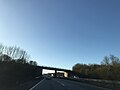
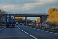
 Kidlington Road bridge over A34 - geograph.org.uk - 5528803.jpg 1,600 × 1,200; 619 KB
-
 Kissing gate on the footpath - geograph.org.uk - 6171928.jpg 2,700 × 2,025; 581 KB
-
 Knapp's Acre - geograph.org.uk - 357873.jpg 640 × 480; 177 KB
-
 Layby at Hampton Gorse - geograph.org.uk - 3296817.jpg 640 × 480; 400 KB
-
 Looking across a field towards Islip - geograph.org.uk - 1743755.jpg 1,500 × 981; 90 KB
-
 Narrowboats on the Oxford Canal - geograph.org.uk - 6168510.jpg 2,700 × 2,025; 882 KB
-
 North of Hampton Poyle Church - geograph.org.uk - 4318443.jpg 4,000 × 3,000; 2.65 MB
-
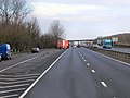
 Northbound A34 - geograph.org.uk - 3296783.jpg 640 × 480; 403 KB
-
 Northbound A34 near Kidlington - geograph.org.uk - 3296772.jpg 640 × 480; 356 KB
-
 Northbound A34, Hampton Gorse - geograph.org.uk - 3296814.jpg 640 × 480; 393 KB
-
 Oxford Canal heading north - geograph.org.uk - 6168507.jpg 2,700 × 2,025; 708 KB
-
 Oxford Canal, near Shipton-on-Cherwell - geograph.org.uk - 6541094.jpg 1,280 × 851; 909 KB
-
 Oxford Greenbelt Way at Hampton Poyle - geograph.org.uk - 4318234.jpg 3,784 × 2,648; 2.14 MB
-
 Oxford Road - geograph.org.uk - 5192398.jpg 640 × 480; 213 KB
-
 Oxford Road - geograph.org.uk - 5192424.jpg 640 × 480; 222 KB
-
 Path from the church at Hampton Gay - geograph.org.uk - 6181523.jpg 2,700 × 2,025; 597 KB
-
 Path to Hampton Poyle - geograph.org.uk - 6075638.jpg 640 × 480; 89 KB
-
 Ploughed field by Madam Hinde's Spinney - geograph.org.uk - 4198179.jpg 1,500 × 999; 209 KB
-
 Ploughed field near Bletchingdon - geograph.org.uk - 4198183.jpg 1,500 × 999; 231 KB
-
 Ploughed field near Hampton Gay - geograph.org.uk - 4198181.jpg 1,500 × 999; 200 KB
-
 River Cherwell - geograph.org.uk - 1875982.jpg 3,648 × 2,736; 2.3 MB
-
 River Cherwell near Gosford Bridge - geograph.org.uk - 4320670.jpg 4,000 × 2,924; 3.16 MB
-
 Road Junction - geograph.org.uk - 966415.jpg 640 × 480; 116 KB
-
 Road to Hampton Gay - geograph.org.uk - 4324841.jpg 1,600 × 1,209; 583 KB
-
 Road to Hampton Gay - panoramio.jpg 3,456 × 4,608; 4.44 MB
-
 Ruined manor house, Hampton Gay - geograph.org.uk - 4913635.jpg 1,024 × 683; 238 KB
-
 Rural road from Hampton Gay - geograph.org.uk - 4198178.jpg 1,500 × 999; 310 KB
-
 Rural road to Hampton Gay - geograph.org.uk - 4198184.jpg 1,500 × 999; 244 KB
-
 Sheep in a field - geograph.org.uk - 2793878.jpg 1,500 × 1,002; 245 KB
-
 Sheep in the Manor House - geograph.org.uk - 4318080.jpg 3,264 × 2,076; 1.99 MB
-
 Solar Power ^ Cycleway - geograph.org.uk - 4320659.jpg 4,000 × 3,000; 3.04 MB
-
 St Giles Church, Hampton Gay - geograph.org.uk - 4318130.jpg 4,000 × 3,000; 3.63 MB
-
 St Giles' Church in Hampton Gay - geograph.org.uk - 6181481.jpg 2,700 × 2,025; 878 KB
-
 St Giles' Church in Hampton Gay - geograph.org.uk - 6181485.jpg 2,700 × 2,025; 767 KB
-
 St Giles' Church in Hampton Gay - geograph.org.uk - 6181486.jpg 2,700 × 2,025; 837 KB
-
 St Giles's Church, Hampton Gay - geograph.org.uk - 4913519.jpg 1,024 × 683; 193 KB
-
 St Mary the Virgin - geograph.org.uk - 5651491.jpg 1,024 × 665; 149 KB
-
 Stile on the footpath - geograph.org.uk - 2793889.jpg 1,500 × 1,000; 348 KB
-
 Stile on the footpath - geograph.org.uk - 2793895.jpg 1,500 × 1,000; 164 KB
-
 The A34 at Gosford - geograph.org.uk - 1743752.jpg 1,500 × 971; 135 KB
-
 The Bell, Hampton Poyle - geograph.org.uk - 5192416.jpg 640 × 480; 183 KB
-
 The Manor House, Hampton Gay - geograph.org.uk - 5668700.jpg 1,024 × 685; 190 KB
-
 The porch of St Giles' Church in Hampton Gay - geograph.org.uk - 6181490.jpg 2,025 × 2,700; 798 KB
-
 The River Cherwell - geograph.org.uk - 6168509.jpg 2,700 × 2,025; 1.03 MB
-
 The River Cherwell - geograph.org.uk - 6168522.jpg 2,700 × 2,025; 1,022 KB
-
 The River Cherwell - geograph.org.uk - 6168523.jpg 2,700 × 2,025; 956 KB
-
 The River Cherwell - geograph.org.uk - 6181526.jpg 2,700 × 2,025; 921 KB
-
 The River Cherwell - geograph.org.uk - 6181528.jpg 2,700 × 2,025; 980 KB
-
 The River Cherwell - geograph.org.uk - 6181530.jpg 2,700 × 2,025; 860 KB
-
 The River Cherwell - geograph.org.uk - 6181531.jpg 2,700 × 2,025; 1.01 MB
-
 The River Cherwell - geograph.org.uk - 6181534.jpg 2,700 × 2,025; 941 KB
-
 The River Cherwell by Shipton-on-Cherwell Bridge - geograph.org.uk - 6181525.jpg 2,700 × 2,025; 975 KB
-

-

-
 The ruins of Hampton Gay Manor - geograph.org.uk - 6171939.jpg 2,700 × 2,025; 959 KB
-
 The slip road from the A34 - geograph.org.uk - 3981574.jpg 1,500 × 999; 142 KB
-
 Walkway under the railway bridge - geograph.org.uk - 6171929.jpg 2,700 × 2,025; 533 KB
-
 Walkway under the railway bridge - geograph.org.uk - 6171935.jpg 2,700 × 2,025; 653 KB
-
 Where Hampton Gay Once Was - geograph.org.uk - 4318169.jpg 3,784 × 2,752; 2.95 MB
-
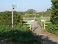
 White Bridge over the River Cherwell - geograph.org.uk - 2793896.jpg 1,500 × 1,000; 156 KB
-
 ^55 Oxford Road - geograph.org.uk - 5660924.jpg 1,024 × 683; 163 KB


