Category:Harefield, Southampton
English: Harefield is a suburb of Southampton, in the unparished area of Southampton, in the Southampton district, in the county of Hampshire, England.
suburb of Southampton, Hampshire, England  | |||||
| Upload media | |||||
| Instance of | |||||
|---|---|---|---|---|---|
| Location | City of Southampton, Hampshire, South East England, England | ||||
| Area |
| ||||
| Different from | |||||
 | |||||
Media in category "Harefield, Southampton"
The following 15 files are in this category, out of 15 total.
-
 Bitterne Sports Ground - geograph.org.uk - 4733816.jpg 640 × 480; 59 KB
-
 Chalk Hill - geograph.org.uk - 4733793.jpg 640 × 480; 98 KB
-
 Cheriton Avenue - geograph.org.uk - 3018927.jpg 640 × 480; 84 KB
-
 Delivery in St Elizabeth Avenue - geograph.org.uk - 4160692.jpg 640 × 480; 57 KB
-
 Exford Arms - geograph.org.uk - 3018931.jpg 640 × 480; 93 KB
-
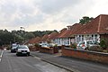
 Harefield Hampshire.jpg 640 × 480; 104 KB
-
 Keynsham Road, Thornhill - geograph.org.uk - 2470766.jpg 640 × 480; 61 KB
-

-
 Looking northwards on Commercial Street - geograph.org.uk - 4046020.jpg 800 × 600; 111 KB
-

-
 Pine Drive, Southampton - geograph.org.uk - 1953991.jpg 640 × 480; 102 KB
-
 Sunningdale Gardens, Bitterne - geograph.org.uk - 2132920.jpg 640 × 480; 137 KB
-
 Sunningdale Gardens, Southampton - geograph.org.uk - 1859858.jpg 640 × 480; 84 KB
-
 Taunton Drive - geograph.org.uk - 3018936.jpg 640 × 427; 61 KB
-
 Taunton Drive in Southampton looking south-east - geograph.org.uk - 3169171.jpg 4,752 × 3,168; 2.41 MB


