Category:Hasland
English: Hasland is a suburb in the south-east of Chesterfield, Derbyshire, England. Although many local residents refer to it as a village, it expanded greatly during the 20th century and now merges with Chesterfield itself.
village in Derbyshire, United Kingdom .jpg) | |||||
| Upload media | |||||
| Instance of | |||||
|---|---|---|---|---|---|
| Location | Chesterfield, Derbyshire, East Midlands, England | ||||
 | |||||
Subcategories
This category has the following 3 subcategories, out of 3 total.
H
- Hasland Junior School (5 F)
- Hasland War Memorial (2 F)
P
Media in category "Hasland"
The following 41 files are in this category, out of 41 total.
-
 92025 Hasland MPD '63 (36431809386).jpg 2,592 × 1,728; 3.15 MB
-
 Calow Lane - geograph.org.uk - 591473.jpg 640 × 480; 90 KB
-
 Class 4 Hasland.jpg 830 × 547; 119 KB
-
 Eastwood Park Reopening Stone, 2013.jpg 2,592 × 1,944; 2.2 MB
-
 Hasland - Baptist Church - geograph.org.uk - 3800204.jpg 1,600 × 1,040; 476 KB
-
 Hasland - carpet shop on Hampton Street - geograph.org.uk - 3800253.jpg 1,600 × 1,175; 539 KB
-
 Hasland - Co-op shop - geograph.org.uk - 3800236.jpg 1,600 × 1,239; 541 KB
-
 Hasland - former Methodist church - geograph.org.uk - 3779141.jpg 1,600 × 1,168; 427 KB
-
 Hasland - Infant School - geograph.org.uk - 3800199.jpg 1,600 × 928; 449 KB
-
 Hasland - Mansfield Road No 273 - geograph.org.uk - 2170672.jpg 1,600 × 1,186; 431 KB
-
 Hasland - New Inn - geograph.org.uk - 1204189.jpg 640 × 480; 72 KB
-
 Hasland - Penmore.jpg 640 × 480; 63 KB
-
 Hasland - shops on The Green - geograph.org.uk - 3800207.jpg 1,600 × 1,163; 494 KB
-
 Hasland - Shoulder of Mutton Inn - geograph.org.uk - 1204194.jpg 640 × 480; 85 KB
-
 Hasland - Toll Bar shop - geograph.org.uk - 3800240.jpg 1,600 × 1,093; 441 KB
-
 Hasland - Village Hall - geograph.org.uk - 1204186.jpg 640 × 480; 81 KB
-
 Hasland Bypass (A617) - geograph.org.uk - 591527.jpg 640 × 480; 96 KB
-
 Hasland Playhouse.jpg 3,264 × 2,448; 1.76 MB
-
 Hasland Road and Penmore Close - geograph.org.uk - 346786.jpg 640 × 480; 98 KB
-
 Hasland Road Chesterfield.jpg 3,264 × 2,448; 2.6 MB
-
 Hasland War Memorial.jpg 2,504 × 1,878; 1.45 MB
-
 Hasland.jpg 3,264 × 2,448; 2.5 MB
-
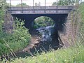 Railway Crosses River Rother - geograph.org.uk - 298660.jpg 640 × 480; 56 KB
-
 River Rother - geograph.org.uk - 306578.jpg 480 × 640; 93 KB
-
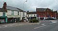 Shops in Hasland (geograph 2423452).jpg 950 × 517; 228 KB
-
 Storforth Lane Building Site.jpg 3,264 × 2,448; 1.73 MB
-
 Storforth Lane, Hasland - geograph.org.uk - 2334607.jpg 1,600 × 1,200; 374 KB
-
 The Devonshire Arms in Hasland - geograph.org.uk - 2566699.jpg 3,503 × 2,448; 1.64 MB
-
 Ultimate signs Chesterfield.jpg 2,448 × 3,264; 2.23 MB
-
 UPVC Stained Glass - geograph.org.uk - 194062.jpg 640 × 480; 89 KB
-
 Hasland Cemetery and Fields of Gold - geograph.org.uk - 306621.jpg 640 × 480; 51 KB
-
 Hasland Cemetery Entrance - geograph.org.uk - 306611.jpg 640 × 480; 56 KB
-
 Hasland Cemetery South Side Footpath - geograph.org.uk - 306616.jpg 480 × 640; 92 KB
-
 Hasland Churchside Cemetery - geograph.org.uk - 306599.jpg 640 × 480; 57 KB
-
 Hasland Churchside Cemetery - geograph.org.uk - 306602.jpg 640 × 480; 57 KB
-

-

-
 Hasland Road - geograph.org.uk - 346783.jpg 640 × 480; 75 KB
-

-
 Midland Cottages Hasland - geograph.org.uk - 298666.jpg 640 × 480; 58 KB
-
 Path next to Railway Line - geograph.org.uk - 306582.jpg 640 × 480; 57 KB
.jpg)


_-_geograph.org.uk_-_591527.jpg)


