Category:Hatley, Cambridgeshire
English: Hatley is a civil parish in South Cambridgeshire, England. It lies between the villages of Gamlingay and Croydon, 12 miles south-west of the city of Cambridge and eight miles south-east of the town of St Neots. In 2001, the population of Hatley parish was 205 people living in 77 households.
civil parish in South Cambridgeshire, Cambridgeshire, England  | |||||
| Upload media | |||||
| Instance of | |||||
|---|---|---|---|---|---|
| Location | South Cambridgeshire, Cambridgeshire, East of England, England | ||||
 | |||||
Subcategories
This category has the following 3 subcategories, out of 3 total.
Media in category "Hatley, Cambridgeshire"
The following 107 files are in this category, out of 107 total.
-
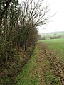
 A footpath near Hatley St George - geograph.org.uk - 5282936.jpg 1,024 × 768; 975 KB
-
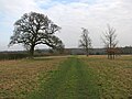
 Across Hatley Park in February - geograph.org.uk - 5282921.jpg 1,024 × 768; 1.1 MB
-
 Approaching Hatley Wilds trig point - geograph.org.uk - 6029179.jpg 1,024 × 768; 240 KB
-
 Around Buff Wood - geograph.org.uk - 4764093.jpg 480 × 640; 67 KB
-
 Beware of children^ - geograph.org.uk - 6266726.jpg 1,071 × 1,600; 858 KB
-
 Bridge beside Hayley Wood - geograph.org.uk - 1839847.jpg 640 × 427; 200 KB
-
 Bridle way in Hatley Park - geograph.org.uk - 5282653.jpg 1,024 × 768; 1.04 MB
-
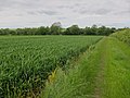 Bridleway past wheat field - geograph.org.uk - 3088157.jpg 1,600 × 1,200; 792 KB
-
 Bridleway to Ermine Street - geograph.org.uk - 4295166.jpg 4,320 × 3,240; 6.29 MB
-
 Bridleway towards Hatley - geograph.org.uk - 6029168.jpg 768 × 1,024; 228 KB
-
 Buff Lane - geograph.org.uk - 4764103.jpg 480 × 640; 97 KB
-
 Buff Lane - geograph.org.uk - 4764106.jpg 640 × 480; 62 KB
-
 Buff Wood, a bridle path and a barn - geograph.org.uk - 5283828.jpg 1,024 × 768; 1.08 MB
-
 Buildings at Holbein's farm - geograph.org.uk - 4295174.jpg 4,320 × 3,240; 3.47 MB
-
 Chancel of St Denis' Church - geograph.org.uk - 6267633.jpg 1,071 × 1,600; 772 KB
-
 Church of St Denis from SE - geograph.org.uk - 6266574.jpg 1,600 × 1,067; 753 KB
-
 Church of St Denis from SW - geograph.org.uk - 6266607.jpg 1,600 × 1,071; 820 KB
-
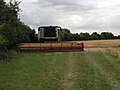 Combine Harvester parked in field - geograph.org.uk - 4602339.jpg 640 × 480; 66 KB
-
 Crossing tracks near Hatley St George - geograph.org.uk - 5282930.jpg 1,024 × 768; 1.16 MB
-
 Datestone at St Denis' Church - geograph.org.uk - 6266990.jpg 1,600 × 1,066; 866 KB
-
 East Hatley Phone Box - geograph.org.uk - 4764109.jpg 480 × 640; 115 KB
-
 East Hatley, Barn Farm - geograph.org.uk - 5283858.jpg 1,024 × 768; 1.01 MB
-
 East Hatley, deconsecrated church - geograph.org.uk - 5559307.jpg 1,024 × 768; 1.14 MB
-
 East Hatley, pink walls and green wattles - geograph.org.uk - 5283870.jpg 819 × 1,024; 1.24 MB
-
 East Hatley, skirting Buff Wood - geograph.org.uk - 5283843.jpg 1,024 × 768; 1.03 MB
-
 East Hatley, St Denis over the hedge - geograph.org.uk - 5297628.jpg 819 × 1,024; 1.02 MB
-
 Entrance to East Hatley - geograph.org.uk - 3306445.jpg 640 × 464; 100 KB
-
 Entrance to Hatley St George - geograph.org.uk - 3306480.jpg 640 × 480; 63 KB
-
 Farm track - geograph.org.uk - 3098340.jpg 1,600 × 1,200; 697 KB
-
 Flush Bracket for Hatley Wilds Trig - geograph.org.uk - 6029204.jpg 768 × 1,024; 391 KB
-
 Footpath view near Hatley St George - geograph.org.uk - 4602292.jpg 480 × 640; 64 KB
-
 Friendly alpaca - geograph.org.uk - 6266648.jpg 1,067 × 1,600; 793 KB
-
 Hatley Park - geograph.org.uk - 3098348.jpg 1,600 × 1,200; 721 KB
-
 Hatley St George - geograph.org.uk - 4295117.jpg 4,320 × 3,240; 5.98 MB
-
 Hatley St George Post Office - geograph.org.uk - 5283569.jpg 1,024 × 1,024; 1.61 MB
-
 Hatley St George, Baulk Lane - geograph.org.uk - 5282940.jpg 1,024 × 732; 1.04 MB
-
 Hatley St George, Buff Lane and winter trees - geograph.org.uk - 5283601.jpg 1,024 × 1,024; 1.5 MB
-
 Hatley St George, bungalows on Buff Lane - geograph.org.uk - 5283584.jpg 1,024 × 768; 997 KB
-
 Hatley St George, Home Farm yard - geograph.org.uk - 5283589.jpg 1,024 × 731; 896 KB
-
 Hatley St George, lake in Hatley Park - geograph.org.uk - 5282637.jpg 1,024 × 732; 986 KB
-
 Hatley St George, Main Street - geograph.org.uk - 5282650.jpg 1,024 × 732; 1.05 MB
-
 Hatley St George, St George - geograph.org.uk - 5282272.jpg 819 × 1,024; 1.02 MB
-
 Hatley St George, The Old George - geograph.org.uk - 5283578.jpg 1,024 × 1,024; 1.55 MB
-
 Hatley St George, timber stacks by Buff Lane - geograph.org.uk - 5283594.jpg 1,024 × 731; 964 KB
-
 Home Farm - geograph.org.uk - 4764105.jpg 640 × 480; 47 KB
-
 Looking west in St Denis' Church - geograph.org.uk - 6266998.jpg 1,071 × 1,600; 829 KB
-
 Meadow saffron (Colchicum autumnale) - geograph.org.uk - 6266540.jpg 1,600 × 1,067; 946 KB
-
 Near East Hatley - geograph.org.uk - 4764084.jpg 480 × 640; 128 KB
-
 Near East Hatley - geograph.org.uk - 4764086.jpg 640 × 480; 45 KB
-
 Near East Hatley - geograph.org.uk - 4764088.jpg 480 × 640; 53 KB
-
 Newlands Buildings - geograph.org.uk - 3098351.jpg 1,600 × 1,200; 614 KB
-
 Newlands Buildings - geograph.org.uk - 3098353.jpg 1,600 × 1,200; 722 KB
-
 North Lodge near Hatley St George - geograph.org.uk - 4602351.jpg 640 × 480; 56 KB
-
 Organ in Hatley St George's Church - geograph.org.uk - 6266770.jpg 1,067 × 1,600; 936 KB
-
 Path towards Hayley Wood - geograph.org.uk - 6029169.jpg 768 × 1,024; 208 KB
-
 Path view near Hatley St George - geograph.org.uk - 4602298.jpg 480 × 640; 69 KB
-
 Path view near Hatley St George - geograph.org.uk - 4602300.jpg 480 × 640; 79 KB
-
 Path view near Hatley St George - geograph.org.uk - 4602302.jpg 480 × 640; 60 KB
-
 Path view near Hatley St George - geograph.org.uk - 4602305.jpg 480 × 640; 69 KB
-
 Path view near Hatley St George - geograph.org.uk - 4602307.jpg 480 × 640; 75 KB
-
 Path view near Hatley St George - geograph.org.uk - 4602310.jpg 640 × 480; 51 KB
-
 Path view near Hatley St George - geograph.org.uk - 4602315.jpg 640 × 480; 76 KB
-
 Path view near Hatley St George - geograph.org.uk - 4602318.jpg 640 × 480; 68 KB
-
 Path view near Hatley St George - geograph.org.uk - 4602319.jpg 640 × 480; 84 KB
-
 Path view near Hatley St George - geograph.org.uk - 4602321.jpg 480 × 640; 58 KB
-
 Path view near Hatley St George - geograph.org.uk - 4602329.jpg 640 × 480; 65 KB
-
 Path view near Hatley St George - geograph.org.uk - 4602332.jpg 640 × 480; 65 KB
-
 Path view near Hatley St George - geograph.org.uk - 4602333.jpg 640 × 480; 49 KB
-
 Path view near Hatley St George - geograph.org.uk - 4602336.jpg 640 × 480; 71 KB
-
 Path view near Hatley St George - geograph.org.uk - 4602337.jpg 480 × 640; 93 KB
-
 Path view near Hatley St George - geograph.org.uk - 4602338.jpg 640 × 480; 61 KB
-
 Path view near Hatley St George - geograph.org.uk - 4602341.jpg 480 × 640; 128 KB
-
 Path view near Hatley St George - geograph.org.uk - 4602342.jpg 640 × 480; 68 KB
-
 Path view near Hatley St George - geograph.org.uk - 4602343.jpg 640 × 480; 60 KB
-
 Path view near Hatley St George - geograph.org.uk - 4602347.jpg 480 × 640; 74 KB
-
 Path view near Hatley St George - geograph.org.uk - 4602348.jpg 480 × 640; 64 KB
-
 Pigs in muck - geograph.org.uk - 4764091.jpg 480 × 640; 84 KB
-
 Polychrome tiles in St Denis' Church - geograph.org.uk - 6267635.jpg 1,071 × 1,600; 873 KB
-
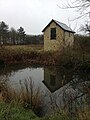
 Pond at Hatley Park - geograph.org.uk - 3098345.jpg 1,600 × 1,200; 1,005 KB
-
 Saints Philip, Andrew and Matthias - geograph.org.uk - 6266765.jpg 1,600 × 1,600; 1.12 MB
-
 Saints Simon, James Major and Matthew - geograph.org.uk - 6266756.jpg 1,600 × 1,600; 1.16 MB
-
 Snowy fields - geograph.org.uk - 3306472.jpg 640 × 484; 24 KB
-
 Snowy track - geograph.org.uk - 3306468.jpg 640 × 480; 35 KB
-
 St George's Church - geograph.org.uk - 6267025.jpg 1,600 × 1,071; 386 KB
-
 St George's Tower - geograph.org.uk - 975443.jpg 425 × 640; 61 KB
-
 The Old George - geograph.org.uk - 6266718.jpg 1,600 × 1,071; 860 KB
-
 Towards Buff Wood - geograph.org.uk - 4764083.jpg 640 × 480; 63 KB
-
 Towards Buff Wood - geograph.org.uk - 4764095.jpg 640 × 480; 99 KB
-
 Towards Buff Wood - geograph.org.uk - 4764096.jpg 480 × 640; 84 KB
-
 Towards Buff Wood - geograph.org.uk - 4764098.jpg 640 × 480; 71 KB
-
 Towards Buff Wood - geograph.org.uk - 4764101.jpg 640 × 480; 68 KB
-
 Towards Hart's Old Farm - geograph.org.uk - 4764080.jpg 640 × 480; 61 KB
-
 Towards Hart's Old Farm - geograph.org.uk - 4764082.jpg 480 × 640; 86 KB
-
 Towards Hayley Wood - geograph.org.uk - 4769745.jpg 1,024 × 731; 1,014 KB
-
 Track past Parker's Farm - geograph.org.uk - 4764110.jpg 480 × 640; 87 KB
-
 Track to Croydon Old Lane - geograph.org.uk - 4764111.jpg 640 × 480; 65 KB
-
 Track to Croydon Old Lane - geograph.org.uk - 4764112.jpg 480 × 640; 82 KB
-
 Track to Croydon Old Lane - geograph.org.uk - 4764115.jpg 640 × 480; 57 KB
-
 Track to Croydon Old Lane - geograph.org.uk - 4764116.jpg 480 × 640; 46 KB
-
 Triangulation Point, Hatley Wilds - geograph.org.uk - 4602331.jpg 480 × 640; 62 KB
-
 Trig Point - Hatley Wilds - geograph.org.uk - 3228802.jpg 4,000 × 2,331; 1.08 MB
-
 View near Hatley St George - geograph.org.uk - 4602289.jpg 640 × 480; 65 KB
-
 View near Hatley St George - geograph.org.uk - 4602294.jpg 640 × 480; 64 KB
-
 View near Hatley St George - geograph.org.uk - 4602295.jpg 480 × 640; 72 KB
-
 Walking to Hatley St George - geograph.org.uk - 5538438.jpg 819 × 1,024; 686 KB
-
 Water Recycling Plant - geograph.org.uk - 4602346.jpg 640 × 480; 66 KB
-
 West gable of St Denis' Church - geograph.org.uk - 6266618.jpg 1,067 × 1,600; 835 KB


_-_geograph.org.uk_-_6266540.jpg)


