Category:Haughton, Nottinghamshire
village and civil parish in Nottinghamshire, UK | |||||
| Upload media | |||||
| Instance of | |||||
|---|---|---|---|---|---|
| Location | Bassetlaw, Nottinghamshire, East Midlands, England | ||||
 | |||||
Media in category "Haughton, Nottinghamshire"
The following 70 files are in this category, out of 70 total.
-
 A bridleway off the B6387 - geograph.org.uk - 3051181.jpg 800 × 600; 135 KB
-
 Abandoned railway bridge - geograph.org.uk - 4139627.jpg 1,280 × 951; 454 KB
-
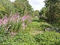 Abandoned railway line - geograph.org.uk - 4139623.jpg 1,280 × 960; 699 KB
-

-
 Between the River Maun and the River Meden - geograph.org.uk - 5989426.jpg 5,137 × 3,426; 4.28 MB
-
 Bevercotes Beck - geograph.org.uk - 4322959.jpg 1,024 × 768; 187 KB
-
 Bevercotes branch line - geograph.org.uk - 2269763.jpg 640 × 427; 164 KB
-
 Bevercotes branch line - geograph.org.uk - 2270005.jpg 640 × 427; 126 KB
-
 Blue gate by Robin Hood Way - geograph.org.uk - 4413050.jpg 4,000 × 2,248; 5.62 MB
-
 Bridge over the River Maun - geograph.org.uk - 2269804.jpg 640 × 427; 87 KB
-
 Carpet laying on a grand scale - geograph.org.uk - 4417670.jpg 1,280 × 960; 1 MB
-
 Conjure Alders woodland - geograph.org.uk - 5975401.jpg 5,184 × 3,888; 4.11 MB
-
 Dead and alive - geograph.org.uk - 4325737.jpg 1,024 × 768; 166 KB
-
 Dead trees beside the River Meden - geograph.org.uk - 4408812.jpg 800 × 533; 168 KB
-
 Entering Blackcliffe Hill Plantation - geograph.org.uk - 2456704.jpg 1,024 × 768; 260 KB
-
 Entrance to Warren Farm - geograph.org.uk - 3051175.jpg 800 × 600; 123 KB
-
 Even more leaves on the line - geograph.org.uk - 1068074.jpg 427 × 640; 106 KB
-
 Farmland near Haughton with pylon - geograph.org.uk - 5989431.jpg 4,997 × 3,418; 2.73 MB
-
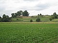
 Field north of Oakham Farm - geograph.org.uk - 5926211.jpg 1,024 × 768; 171 KB
-
 Flood plain between Rivers Maun and Meden - geograph.org.uk - 4411189.jpg 3,964 × 2,180; 5.11 MB
-
 Flood plain between Rivers Maun and Meden - geograph.org.uk - 4411192.jpg 4,000 × 2,248; 4.31 MB
-
 Gate and track south of Bothamsall - geograph.org.uk - 4409152.jpg 800 × 533; 102 KB
-
 Giant haystack south of Haughton Hall Farm - geograph.org.uk - 5974658.jpg 5,184 × 3,888; 7.05 MB
-
 Haughton Chapel (I) - geograph.org.uk - 5975063.jpg 5,039 × 3,704; 7.41 MB
-
 Haughton Chapel (II) - geograph.org.uk - 5975067.jpg 4,996 × 3,549; 5.9 MB
-
 Haughton Chapel (III) - geograph.org.uk - 5975070.jpg 3,888 × 5,184; 5.81 MB
-
 Haughton Chapel (IV) - geograph.org.uk - 5975073.jpg 5,067 × 3,716; 6.86 MB
-
 Haughton Hall Farm - geograph.org.uk - 4325751.jpg 1,024 × 768; 184 KB
-
 Haughton Hall Farm - geograph.org.uk - 4413041.jpg 4,000 × 2,248; 4.18 MB
-
 Haughton nature reserve car park - geograph.org.uk - 1122102.jpg 640 × 480; 75 KB
-
 Haughton postbox - geograph.org.uk - 1122101.jpg 640 × 461; 74 KB
-
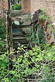 Haughton Watermill - geograph.org.uk - 560145.jpg 427 × 640; 142 KB
-

-
 Hay field by the River Meden - geograph.org.uk - 2456849.jpg 1,024 × 768; 225 KB
-

-
 Lane to Haughton - geograph.org.uk - 4323242.jpg 1,024 × 768; 296 KB
-
 Laying ground cover fabric - geograph.org.uk - 4408807.jpg 800 × 533; 124 KB
-
 Leaves on the Line - geograph.org.uk - 174787.jpg 640 × 480; 184 KB
-
 Leeks on Blackcliffe Hill - geograph.org.uk - 2729695.jpg 640 × 480; 117 KB
-
 Meadow Lane - geograph.org.uk - 2729397.jpg 480 × 640; 91 KB
-
 Mind the bend - geograph.org.uk - 1068207.jpg 640 × 427; 63 KB
-
 On the Robin Hood Way - geograph.org.uk - 4409688.jpg 800 × 533; 142 KB
-
 On the track to Conjure Alders. - geograph.org.uk - 4037904.jpg 480 × 640; 59 KB
-
 Parsnips under the snow.^ - geograph.org.uk - 4408805.jpg 800 × 533; 85 KB
-
 Path crossing the Robin Hood Way - geograph.org.uk - 3891373.jpg 640 × 427; 83 KB
-
 Rail bridge over River Maun - geograph.org.uk - 4413015.jpg 4,000 × 2,248; 4.51 MB
-
 Ready for reaping - geograph.org.uk - 4139617.jpg 1,280 × 960; 551 KB
-

-
 Robin Hood Way to Haughton Hall Farm - geograph.org.uk - 1253095.jpg 640 × 480; 99 KB
-
 Rolling out the carpet - geograph.org.uk - 4417666.jpg 1,280 × 960; 1.2 MB
-
 Slow down better late than never - geograph.org.uk - 1126629.jpg 640 × 377; 45 KB
-
 Strawstack and footpath - geograph.org.uk - 4325742.jpg 1,024 × 768; 180 KB
-
 Sugar beet at Haughton Hall Farm - geograph.org.uk - 4325754.jpg 1,024 × 768; 195 KB
-
 The bridleway alongside Beard's Belt - geograph.org.uk - 1320029.jpg 640 × 480; 81 KB
-
 The footpath from Bothamsall - geograph.org.uk - 2456690.jpg 1,024 × 768; 158 KB
-
 The great wall of Haughton - geograph.org.uk - 4322010.jpg 1,024 × 768; 215 KB
-
 The railway bridge over the River Maun - geograph.org.uk - 2733532.jpg 1,024 × 768; 282 KB
-
 The River Maun near Haughton Hall Farm - geograph.org.uk - 4409682.jpg 800 × 533; 183 KB
-
 The River Maun near Haughton Hall Farm - geograph.org.uk - 5974649.jpg 3,888 × 5,184; 7.33 MB
-
 Track heading east past Cresswell Plantation - geograph.org.uk - 5975081.jpg 3,888 × 5,184; 7.28 MB
-
 Track to Bevercotes - geograph.org.uk - 4323278.jpg 1,024 × 768; 339 KB
-
 Track to Haughton - geograph.org.uk - 4323289.jpg 1,024 × 768; 227 KB
-
 Track to paddocks and stabling - geograph.org.uk - 5932558.jpg 1,024 × 768; 123 KB
-
 Tractor Tracks - geograph.org.uk - 1068185.jpg 640 × 405; 73 KB
-
 Tucking up the parsnips into very long beds - geograph.org.uk - 4408761.jpg 4,000 × 2,248; 4.99 MB
-
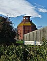 Unusual grain store at Haughton Hall Farm - geograph.org.uk - 5974646.jpg 3,666 × 4,786; 4.05 MB
-
 View to the site of Bothamsall Castle - geograph.org.uk - 5975406.jpg 5,003 × 3,786; 4.58 MB
-
 View towards Castle Hill - geograph.org.uk - 2456837.jpg 1,024 × 768; 186 KB
-
 View towards Haughton - geograph.org.uk - 4322951.jpg 1,024 × 768; 176 KB
-
 Warren Farm irrigator - geograph.org.uk - 2729706.jpg 640 × 480; 112 KB


_-_geograph.org.uk_-_5975063.jpg)
_-_geograph.org.uk_-_5975067.jpg)
_-_geograph.org.uk_-_5975070.jpg)
_-_geograph.org.uk_-_5975073.jpg)


