Category:Haven 44, Schoonhoven
| Object location | | View all coordinates using: OpenStreetMap |
|---|
building in Krimpenerwaard, Netherlands  | |||||
| Upload media | |||||
| Instance of | |||||
|---|---|---|---|---|---|
| Location | Schoonhoven, Krimpenerwaard, South Holland, Netherlands | ||||
| Street address |
| ||||
| Located on street | |||||
| Heritage designation |
| ||||
 | |||||
|
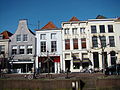
This is a category about rijksmonument number 33456
|
| Address |
|
Media in category "Haven 44, Schoonhoven"
The following 8 files are in this category, out of 8 total.
-
 Exterieur OVERZICHT - Schoonhoven - 20301702 - RCE.jpg 1,187 × 1,200; 324 KB
-
 Hoger, overzicht - Schoonhoven - 20198506 - RCE.jpg 1,200 × 958; 240 KB
-
 Lager, vanaf bordes Stadhuis, overzicht - Schoonhoven - 20198509 - RCE.jpg 1,200 × 812; 212 KB
-
 Overzicht voorgevels - Schoonhoven - 20198505 - RCE.jpg 1,198 × 1,200; 321 KB
-
 RM33456 Schoonhoven - Haven 44.jpg 1,944 × 2,592; 1.35 MB
-
 RM33457 Schoonhoven - Haven 46.jpg 1,944 × 2,592; 1.39 MB
-
 Schoonhoven 039.JPG 3,264 × 2,448; 1.82 MB
-
 Voorgevels - Schoonhoven - 20198507 - RCE.jpg 813 × 1,200; 232 KB


