Category:Hawkinge
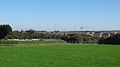
English: Hawkinge is a village and civil parish in the Folkestone and Hythe District of Kent, England. The original village of Hawkinge is actually just less than a mile (c. 1.3 km) due east of the present village centre (roughly 51° 6'55.14"N, 1°11'2.00"E); the modern, much larger, village of Hawkinge was formed by the merging of Hawkinge and Uphill. Walking south from the village past it is possible to see stunning views of Cheriton, Folkestone and the Channel Tunnel complex.
village in the United Kingdom  | |||||
| Upload media | |||||
| Instance of | |||||
|---|---|---|---|---|---|
| Location | Folkestone and Hythe, Kent, South East England, England | ||||
| Said to be the same as | Hawkinge (Wikimedia duplicated page, civil parish) | ||||
 | |||||
Subcategories
This category has the following 7 subcategories, out of 7 total.
K
- Kent Battle of Britain Museum (11 F)
L
- St Luke's Church, Hawkinge (2 F)
M
- The Mayfly, Hawkinge (2 F)
O
- Old Hawkinge (9 F)
R
- RAF Hawkinge (15 F)
W
- White Horse, Hawkinge (3 F)
Media in category "Hawkinge"
The following 200 files are in this category, out of 287 total.
(previous page) (next page)-
 18, The Street - geograph.org.uk - 4472600.jpg 3,264 × 2,448; 3.73 MB
-
 34, Canterbury Road - geograph.org.uk - 6095242.jpg 3,264 × 2,448; 1.89 MB
-
 5, Canterbury Road, Hawkinge - geograph.org.uk - 4365521.jpg 3,264 × 2,448; 1.98 MB
-
 A cold day in Hawkinge Cemetery - geograph.org.uk - 3298930.jpg 640 × 480; 166 KB
-
 A corner of Hawkinge Cemetery - geograph.org.uk - 3298935.jpg 640 × 480; 134 KB
-
 A20 - geograph.org.uk - 4613324.jpg 640 × 491; 45 KB
-
 A20 - Keep your distance - geograph.org.uk - 3306125.jpg 640 × 428; 67 KB
-
 A20 - Six miles to Dover - geograph.org.uk - 3298735.jpg 640 × 428; 64 KB
-
 A20 Flyover - geograph.org.uk - 99094.jpg 640 × 480; 45 KB
-
 A20 near Hawkinge - geograph.org.uk - 2269505.jpg 2,272 × 1,704; 468 KB
-
 A20 near Hawkinge - geograph.org.uk - 2269513.jpg 2,272 × 1,704; 452 KB
-
 Access Road from Hawkinge - geograph.org.uk - 2255446.jpg 3,072 × 2,304; 1.65 MB
-

-
 Aerodrome Road approaches roundabout junction with A260 - geograph.org.uk - 3917947.jpg 3,343 × 2,527; 1.36 MB
-

-
 Alkham Valley Road - geograph.org.uk - 2741159.jpg 3,648 × 2,736; 1.32 MB
-
 Alkham Valley Road - geograph.org.uk - 2741160.jpg 3,648 × 2,736; 2.09 MB
-
 Alkham Valley Road - geograph.org.uk - 2741162.jpg 3,648 × 2,736; 1.98 MB
-
 Alkham Valley Road - geograph.org.uk - 2741166.jpg 3,648 × 2,736; 1.95 MB
-
 Alkham Valley Road - geograph.org.uk - 3170159.jpg 4,288 × 3,216; 3.41 MB
-
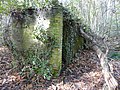
 Army building in Reinden Wood - geograph.org.uk - 2231813.jpg 3,072 × 2,304; 3 MB
-
 Blast shelter, Reinden Wood - geograph.org.uk - 3308893.jpg 816 × 612; 139 KB
-
 Bluebell carpet - panoramio.jpg 2,035 × 1,389; 1.02 MB
-
 Bridleway and footpath junction on Cowgate Lane - geograph.org.uk - 2287267.jpg 3,072 × 2,304; 2.46 MB
-
 Bridleway in Reinden Wood - geograph.org.uk - 2231816.jpg 3,072 × 2,304; 3.06 MB
-
 Bridleway junction on the A260 Access Road - geograph.org.uk - 2231772.jpg 3,072 × 2,304; 3.14 MB
-
 Bridleway near Reinden Wood - geograph.org.uk - 2255440.jpg 3,072 × 2,304; 3.66 MB
-
 Bridleway to Gibraltar Lane - geograph.org.uk - 2107951.jpg 3,072 × 2,304; 2.55 MB
-
 Bridleway to Reinden Wood - geograph.org.uk - 2231798.jpg 3,072 × 2,304; 3.59 MB
-
 Building site entrance, Hurricane Way - geograph.org.uk - 4735057.jpg 3,264 × 2,448; 1.44 MB
-
 Building site entrance, Hurricane Way - geograph.org.uk - 4859420.jpg 3,264 × 2,395; 2.33 MB
-
 Building site entrance, Hurricane Way - geograph.org.uk - 5049254.jpg 3,264 × 2,448; 1.76 MB
-
 Building site, plot 1, Hurricane Way - geograph.org.uk - 5440641.jpg 3,264 × 2,448; 2.02 MB
-
 Building site, plot 1, Hurricane Way - geograph.org.uk - 5640516.jpg 3,264 × 2,363; 2.23 MB
-
 Building site, plot 1, Hurricane Way - geograph.org.uk - 5712190.jpg 3,264 × 2,448; 2.43 MB
-
 Building site, plot 1, Hurricane Way - geograph.org.uk - 5921075.jpg 3,264 × 2,448; 2.02 MB
-
 Building site, plot 1, Hurricane Way - geograph.org.uk - 5921092.jpg 3,264 × 2,448; 3.69 MB
-
 Building work in Defiant Close, Hawkinge - geograph.org.uk - 2771964.jpg 979 × 734; 194 KB
-
 Building work in Defiant Close, Hawkinge - geograph.org.uk - 2780941.jpg 685 × 513; 125 KB
-
 Bus on Canterbury Road - geograph.org.uk - 1966617.jpg 1,024 × 768; 230 KB
-
 Canterbury Road, Hawkinge - geograph.org.uk - 2398994.jpg 4,320 × 3,240; 4.29 MB
-
 Canterbury Road, Hawkinge - geograph.org.uk - 2399004.jpg 4,320 × 3,240; 3.8 MB
-
 Canterbury Road, Hawkinge in 2001 - geograph.org.uk - 2709181.jpg 1,052 × 680; 139 KB
-
 Cattle from Crete Road West - geograph.org.uk - 1525595.jpg 640 × 480; 164 KB
-
 Church Hill - geograph.org.uk - 3170145.jpg 4,288 × 3,216; 3.38 MB
-
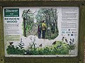 Close-up of Reinden Wood Information Board - geograph.org.uk - 2255435.jpg 3,072 × 2,304; 2.28 MB
-
 Commercial buildings, Hurricane Way - geograph.org.uk - 6108907.jpg 3,264 × 2,448; 2.18 MB
-
 Commercial buildings, Hurricane Way - geograph.org.uk - 6108925.jpg 3,264 × 2,448; 2.1 MB
-

-
 Construction of new houses, Hurricane Way - geograph.org.uk - 5049261.jpg 3,264 × 2,448; 1.79 MB
-
 Coombe Wood Lane - geograph.org.uk - 4366989.jpg 3,264 × 2,448; 1.89 MB
-
 Coombe Wood Lane becomes a footpath - geograph.org.uk - 852144.jpg 640 × 480; 175 KB
-
 Cowgate Farm, Cowgate Lane - geograph.org.uk - 4366970.jpg 3,264 × 2,448; 2.42 MB
-
 Crete Road West, looking east - geograph.org.uk - 1525617.jpg 640 × 480; 106 KB
-
 Demolition of Lidl Food Store, Haven Drive - geograph.org.uk - 5264131.jpg 3,264 × 2,448; 1.99 MB
-
 Demolition of Lidl Food Store, Haven Drive - geograph.org.uk - 5264151.jpg 3,264 × 2,448; 1.72 MB
-
 Densole, Canterbury Road - geograph.org.uk - 3228278.jpg 3,648 × 2,736; 1.79 MB
-

-
 Employment land, Hurricane Way - geograph.org.uk - 4735087.jpg 3,264 × 2,448; 2.33 MB
-
 Encliffe Farm and Alkham Valley - geograph.org.uk - 3171070.jpg 4,288 × 3,216; 3.59 MB
-
-
 Entrance to building site, plot 1, Hurricane Way - geograph.org.uk - 5311591.jpg 3,264 × 2,448; 3.62 MB
-
 Entrance to building site, plot 1, Hurricane Way - geograph.org.uk - 5379201.jpg 3,264 × 2,448; 3.76 MB
-
 Equipment storage, Hurricane Way - geograph.org.uk - 5230532.jpg 3,264 × 2,448; 3.74 MB
-
 Erection of new Lidl Food Store, Haven Drive - geograph.org.uk - 5327111.jpg 3,264 × 2,448; 1.8 MB
-
 Erection of new Lidl Food Store, Haven Drive - geograph.org.uk - 5379224.jpg 3,264 × 2,448; 1.84 MB
-
 Erection of new Lidl Food Store, Haven Drive - geograph.org.uk - 5379232.jpg 3,264 × 2,448; 3.84 MB
-
 Erection of new Lidl Food Store, Haven Drive - geograph.org.uk - 5440593.jpg 3,264 × 2,448; 3.78 MB
-
 Extension to Lidl Food Store, Haven Drive - geograph.org.uk - 3715089.jpg 1,077 × 807; 203 KB
-
 Farm road to Hope Farm - geograph.org.uk - 3171087.jpg 4,288 × 3,216; 3.69 MB
-
 Farmland by the A20 - geograph.org.uk - 4613341.jpg 640 × 426; 36 KB
-
 Farmland to the N of Crete Road West - geograph.org.uk - 1525607.jpg 640 × 480; 147 KB
-

-
 Fernfield Farm near Hawkinge - geograph.org.uk - 873012.jpg 640 × 480; 193 KB
-
 Field near Church Hill - geograph.org.uk - 3170139.jpg 4,288 × 3,216; 3.58 MB
-
 Field of kale on top of downs - geograph.org.uk - 3300831.jpg 640 × 480; 119 KB
-
 Firing aperture - panoramio.jpg 2,048 × 1,536; 1.17 MB
-
 Firs Farm - geograph.org.uk - 4366956.jpg 3,264 × 2,448; 2.27 MB
-
 Flegis Court - geograph.org.uk - 4366914.jpg 3,264 × 2,448; 3.81 MB
-
 Folkestone - 2008 - geograph.org.uk - 3455812.jpg 2,272 × 1,704; 789 KB
-
 Footpath junction on the bridleway near Coombe Wood - geograph.org.uk - 2287261.jpg 3,072 × 2,304; 3.69 MB
-
 Footpath to Alkham Valley Road - geograph.org.uk - 2287301.jpg 3,072 × 2,304; 3.34 MB
-
 Footpath to Hawkinge - geograph.org.uk - 3170128.jpg 4,288 × 3,216; 3.87 MB
-
 Footpath to Old Hawkinge (2) - geograph.org.uk - 2287314.jpg 3,072 × 2,304; 2.12 MB
-
 Footpath to Old Hawkinge - geograph.org.uk - 2287310.jpg 3,072 × 2,304; 2.5 MB
-
 Former entrance to Hawkinge Crematorium - geograph.org.uk - 3170043.jpg 4,288 × 3,216; 3.35 MB
-
 Garage on the Canterbury Road, Hawkinge - geograph.org.uk - 852311.jpg 640 × 480; 151 KB
-

-
 Gate on Coombe Wood Lane - geograph.org.uk - 2287251.jpg 3,072 × 2,304; 2.08 MB
-
 Gibraltar Lane meets Elvington Lane - geograph.org.uk - 3300763.jpg 640 × 480; 126 KB
-
 Grave diggers, Hawkinge Cemetery - geograph.org.uk - 3298953.jpg 640 × 480; 110 KB
-
 Green and Pleasant Land - geograph.org.uk - 2432880.jpg 1,024 × 768; 169 KB
-
 Haven Drive, Hawkinge - geograph.org.uk - 2358548.jpg 816 × 612; 162 KB
-
 Hawkinge - 2008 - geograph.org.uk - 3455800.jpg 2,272 × 1,704; 587 KB
-
 Hawkinge - 2008 - geograph.org.uk - 3455803.jpg 2,272 × 1,704; 588 KB
-
 Hawkinge - 2008 - geograph.org.uk - 3455804.jpg 2,272 × 1,704; 762 KB
-
 Hawkinge - 2008 - geograph.org.uk - 3455808.jpg 2,272 × 1,704; 766 KB
-

-
 Hawkinge Battle of Britain museum - geograph.org.uk - 2594933.jpg 640 × 480; 165 KB
-
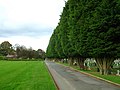
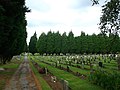
 Hawkinge Cemetery - geograph.org.uk - 3169912.jpg 4,288 × 3,216; 3.83 MB
-
 Hawkinge Cemetery - geograph.org.uk - 3169982.jpg 4,288 × 3,216; 4.38 MB
-
 Hawkinge Cemetery Crematorium - geograph.org.uk - 3169894.jpg 4,288 × 3,216; 3.7 MB
-
 Hawkinge Hall - geograph.org.uk - 4366939.jpg 3,264 × 2,448; 3.73 MB
-
 Hawkinge Hall - geograph.org.uk - 4366947.jpg 3,264 × 2,448; 2.34 MB
-
 Hawkinge House - geograph.org.uk - 2358533.jpg 1,077 × 669; 126 KB
-
 Hawkinge House - geograph.org.uk - 2358540.jpg 1,011 × 758; 156 KB
-
 Hawkinge primary school - geograph.org.uk - 852257.jpg 640 × 480; 148 KB
-
 Hawkinge primary school - geograph.org.uk - 852289.jpg 640 × 480; 174 KB
-
 Hawkinge Village Hall - geograph.org.uk - 1150167.jpg 640 × 481; 49 KB
-
 Hawkinge village hall - geograph.org.uk - 852260.jpg 640 × 480; 148 KB
-
 Hawkinge village hall - geograph.org.uk - 852283.jpg 640 × 480; 166 KB
-
 Hawkinge Village Sign (close-up) - geograph.org.uk - 3170101.jpg 2,947 × 3,698; 2.55 MB
-
 Hawkinge Village Sign - geograph.org.uk - 1150176.jpg 481 × 640; 81 KB
-
 Hawkinge, Canterbury Road - geograph.org.uk - 2591021.jpg 3,648 × 2,736; 1.87 MB
-
 Hawkinge, Canterbury Road - geograph.org.uk - 2591024.jpg 3,648 × 2,736; 1.51 MB
-
 Hawkinge, Canterbury Road - geograph.org.uk - 2591029.jpg 3,648 × 2,736; 1.68 MB
-
 Hawkinge, Canterbury Road - geograph.org.uk - 2591037.jpg 3,648 × 2,736; 1.89 MB
-
 Hillside in the Alkham Valley - geograph.org.uk - 1585080.jpg 640 × 480; 171 KB
-
 Hope farm - panoramio.jpg 2,048 × 1,536; 1.12 MB
-
 Houses on Green Close, Hawkinge - geograph.org.uk - 852277.jpg 640 × 480; 216 KB
-
 Hurricane Way, Hawkinge - geograph.org.uk - 2771908.jpg 966 × 722; 141 KB
-
 Hurricane Way, Hawkinge - geograph.org.uk - 2771949.jpg 832 × 623; 160 KB
-
 Hurricane Way, Hawkinge - geograph.org.uk - 3205832.jpg 799 × 580; 152 KB
-
 Information Board and walk in Reinden Wood - geograph.org.uk - 2255432.jpg 3,072 × 2,304; 3.19 MB
-

-

-
 Joining the A20 towards Dover - geograph.org.uk - 3306127.jpg 640 × 428; 66 KB
-

-

-
 Juniper Way - geograph.org.uk - 5640507.jpg 3,264 × 2,448; 1.75 MB
-
 Juniper Way - geograph.org.uk - 5712195.jpg 3,264 × 2,448; 2.02 MB
-
 Juniper Way - geograph.org.uk - 5712196.jpg 2,968 × 2,448; 1.97 MB
-
 Juniper Way - geograph.org.uk - 5920018.jpg 3,264 × 2,448; 2.29 MB
-
 Juniper Way - geograph.org.uk - 5920041.jpg 3,264 × 2,448; 1.95 MB
-
 Juniper Way - geograph.org.uk - 5920046.jpg 3,264 × 2,448; 1.86 MB
-
 Juniper Way - geograph.org.uk - 5920058.jpg 3,126 × 2,448; 1.63 MB
-
 Juniper Way off Hurricane Way - geograph.org.uk - 5310311.jpg 3,264 × 2,448; 1.74 MB
-
 Juniper Way off Hurricane Way - geograph.org.uk - 5379177.jpg 3,264 × 2,448; 3.76 MB
-
 Juniper Way off Hurricane Way - geograph.org.uk - 5440626.jpg 2,448 × 3,264; 2.08 MB
-
 Lane to Hawkinge Crematorium - geograph.org.uk - 3169899.jpg 4,288 × 3,216; 3.75 MB
-
 Liberty Green, Hawkinge - geograph.org.uk - 2402662.jpg 4,320 × 3,240; 3.96 MB
-
 Lidl Food Store, Haven Drive - geograph.org.uk - 5640529.jpg 3,214 × 2,426; 1.64 MB
-
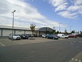 Lidl supermarket, Hawkinge - geograph.org.uk - 2402679.jpg 4,320 × 3,240; 3.91 MB
-
 Looking E along Crete Road West - geograph.org.uk - 1525602.jpg 640 × 480; 142 KB
-
 Looking east-northeast along a bridleway - geograph.org.uk - 4365557.jpg 3,264 × 2,448; 3.98 MB
-
 Looking east-southeast along Canterbury Road - geograph.org.uk - 4365538.jpg 3,264 × 2,448; 3.83 MB
-

-

-
 Looking north from Terlingham Forum - geograph.org.uk - 3715113.jpg 913 × 684; 198 KB
-

-
 Looking out - panoramio - Mutzy.jpg 2,048 × 1,536; 1.16 MB
-

-
 Looking south along Hurricane Way - geograph.org.uk - 4735072.jpg 3,264 × 2,448; 1.91 MB
-
 Looking south along Hurricane Way - geograph.org.uk - 5049268.jpg 3,264 × 2,383; 1.74 MB
-

-
 Looking W along Crete Road West - geograph.org.uk - 1525599.jpg 640 × 480; 137 KB
-
 Looking W along Crete Road West - geograph.org.uk - 1525612.jpg 640 × 480; 84 KB
-
 Looking WSW along Coombe Wood Lane - geograph.org.uk - 852149.jpg 640 × 480; 173 KB
-
-
 MOD track in Reinden Wood - geograph.org.uk - 2231846.jpg 3,072 × 2,304; 3.41 MB
-
 NATS Swingfield Tx Comms Station - geograph.org.uk - 3308816.jpg 816 × 612; 157 KB
-
 Near Hope farm - panoramio.jpg 2,048 × 1,536; 1.13 MB
-
 New footpath into Hawkinge Housing Development - geograph.org.uk - 2107893.jpg 3,072 × 2,304; 2.83 MB
-
 New Houses in Hawkinge - geograph.org.uk - 2107886.jpg 3,072 × 1,728; 1.22 MB
-
 New houses on Heron Forstal Avenue - geograph.org.uk - 852273.jpg 640 × 480; 153 KB
-
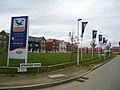
 New Housing Estate at Hawkinge - geograph.org.uk - 1966557.jpg 1,024 × 768; 310 KB
-
 New road lay out on the old A260 - geograph.org.uk - 852359.jpg 640 × 480; 161 KB
-
 Newly planted bank, Hawkinge - geograph.org.uk - 3298942.jpg 640 × 480; 103 KB
-
 Not near the Great Western Railway - geograph.org.uk - 2107901.jpg 3,072 × 2,304; 2.48 MB
-
 Oak Tree in field in Old Hawkinge - geograph.org.uk - 2287274.jpg 3,072 × 2,304; 2.75 MB
-
 Old Gamekeepers cottage - panoramio.jpg 2,048 × 1,536; 1.17 MB
-
 Page Road, Hawkinge - geograph.org.uk - 2402653.jpg 4,320 × 3,240; 4.24 MB
-
 Page Road, Hawkinge - geograph.org.uk - 2402667.jpg 4,320 × 3,240; 4.35 MB
-

-
 Path in Hawkinge Cemetery (2) - geograph.org.uk - 3169961.jpg 4,288 × 3,216; 4.09 MB
-
 Path in Hawkinge Cemetery - geograph.org.uk - 3169920.jpg 4,288 × 3,216; 3.62 MB
-
 Pedestrian crossing, Spitfire Way, Hawkinge - geograph.org.uk - 2965670.jpg 1,118 × 818; 184 KB
-
-
 Permissive path to Alkham Valley Road (2) - geograph.org.uk - 3171106.jpg 4,288 × 3,216; 3.59 MB
-
 Permissive path to Alkham Valley Road - geograph.org.uk - 3171097.jpg 4,288 × 3,151; 3.23 MB
-
 Permissive path to Creteway Down (2) - geograph.org.uk - 3171098.jpg 4,288 × 3,216; 3.4 MB
-
 Permissive path to Creteway Down - geograph.org.uk - 3171090.jpg 4,288 × 3,216; 3.6 MB
-
 Pillbox Hope farm - panoramio - Mutzy.jpg 2,048 × 1,536; 957 KB
-
 Pillbox Hope farm - panoramio.jpg 2,048 × 1,536; 730 KB
-
 Pillbox near Gibraltar Lane - geograph.org.uk - 2107907.jpg 3,072 × 2,304; 2.64 MB
-

-

-

-

-
-

-

-
 Radnor Garage, Canterbury Road - geograph.org.uk - 4472587.jpg 3,264 × 2,448; 3.78 MB
-
 Reconstruction of a roundabout - geograph.org.uk - 4016707.jpg 1,011 × 758; 220 KB
-
 Reinden Lodge, Reinden Wood - geograph.org.uk - 3308859.jpg 816 × 612; 145 KB
-
 Reinden Wood Panel 10 - geograph.org.uk - 2231821.jpg 2,304 × 3,072; 1.98 MB
-
 Reinforced concrete - panoramio.jpg 2,048 × 1,536; 1.16 MB
-

-
 Road junction of Pay Streets - geograph.org.uk - 2255418.jpg 3,072 × 2,304; 2.3 MB
-
 Road to builder’s storage area - geograph.org.uk - 5920035.jpg 3,264 × 2,448; 2.3 MB


_-_geograph.org.uk_-_873021.jpg)


_-_geograph.org.uk_-_2287314.jpg)


_-_geograph.org.uk_-_3170101.jpg)


_building_in_Reinden_Wood_-_geograph.org.uk_-_3341197.jpg)


_-_geograph.org.uk_-_3169961.jpg)


_-_geograph.org.uk_-_3171106.jpg)

_-_geograph.org.uk_-_3171098.jpg)


