Category:Hazard maps of volcanoes in the United States
Subcategories
This category has the following 2 subcategories, out of 2 total.
Media in category "Hazard maps of volcanoes in the United States"
The following 7 files are in this category, out of 7 total.
-
 FutureMono-InyoTephraFall.gif 458 × 576; 23 KB
-
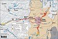
 Volcano Hazards of the Lassen area.jpg 441 × 417; 42 KB
-
 Mount Mazama hazard map-fr.svg 2,281 × 2,199; 6.48 MB
-
 MSH80 Hazard map April 1st.gif 894 × 906; 46 KB
-
 NPS crater-lake-hazards-map.jpg 2,565 × 3,814; 2.34 MB
-
 Three Sisters hazards map.jpg 3,086 × 2,103; 2.36 MB
-
 Volcano Hazards of the Lassen area-explanation.jpg 293 × 406; 49 KB


